
The long-legged myotis is named for its slightly longer tibia in relation to other myotis species. It is distinguished from other member of its genus by its short, rounded ears, small hind feet, a distinctly keeled calcar, fur on the underwing membranes, and general size. Total length ranges from 83 to 106 mm, tail length 32 to 49 mm, ear length 10 to 15 mm, and weight 6 to 9 grams. There is some sexual dimorphism in the species, with females having larger forearm and condylocanine lengths. Compared to most other bats from the same genus, their flight pattern is stronger, more direct and with less flutter, and they are capable of good speed. Their wings are also longer than many other bat species and have slightly pointed tips which makes them better adapted to fly in open areas. Pelage coloration varies and can range from light brownish yellow to dark, reddish, or blackish brown; fur on their ventral side ranges from pale buff to darker browns and ear and flight membranes are blackish.
Overview
- Species Common Name Long-legged Myotis
- Species Scientific Name Myotis volans
- Federal Listing Status Species of Concern
- State Listing Status Sensitive
Ecoregions
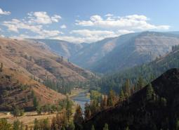
Blue Mountains
Located in NE Oregon, the Blue Mountains ecoregion is the largest ecoregion in the state. It provides a diverse complex of mountain ranges, valleys, and plateaus that extend beyond Oregon into the states of Idaho and Washington.
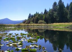
Coast Range
Oregon's Coast Range, known for its dramatic scenery, is extremely diverse, with habitats ranging from open sandy dunes to lush forests and from tidepools to headwater streams. It follows the coastline and extends east through coastal forest to the border of the Willamette Valley and Klamath Mountains ecoregions
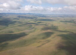
Columbia Plateau
The Columbia Plateau ecoregion was shaped by cataclysmic floods and large deposits of wind-borne silt and sand earlier in its geological history. It is dominated by a rolling landscape of arid lowlands dissected by several important rivers, and extends from the eastern slopes of the Cascades Mountains, south and east from the Columbia River to the Blue Mountains.
East Cascades
The East Cascade ecoregion extends from the Cascade Mountains' summit east to the warmer, drier high desert and down the length of the state. This ecoregion varies dramatically from its cool, moist border with the West Cascades ecoregion to its dry eastern border, where it meets sagebrush desert landscapes.

Klamath Mountains
The Klamath Mountains ecoregion covers much of southwestern Oregon, including the Klamath Mountains, Siskiyou Mountains, the interior valleys and foothills between these and the Cascade Range, and the Rogue and Umpqua river valleys. Several popular and scenic rivers run through the ecoregion, including the Umpqua, Rogue, Illinois, and Applegate rivers. Historically, this ecoregion is known …
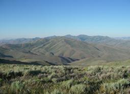
Northern Basin and Range
The Northern Basin and Range ecoregion covers the very large southeastern portion of the state, from Burns south to the Nevada border and from the Christmas Valley east to Idaho. It is largely a high elevation desert-like area dominated by sagebrush communities and habitats.

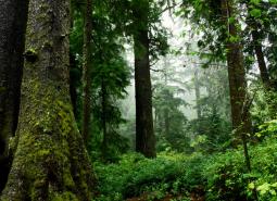
West Cascades
The West Cascades ecoregion extends from east of the Cascade Mountains summit to the foothills of the Willamette, Umpqua, and Rogue Valleys, and spans the entire length of the state of Oregon. It is largely dominated by conifer forests, moving into alpine parklands and dwarf shrubs at higher elevations.
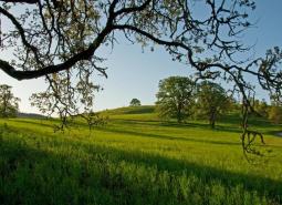
Willamette Valley
The Willamette Valley ecoregion is bounded on the west by the Coast Range and on the east by the Cascade Range. This long mostly level alluvial plain has some scattered areas of low basalt, and contrasts with productive farmland and large urban areas. It has the fastest-growing human population in the state resulting in challenges due to land-use changes.