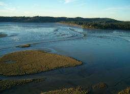
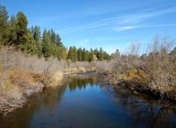
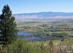
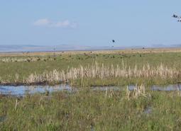
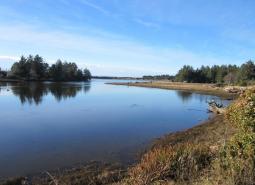
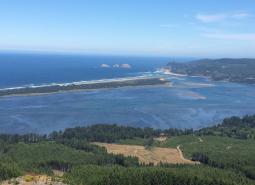
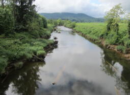
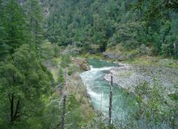
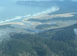
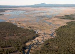
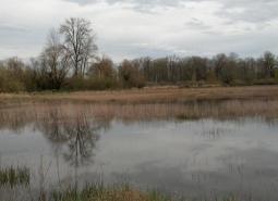
Alsea Estuary-Alsea River [COA ID: 029]
Geographic boundaries of the COAs were updated for the 2026 State Wildlife Action Plan and the associated COA profiles are intended to provide additional information. Content of each COA profile is being refined and will be updated to reflect current conditions when feasible. Please help us by submitting information on Local Conservation Actions, Plans, or …

Alvord Lake Basin [COA ID: 194]
Geographic boundaries of the COAs were updated for the 2026 State Wildlife Action Plan and the associated COA profiles are intended to provide additional information. Content of each COA profile is being refined and will be updated to reflect current conditions when feasible. Please help us by submitting information on Local Conservation Actions, Plans, or …
Anderson Butte [COA ID: 103]
Geographic boundaries of the COAs were updated for the 2026 State Wildlife Action Plan and the associated COA profiles are intended to provide additional information. Content of each COA profile is being refined and will be updated to reflect current conditions when feasible. Please help us by submitting information on Local Conservation Actions, Plans, or …

Antelope Creek-Paynes Cliffs [COA ID: 099]
Geographic boundaries of the COAs were updated for the 2026 State Wildlife Action Plan and the associated COA profiles are intended to provide additional information. Content of each COA profile is being refined and will be updated to reflect current conditions when feasible. Please help us by submitting information on Local Conservation Actions, Plans, or …
Bakeoven Creek-Buckhollow Creek [COA ID: 151]
Geographic boundaries of the COAs were updated for the 2026 State Wildlife Action Plan and the associated COA profiles are intended to provide additional information. Content of each COA profile is being refined and will be updated to reflect current conditions when feasible. Please help us by submitting information on Local Conservation Actions, Plans, or …
Baker Valley Wetlands [COA ID: 165]
Geographic boundaries of the COAs were updated for the 2026 State Wildlife Action Plan and the associated COA profiles are intended to provide additional information. Content of each COA profile is being refined and will be updated to reflect current conditions when feasible. Please help us by submitting information on Local Conservation Actions, Plans, or …
Baskett Butte [COA ID: 072]
Geographic boundaries of the COAs were updated for the 2026 State Wildlife Action Plan and the associated COA profiles are intended to provide additional information. Content of each COA profile is being refined and will be updated to reflect current conditions when feasible. Please help us by submitting information on Local Conservation Actions, Plans, or …
Basque Hills Area Plains [COA ID: 202]
Geographic boundaries of the COAs were updated for the 2026 State Wildlife Action Plan and the associated COA profiles are intended to provide additional information. Content of each COA profile is being refined and will be updated to reflect current conditions when feasible. Please help us by submitting information on Local Conservation Actions, Plans, or …
Bear Valley [COA ID: 177]
Geographic boundaries of the COAs were updated for the 2026 State Wildlife Action Plan and the associated COA profiles are intended to provide additional information. Content of each COA profile is being refined and will be updated to reflect current conditions when feasible. Please help us by submitting information on Local Conservation Actions, Plans, or …
Beaver Creek [COA ID: 027]
Geographic boundaries of the COAs were updated for the 2026 State Wildlife Action Plan and the associated COA profiles are intended to provide additional information. Content of each COA profile is being refined and will be updated to reflect current conditions when feasible. Please help us by submitting information on Local Conservation Actions, Plans, or …
Big Butte Area [COA ID: 122]
Geographic boundaries of the COAs were updated for the 2026 State Wildlife Action Plan and the associated COA profiles are intended to provide additional information. Content of each COA profile is being refined and will be updated to reflect current conditions when feasible. Please help us by submitting information on Local Conservation Actions, Plans, or …
Big Marsh Creek [COA ID: 133]
Geographic boundaries of the COAs were updated for the 2026 State Wildlife Action Plan and the associated COA profiles are intended to provide additional information. Content of each COA profile is being refined and will be updated to reflect current conditions when feasible. Please help us by submitting information on Local Conservation Actions, Plans, or …
Boardman Area [COA ID: 154]
Geographic boundaries of the COAs were updated for the 2026 State Wildlife Action Plan and the associated COA profiles are intended to provide additional information. Content of each COA profile is being refined and will be updated to reflect current conditions when feasible. Please help us by submitting information on Local Conservation Actions, Plans, or …

Breitenbush River [COA ID: 110]
Geographic boundaries of the COAs were updated for the 2026 State Wildlife Action Plan and the associated COA profiles are intended to provide additional information. Content of each COA profile is being refined and will be updated to reflect current conditions when feasible. Please help us by submitting information on Local Conservation Actions, Plans, or …
Brothers-North Wagontire [COA ID: 184]
Geographic boundaries of the COAs were updated for the 2026 State Wildlife Action Plan and the associated COA profiles are intended to provide additional information. Content of each COA profile is being refined and will be updated to reflect current conditions when feasible. Please help us by submitting information on Local Conservation Actions, Plans, or …
Bull of the Woods, North [COA ID: 108]
Geographic boundaries of the COAs were updated for the 2026 State Wildlife Action Plan and the associated COA profiles are intended to provide additional information. Content of each COA profile is being refined and will be updated to reflect current conditions when feasible. Please help us by submitting information on Local Conservation Actions, Plans, or …
Bull Run-Sandy Rivers [COA ID: 105]
Geographic boundaries of the COAs were updated for the 2026 State Wildlife Action Plan and the associated COA profiles are intended to provide additional information. Content of each COA profile is being refined and will be updated to reflect current conditions when feasible. Please help us by submitting information on Local Conservation Actions, Plans, or …
Bully Creek Area [COA ID: 183]
Geographic boundaries of the COAs were updated for the 2026 State Wildlife Action Plan and the associated COA profiles are intended to provide additional information. Content of each COA profile is being refined and will be updated to reflect current conditions when feasible. Please help us by submitting information on Local Conservation Actions, Plans, or …
Burnt River [COA ID: 166]
Geographic boundaries of the COAs were updated for the 2026 State Wildlife Action Plan and the associated COA profiles are intended to provide additional information. Content of each COA profile is being refined and will be updated to reflect current conditions when feasible. Please help us by submitting information on Local Conservation Actions, Plans, or …
Calapooia River [COA ID: 082]
Geographic boundaries of the COAs were updated for the 2026 State Wildlife Action Plan and the associated COA profiles are intended to provide additional information. Content of each COA profile is being refined and will be updated to reflect current conditions when feasible. Please help us by submitting information on Local Conservation Actions, Plans, or …
Cape Ferrelo [COA ID: 051]
Geographic boundaries of the COAs were updated for the 2026 State Wildlife Action Plan and the associated COA profiles are intended to provide additional information. Content of each COA profile is being refined and will be updated to reflect current conditions when feasible. Please help us by submitting information on Local Conservation Actions, Plans, or …
Central Cascades Crest, Southeast [COA ID: 116]
Geographic boundaries of the COAs were updated for the 2026 State Wildlife Action Plan and the associated COA profiles are intended to provide additional information. Content of each COA profile is being refined and will be updated to reflect current conditions when feasible. Please help us by submitting information on Local Conservation Actions, Plans, or …
Central Cascades Crest, West [COA ID: 113]
Geographic boundaries of the COAs were updated for the 2026 State Wildlife Action Plan and the associated COA profiles are intended to provide additional information. Content of each COA profile is being refined and will be updated to reflect current conditions when feasible. Please help us by submitting information on Local Conservation Actions, Plans, or …
Chetco River-Winhchuck River Estuaries [COA ID: 052]
Geographic boundaries of the COAs were updated for the 2026 State Wildlife Action Plan and the associated COA profiles are intended to provide additional information. Content of each COA profile is being refined and will be updated to reflect current conditions when feasible. Please help us by submitting information on Local Conservation Actions, Plans, or …
Chewaucan River [COA ID: 141]
Geographic boundaries of the COAs were updated for the 2026 State Wildlife Action Plan and the associated COA profiles are intended to provide additional information. Content of each COA profile is being refined and will be updated to reflect current conditions when feasible. Please help us by submitting information on Local Conservation Actions, Plans, or …
Clackamas River and Tributaries [COA ID: 065]
Geographic boundaries of the COAs were updated for the 2026 State Wildlife Action Plan and the associated COA profiles are intended to provide additional information. Content of each COA profile is being refined and will be updated to reflect current conditions when feasible. Please help us by submitting information on Local Conservation Actions, Plans, or …
Clatskanie River [COA ID: 008]
Geographic boundaries of the COAs were updated for the 2026 State Wildlife Action Plan and the associated COA profiles are intended to provide additional information. Content of each COA profile is being refined and will be updated to reflect current conditions when feasible. Please help us by submitting information on Local Conservation Actions, Plans, or …
Clatsop Plains [COA ID: 001]
Geographic boundaries of the COAs were updated for the 2026 State Wildlife Action Plan and the associated COA profiles are intended to provide additional information. Content of each COA profile is being refined and will be updated to reflect current conditions when feasible. Please help us by submitting information on Local Conservation Actions, Plans, or …
Clatsop State Forest-Jewel Meadows Area [COA ID: 007]
Geographic boundaries of the COAs were updated for the 2026 State Wildlife Action Plan and the associated COA profiles are intended to provide additional information. Content of each COA profile is being refined and will be updated to reflect current conditions when feasible. Please help us by submitting information on Local Conservation Actions, Plans, or …
Coburg Ridge [COA ID: 087]
Geographic boundaries of the COAs were updated for the 2026 State Wildlife Action Plan and the associated COA profiles are intended to provide additional information. Content of each COA profile is being refined and will be updated to reflect current conditions when feasible. Please help us by submitting information on Local Conservation Actions, Plans, or …
Cold Springs National Wildlife Refuge Area [COA ID: 156]
Geographic boundaries of the COAs were updated for the 2026 State Wildlife Action Plan and the associated COA profiles are intended to provide additional information. Content of each COA profile is being refined and will be updated to reflect current conditions when feasible. Please help us by submitting information on Local Conservation Actions, Plans, or …
Columbia River-Blind Slough Swamp [COA ID: 006]
Geographic boundaries of the COAs were updated for the 2026 State Wildlife Action Plan and the associated COA profiles are intended to provide additional information. Content of each COA profile is being refined and will be updated to reflect current conditions when feasible. Please help us by submitting information on Local Conservation Actions, Plans, or …
Coos Bay [COA ID: 043]
Geographic boundaries of the COAs were updated for the 2026 State Wildlife Action Plan and the associated COA profiles are intended to provide additional information. Content of each COA profile is being refined and will be updated to reflect current conditions when feasible. Please help us by submitting information on Local Conservation Actions, Plans, or …
Coos Mountain-Middle Creek [COA ID: 044]
Geographic boundaries of the COAs were updated for the 2026 State Wildlife Action Plan and the associated COA profiles are intended to provide additional information. Content of each COA profile is being refined and will be updated to reflect current conditions when feasible. Please help us by submitting information on Local Conservation Actions, Plans, or …
Corvallis Area Forests and Balds [COA ID: 081]
Geographic boundaries of the COAs were updated for the 2026 State Wildlife Action Plan and the associated COA profiles are intended to provide additional information. Content of each COA profile is being refined and will be updated to reflect current conditions when feasible. Please help us by submitting information on Local Conservation Actions, Plans, or …
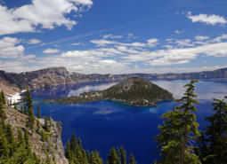
Crater Lake [COA ID: 121]
Geographic boundaries of the COAs were updated for the 2026 State Wildlife Action Plan and the associated COA profiles are intended to provide additional information. Content of each COA profile is being refined and will be updated to reflect current conditions when feasible. Please help us by submitting information on Local Conservation Actions, Plans, or …
Crawfordsville Oak-Washburn Butte [COA ID: 085]
Geographic boundaries of the COAs were updated for the 2026 State Wildlife Action Plan and the associated COA profiles are intended to provide additional information. Content of each COA profile is being refined and will be updated to reflect current conditions when feasible. Please help us by submitting information on Local Conservation Actions, Plans, or …
Crowley [COA ID: 185]
Geographic boundaries of the COAs were updated for the 2026 State Wildlife Action Plan and the associated COA profiles are intended to provide additional information. Content of each COA profile is being refined and will be updated to reflect current conditions when feasible. Please help us by submitting information on Local Conservation Actions, Plans, or …
Deer Island [COA ID: 053]
Geographic boundaries of the COAs were updated for the 2026 State Wildlife Action Plan and the associated COA profiles are intended to provide additional information. Content of each COA profile is being refined and will be updated to reflect current conditions when feasible. Please help us by submitting information on Local Conservation Actions, Plans, or …
Depoe Bay Area [COA ID: 023]
Geographic boundaries of the COAs were updated for the 2026 State Wildlife Action Plan and the associated COA profiles are intended to provide additional information. Content of each COA profile is being refined and will be updated to reflect current conditions when feasible. Please help us by submitting information on Local Conservation Actions, Plans, or …
Deschutes River [COA ID: 149]
Geographic boundaries of the COAs were updated for the 2026 State Wildlife Action Plan and the associated COA profiles are intended to provide additional information. Content of each COA profile is being refined and will be updated to reflect current conditions when feasible. Please help us by submitting information on Local Conservation Actions, Plans, or …
Devil’s Lake [COA ID: 020]
Geographic boundaries of the COAs were updated for the 2026 State Wildlife Action Plan and the associated COA profiles are intended to provide additional information. Content of each COA profile is being refined and will be updated to reflect current conditions when feasible. Please help us by submitting information on Local Conservation Actions, Plans, or …
Dry Valley (or Dog Lake) [COA ID: 144]
Geographic boundaries of the COAs were updated for the 2026 State Wildlife Action Plan and the associated COA profiles are intended to provide additional information. Content of each COA profile is being refined and will be updated to reflect current conditions when feasible. Please help us by submitting information on Local Conservation Actions, Plans, or …
Dundee Oaks [COA ID: 066]
Geographic boundaries of the COAs were updated for the 2026 State Wildlife Action Plan and the associated COA profiles are intended to provide additional information. Content of each COA profile is being refined and will be updated to reflect current conditions when feasible. Please help us by submitting information on Local Conservation Actions, Plans, or …
East Fork Illinois River [COA ID: 101]
Geographic boundaries of the COAs were updated for the 2026 State Wildlife Action Plan and the associated COA profiles are intended to provide additional information. Content of each COA profile is being refined and will be updated to reflect current conditions when feasible. Please help us by submitting information on Local Conservation Actions, Plans, or …
East Madras-Trout Creek Sagebrush and Grassland Area [COA ID: 172]
Geographic boundaries of the COAs were updated for the 2026 State Wildlife Action Plan and the associated COA profiles are intended to provide additional information. Content of each COA profile is being refined and will be updated to reflect current conditions when feasible. Please help us by submitting information on Local Conservation Actions, Plans, or …
Elliott State Forest [COA ID: 041]
Geographic boundaries of the COAs were updated for the 2026 State Wildlife Action Plan and the associated COA profiles are intended to provide additional information. Content of each COA profile is being refined and will be updated to reflect current conditions when feasible. Please help us by submitting information on Local Conservation Actions, Plans, or …
Eola Hills [COA ID: 073]
Geographic boundaries of the COAs were updated for the 2026 State Wildlife Action Plan and the associated COA profiles are intended to provide additional information. Content of each COA profile is being refined and will be updated to reflect current conditions when feasible. Please help us by submitting information on Local Conservation Actions, Plans, or …
Fields Peak [COA ID: 176]
Geographic boundaries of the COAs were updated for the 2026 State Wildlife Action Plan and the associated COA profiles are intended to provide additional information. Content of each COA profile is being refined and will be updated to reflect current conditions when feasible. Please help us by submitting information on Local Conservation Actions, Plans, or …
Fifteenmile Creek [COA ID: 147]
Geographic boundaries of the COAs were updated for the 2026 State Wildlife Action Plan and the associated COA profiles are intended to provide additional information. Content of each COA profile is being refined and will be updated to reflect current conditions when feasible. Please help us by submitting information on Local Conservation Actions, Plans, or …
Finley-Muddy Creek Area [COA ID: 084]
Geographic boundaries of the COAs were updated for the 2026 State Wildlife Action Plan and the associated COA profiles are intended to provide additional information. Content of each COA profile is being refined and will be updated to reflect current conditions when feasible. Please help us by submitting information on Local Conservation Actions, Plans, or …
Forest Park [COA ID: 058]
Geographic boundaries of the COAs were updated for the 2026 State Wildlife Action Plan and the associated COA profiles are intended to provide additional information. Content of each COA profile is being refined and will be updated to reflect current conditions when feasible. Please help us by submitting information on Local Conservation Actions, Plans, or …
Foster Flat-Black Rim Sagebrush Area [COA ID: 191]
Geographic boundaries of the COAs were updated for the 2026 State Wildlife Action Plan and the associated COA profiles are intended to provide additional information. Content of each COA profile is being refined and will be updated to reflect current conditions when feasible. Please help us by submitting information on Local Conservation Actions, Plans, or …
Gales Creek [COA ID: 013]
Geographic boundaries of the COAs were updated for the 2026 State Wildlife Action Plan and the associated COA profiles are intended to provide additional information. Content of each COA profile is being refined and will be updated to reflect current conditions when feasible. Please help us by submitting information on Local Conservation Actions, Plans, or …
Gearhart Mountain-North Fork Sprague [COA ID: 140]
Geographic boundaries of the COAs were updated for the 2026 State Wildlife Action Plan and the associated COA profiles are intended to provide additional information. Content of each COA profile is being refined and will be updated to reflect current conditions when feasible. Please help us by submitting information on Local Conservation Actions, Plans, or …
Grande Ronde Valley [COA ID: 159]
Geographic boundaries of the COAs were updated for the 2026 State Wildlife Action Plan and the associated COA profiles are intended to provide additional information. Content of each COA profile is being refined and will be updated to reflect current conditions when feasible. Please help us by submitting information on Local Conservation Actions, Plans, or …
Grave Creek [COA ID: 094]
Geographic boundaries of the COAs were updated for the 2026 State Wildlife Action Plan and the associated COA profiles are intended to provide additional information. Content of each COA profile is being refined and will be updated to reflect current conditions when feasible. Please help us by submitting information on Local Conservation Actions, Plans, or …
Habeck Oaks [COA ID: 074]
Geographic boundaries of the COAs were updated for the 2026 State Wildlife Action Plan and the associated COA profiles are intended to provide additional information. Content of each COA profile is being refined and will be updated to reflect current conditions when feasible. Please help us by submitting information on Local Conservation Actions, Plans, or …
Harney-Malheur Area [COA ID: 187]
Geographic boundaries of the COAs were updated for the 2026 State Wildlife Action Plan and the associated COA profiles are intended to provide additional information. Content of each COA profile is being refined and will be updated to reflect current conditions when feasible. Please help us by submitting information on Local Conservation Actions, Plans, or …
Hart Mountain Area [COA ID: 200]
Geographic boundaries of the COAs were updated for the 2026 State Wildlife Action Plan and the associated COA profiles are intended to provide additional information. Content of each COA profile is being refined and will be updated to reflect current conditions when feasible. Please help us by submitting information on Local Conservation Actions, Plans, or …
Hayden Island-Government Island [COA ID: 055]
Geographic boundaries of the COAs were updated for the 2026 State Wildlife Action Plan and the associated COA profiles are intended to provide additional information. Content of each COA profile is being refined and will be updated to reflect current conditions when feasible. Please help us by submitting information on Local Conservation Actions, Plans, or …
Heceta Head [COA ID: 031]
Geographic boundaries of the COAs were updated for the 2026 State Wildlife Action Plan and the associated COA profiles are intended to provide additional information. Content of each COA profile is being refined and will be updated to reflect current conditions when feasible. Please help us by submitting information on Local Conservation Actions, Plans, or …
Hood River [COA ID: 106]
Geographic boundaries of the COAs were updated for the 2026 State Wildlife Action Plan and the associated COA profiles are intended to provide additional information. Content of each COA profile is being refined and will be updated to reflect current conditions when feasible. Please help us by submitting information on Local Conservation Actions, Plans, or …
Illinois River-Silver Creek [COA ID: 096]
Geographic boundaries of the COAs were updated for the 2026 State Wildlife Action Plan and the associated COA profiles are intended to provide additional information. Content of each COA profile is being refined and will be updated to reflect current conditions when feasible. Please help us by submitting information on Local Conservation Actions, Plans, or …
Imnaha [COA ID: 161]
Geographic boundaries of the COAs were updated for the 2026 State Wildlife Action Plan and the associated COA profiles are intended to provide additional information. Content of each COA profile is being refined and will be updated to reflect current conditions when feasible. Please help us by submitting information on Local Conservation Actions, Plans, or …
Jordan Creek Wetlands [COA ID: 195]
Geographic boundaries of the COAs were updated for the 2026 State Wildlife Action Plan and the associated COA profiles are intended to provide additional information. Content of each COA profile is being refined and will be updated to reflect current conditions when feasible. Please help us by submitting information on Local Conservation Actions, Plans, or …
Kalmiopsis Area [COA ID: 100]
Geographic boundaries of the COAs were updated for the 2026 State Wildlife Action Plan and the associated COA profiles are intended to provide additional information. Content of each COA profile is being refined and will be updated to reflect current conditions when feasible. Please help us by submitting information on Local Conservation Actions, Plans, or …
King Mountain Area [COA ID: 095]
Geographic boundaries of the COAs were updated for the 2026 State Wildlife Action Plan and the associated COA profiles are intended to provide additional information. Content of each COA profile is being refined and will be updated to reflect current conditions when feasible. Please help us by submitting information on Local Conservation Actions, Plans, or …
Kings Valley-Woods Creek Oak Woodlands [COA ID: 080]
Geographic boundaries of the COAs were updated for the 2026 State Wildlife Action Plan and the associated COA profiles are intended to provide additional information. Content of each COA profile is being refined and will be updated to reflect current conditions when feasible. Please help us by submitting information on Local Conservation Actions, Plans, or …
Kingston Prairie-Scio Oak Pine Savanna [COA ID: 079]
Geographic boundaries of the COAs were updated for the 2026 State Wildlife Action Plan and the associated COA profiles are intended to provide additional information. Content of each COA profile is being refined and will be updated to reflect current conditions when feasible. Please help us by submitting information on Local Conservation Actions, Plans, or …
Klamath Marsh-Williamson River [COA ID: 134]
Geographic boundaries of the COAs were updated for the 2026 State Wildlife Action Plan and the associated COA profiles are intended to provide additional information. Content of each COA profile is being refined and will be updated to reflect current conditions when feasible. Please help us by submitting information on Local Conservation Actions, Plans, or …
Klamath River Canyon [COA ID: 142]
Geographic boundaries of the COAs were updated for the 2026 State Wildlife Action Plan and the associated COA profiles are intended to provide additional information. Content of each COA profile is being refined and will be updated to reflect current conditions when feasible. Please help us by submitting information on Local Conservation Actions, Plans, or …
Lake Abert [COA ID: 197]
Geographic boundaries of the COAs were updated for the 2026 State Wildlife Action Plan and the associated COA profiles are intended to provide additional information. Content of each COA profile is being refined and will be updated to reflect current conditions when feasible. Please help us by submitting information on Local Conservation Actions, Plans, or …
Lawrence Grasslands [COA ID: 152]
Geographic boundaries of the COAs were updated for the 2026 State Wildlife Action Plan and the associated COA profiles are intended to provide additional information. Content of each COA profile is being refined and will be updated to reflect current conditions when feasible. Please help us by submitting information on Local Conservation Actions, Plans, or …
Little Deschutes River [COA ID: 132]
Geographic boundaries of the COAs were updated for the 2026 State Wildlife Action Plan and the associated COA profiles are intended to provide additional information. Content of each COA profile is being refined and will be updated to reflect current conditions when feasible. Please help us by submitting information on Local Conservation Actions, Plans, or …
Little Louse Canyon [COA ID: 205]
Geographic boundaries of the COAs were updated for the 2026 State Wildlife Action Plan and the associated COA profiles are intended to provide additional information. Content of each COA profile is being refined and will be updated to reflect current conditions when feasible. Please help us by submitting information on Local Conservation Actions, Plans, or …
Little North Santiam River Area [COA ID: 109]
Geographic boundaries of the COAs were updated for the 2026 State Wildlife Action Plan and the associated COA profiles are intended to provide additional information. Content of each COA profile is being refined and will be updated to reflect current conditions when feasible. Please help us by submitting information on Local Conservation Actions, Plans, or …
Logan Valley-John Day River Headwaters [COA ID: 179]
Geographic boundaries of the COAs were updated for the 2026 State Wildlife Action Plan and the associated COA profiles are intended to provide additional information. Content of each COA profile is being refined and will be updated to reflect current conditions when feasible. Please help us by submitting information on Local Conservation Actions, Plans, or …
Long Creek-Coyote Creek-Silver Creek [COA ID: 135]
Geographic boundaries of the COAs were updated for the 2026 State Wildlife Action Plan and the associated COA profiles are intended to provide additional information. Content of each COA profile is being refined and will be updated to reflect current conditions when feasible. Please help us by submitting information on Local Conservation Actions, Plans, or …
Lost River Area [COA ID: 143]
Geographic boundaries of the COAs were updated for the 2026 State Wildlife Action Plan and the associated COA profiles are intended to provide additional information. Content of each COA profile is being refined and will be updated to reflect current conditions when feasible. Please help us by submitting information on Local Conservation Actions, Plans, or …
Lower Coquille River [COA ID: 045]
Geographic boundaries of the COAs were updated for the 2026 State Wildlife Action Plan and the associated COA profiles are intended to provide additional information. Content of each COA profile is being refined and will be updated to reflect current conditions when feasible. Please help us by submitting information on Local Conservation Actions, Plans, or …
Lower Deschutes River [COA ID: 148]
Geographic boundaries of the COAs were updated for the 2026 State Wildlife Action Plan and the associated COA profiles are intended to provide additional information. Content of each COA profile is being refined and will be updated to reflect current conditions when feasible. Please help us by submitting information on Local Conservation Actions, Plans, or …
Lower Grande Ronde [COA ID: 158]
Geographic boundaries of the COAs were updated for the 2026 State Wildlife Action Plan and the associated COA profiles are intended to provide additional information. Content of each COA profile is being refined and will be updated to reflect current conditions when feasible. Please help us by submitting information on Local Conservation Actions, Plans, or …
Lower John Day River [COA ID: 153]
Geographic boundaries of the COAs were updated for the 2026 State Wildlife Action Plan and the associated COA profiles are intended to provide additional information. Content of each COA profile is being refined and will be updated to reflect current conditions when feasible. Please help us by submitting information on Local Conservation Actions, Plans, or …

Lower Rogue River and Estuary [COA ID: 049]
Geographic boundaries of the COAs were updated for the 2026 State Wildlife Action Plan and the associated COA profiles are intended to provide additional information. Content of each COA profile is being refined and will be updated to reflect current conditions when feasible. Please help us by submitting information on Local Conservation Actions, Plans, or …

Lower Sandy River [COA ID: 057]
Geographic boundaries of the COAs were updated for the 2026 State Wildlife Action Plan and the associated COA profiles are intended to provide additional information. Content of each COA profile is being refined and will be updated to reflect current conditions when feasible. Please help us by submitting information on Local Conservation Actions, Plans, or …
Lower Willamette River Floodplain [COA ID: 059]
Geographic boundaries of the COAs were updated for the 2026 State Wildlife Action Plan and the associated COA profiles are intended to provide additional information. Content of each COA profile is being refined and will be updated to reflect current conditions when feasible. Please help us by submitting information on Local Conservation Actions, Plans, or …
Luckiamute River and Tributaries [COA ID: 075]
Geographic boundaries of the COAs were updated for the 2026 State Wildlife Action Plan and the associated COA profiles are intended to provide additional information. Content of each COA profile is being refined and will be updated to reflect current conditions when feasible. Please help us by submitting information on Local Conservation Actions, Plans, or …
Malheur River Headwaters [COA ID: 180]
Geographic boundaries of the COAs were updated for the 2026 State Wildlife Action Plan and the associated COA profiles are intended to provide additional information. Content of each COA profile is being refined and will be updated to reflect current conditions when feasible. Please help us by submitting information on Local Conservation Actions, Plans, or …
Mary’s Peak [COA ID: 028]
Geographic boundaries of the COAs were updated for the 2026 State Wildlife Action Plan and the associated COA profiles are intended to provide additional information. Content of each COA profile is being refined and will be updated to reflect current conditions when feasible. Please help us by submitting information on Local Conservation Actions, Plans, or …
McKenzie River Area [COA ID: 114]
Geographic boundaries of the COAs were updated for the 2026 State Wildlife Action Plan and the associated COA profiles are intended to provide additional information. Content of each COA profile is being refined and will be updated to reflect current conditions when feasible. Please help us by submitting information on Local Conservation Actions, Plans, or …
McTimmons Valley – Airlie Savanna [COA ID: 076]
Geographic boundaries of the COAs were updated for the 2026 State Wildlife Action Plan and the associated COA profiles are intended to provide additional information. Content of each COA profile is being refined and will be updated to reflect current conditions when feasible. Please help us by submitting information on Local Conservation Actions, Plans, or …
Metolius Bench-Mutton Mountains Wildlife Movement Corridor [COA ID: 150]
Geographic boundaries of the COAs were updated for the 2026 State Wildlife Action Plan and the associated COA profiles are intended to provide additional information. Content of each COA profile is being refined and will be updated to reflect current conditions when feasible. Please help us by submitting information on Local Conservation Actions, Plans, or …
Metolius River Area [COA ID: 127]
Geographic boundaries of the COAs were updated for the 2026 State Wildlife Action Plan and the associated COA profiles are intended to provide additional information. Content of each COA profile is being refined and will be updated to reflect current conditions when feasible. Please help us by submitting information on Local Conservation Actions, Plans, or …
Middle Fork John Day River [COA ID: 170]
Geographic boundaries of the COAs were updated for the 2026 State Wildlife Action Plan and the associated COA profiles are intended to provide additional information. Content of each COA profile is being refined and will be updated to reflect current conditions when feasible. Please help us by submitting information on Local Conservation Actions, Plans, or …
Middle Fork Willamette River [COA ID: 115]
Geographic boundaries of the COAs were updated for the 2026 State Wildlife Action Plan and the associated COA profiles are intended to provide additional information. Content of each COA profile is being refined and will be updated to reflect current conditions when feasible. Please help us by submitting information on Local Conservation Actions, Plans, or …
Middle Owyhee River Area [COA ID: 186]
Geographic boundaries of the COAs were updated for the 2026 State Wildlife Action Plan and the associated COA profiles are intended to provide additional information. Content of each COA profile is being refined and will be updated to reflect current conditions when feasible. Please help us by submitting information on Local Conservation Actions, Plans, or …
Middle Willamette River Floodplain [COA ID: 060]
Geographic boundaries of the COAs were updated for the 2026 State Wildlife Action Plan and the associated COA profiles are intended to provide additional information. Content of each COA profile is being refined and will be updated to reflect current conditions when feasible. Please help us by submitting information on Local Conservation Actions, Plans, or …
Middlefork Willamette River Headwaters [COA ID: 118]
Geographic boundaries of the COAs were updated for the 2026 State Wildlife Action Plan and the associated COA profiles are intended to provide additional information. Content of each COA profile is being refined and will be updated to reflect current conditions when feasible. Please help us by submitting information on Local Conservation Actions, Plans, or …
Mill Creek [COA ID: 024]
Geographic boundaries of the COAs were updated for the 2026 State Wildlife Action Plan and the associated COA profiles are intended to provide additional information. Content of each COA profile is being refined and will be updated to reflect current conditions when feasible. Please help us by submitting information on Local Conservation Actions, Plans, or …
Missouri Ridge [COA ID: 070]
Geographic boundaries of the COAs were updated for the 2026 State Wildlife Action Plan and the associated COA profiles are intended to provide additional information. Content of each COA profile is being refined and will be updated to reflect current conditions when feasible. Please help us by submitting information on Local Conservation Actions, Plans, or …
Mohawk River [COA ID: 088]
Geographic boundaries of the COAs were updated for the 2026 State Wildlife Action Plan and the associated COA profiles are intended to provide additional information. Content of each COA profile is being refined and will be updated to reflect current conditions when feasible. Please help us by submitting information on Local Conservation Actions, Plans, or …
Molalla River [COA ID: 069]
Geographic boundaries of the COAs were updated for the 2026 State Wildlife Action Plan and the associated COA profiles are intended to provide additional information. Content of each COA profile is being refined and will be updated to reflect current conditions when feasible. Please help us by submitting information on Local Conservation Actions, Plans, or …
Mt Hood Area [COA ID: 107]
Geographic boundaries of the COAs were updated for the 2026 State Wildlife Action Plan and the associated COA profiles are intended to provide additional information. Content of each COA profile is being refined and will be updated to reflect current conditions when feasible. Please help us by submitting information on Local Conservation Actions, Plans, or …
Mt Jefferson Wilderness, North [COA ID: 111]
Geographic boundaries of the COAs were updated for the 2026 State Wildlife Action Plan and the associated COA profiles are intended to provide additional information. Content of each COA profile is being refined and will be updated to reflect current conditions when feasible. Please help us by submitting information on Local Conservation Actions, Plans, or …
Necanicum Estuary [COA ID: 002]
Geographic boundaries of the COAs were updated for the 2026 State Wildlife Action Plan and the associated COA profiles are intended to provide additional information. Content of each COA profile is being refined and will be updated to reflect current conditions when feasible. Please help us by submitting information on Local Conservation Actions, Plans, or …

Necanicum River [COA ID: 004]
Geographic boundaries of the COAs were updated for the 2026 State Wildlife Action Plan and the associated COA profiles are intended to provide additional information. Content of each COA profile is being refined and will be updated to reflect current conditions when feasible. Please help us by submitting information on Local Conservation Actions, Plans, or …
Nehalem and Salmonberry River Headwaters [COA ID: 012]
Geographic boundaries of the COAs were updated for the 2026 State Wildlife Action Plan and the associated COA profiles are intended to provide additional information. Content of each COA profile is being refined and will be updated to reflect current conditions when feasible. Please help us by submitting information on Local Conservation Actions, Plans, or …
Nehalem River Estuary [COA ID: 009]
Geographic boundaries of the COAs were updated for the 2026 State Wildlife Action Plan and the associated COA profiles are intended to provide additional information. Content of each COA profile is being refined and will be updated to reflect current conditions when feasible. Please help us by submitting information on Local Conservation Actions, Plans, or …
Nestucca Bay [COA ID: 016]
Geographic boundaries of the COAs were updated for the 2026 State Wildlife Action Plan and the associated COA profiles are intended to provide additional information. Content of each COA profile is being refined and will be updated to reflect current conditions when feasible. Please help us by submitting information on Local Conservation Actions, Plans, or …
Nestucca River Watershed [COA ID: 017]
Geographic boundaries of the COAs were updated for the 2026 State Wildlife Action Plan and the associated COA profiles are intended to provide additional information. Content of each COA profile is being refined and will be updated to reflect current conditions when feasible. Please help us by submitting information on Local Conservation Actions, Plans, or …
Netarts Bay [COA ID: 014]
Geographic boundaries of the COAs were updated for the 2026 State Wildlife Action Plan and the associated COA profiles are intended to provide additional information. Content of each COA profile is being refined and will be updated to reflect current conditions when feasible. Please help us by submitting information on Local Conservation Actions, Plans, or …
New River Area [COA ID: 047]
Geographic boundaries of the COAs were updated for the 2026 State Wildlife Action Plan and the associated COA profiles are intended to provide additional information. Content of each COA profile is being refined and will be updated to reflect current conditions when feasible. Please help us by submitting information on Local Conservation Actions, Plans, or …

Newberry Crater [COA ID: 130]
Geographic boundaries of the COAs were updated for the 2026 State Wildlife Action Plan and the associated COA profiles are intended to provide additional information. Content of each COA profile is being refined and will be updated to reflect current conditions when feasible. Please help us by submitting information on Local Conservation Actions, Plans, or …
North Fork John Day River 1 [COA ID: 168]
Geographic boundaries of the COAs were updated for the 2026 State Wildlife Action Plan and the associated COA profiles are intended to provide additional information. Content of each COA profile is being refined and will be updated to reflect current conditions when feasible. Please help us by submitting information on Local Conservation Actions, Plans, or …
North Fork John Day River 2 [COA ID: 169]
Geographic boundaries of the COAs were updated for the 2026 State Wildlife Action Plan and the associated COA profiles are intended to provide additional information. Content of each COA profile is being refined and will be updated to reflect current conditions when feasible. Please help us by submitting information on Local Conservation Actions, Plans, or …
North Fork Malheur-Monument Rock Area [COA ID: 182]
Geographic boundaries of the COAs were updated for the 2026 State Wildlife Action Plan and the associated COA profiles are intended to provide additional information. Content of each COA profile is being refined and will be updated to reflect current conditions when feasible. Please help us by submitting information on Local Conservation Actions, Plans, or …
North Fork Nehalem River [COA ID: 010]
Geographic boundaries of the COAs were updated for the 2026 State Wildlife Action Plan and the associated COA profiles are intended to provide additional information. Content of each COA profile is being refined and will be updated to reflect current conditions when feasible. Please help us by submitting information on Local Conservation Actions, Plans, or …
North Fork Siuslaw River [COA ID: 032]
Geographic boundaries of the COAs were updated for the 2026 State Wildlife Action Plan and the associated COA profiles are intended to provide additional information. Content of each COA profile is being refined and will be updated to reflect current conditions when feasible. Please help us by submitting information on Local Conservation Actions, Plans, or …
North Fork Smith River [COA ID: 037]
Geographic boundaries of the COAs were updated for the 2026 State Wildlife Action Plan and the associated COA profiles are intended to provide additional information. Content of each COA profile is being refined and will be updated to reflect current conditions when feasible. Please help us by submitting information on Local Conservation Actions, Plans, or …
North Medford Area [COA ID: 097]
Geographic boundaries of the COAs were updated for the 2026 State Wildlife Action Plan and the associated COA profiles are intended to provide additional information. Content of each COA profile is being refined and will be updated to reflect current conditions when feasible. Please help us by submitting information on Local Conservation Actions, Plans, or …
North Umpqua River Area [COA ID: 090]
Geographic boundaries of the COAs were updated for the 2026 State Wildlife Action Plan and the associated COA profiles are intended to provide additional information. Content of each COA profile is being refined and will be updated to reflect current conditions when feasible. Please help us by submitting information on Local Conservation Actions, Plans, or …
Ochoco Mountains [COA ID: 173]
Geographic boundaries of the COAs were updated for the 2026 State Wildlife Action Plan and the associated COA profiles are intended to provide additional information. Content of each COA profile is being refined and will be updated to reflect current conditions when feasible. Please help us by submitting information on Local Conservation Actions, Plans, or …
Odell Lake-Davis Lake [COA ID: 117]
Geographic boundaries of the COAs were updated for the 2026 State Wildlife Action Plan and the associated COA profiles are intended to provide additional information. Content of each COA profile is being refined and will be updated to reflect current conditions when feasible. Please help us by submitting information on Local Conservation Actions, Plans, or …
One Horse Slough-Beaver Creek [COA ID: 083]
Geographic boundaries of the COAs were updated for the 2026 State Wildlife Action Plan and the associated COA profiles are intended to provide additional information. Content of each COA profile is being refined and will be updated to reflect current conditions when feasible. Please help us by submitting information on Local Conservation Actions, Plans, or …
Oregon Caves-Applegate Area [COA ID: 102]
Geographic boundaries of the COAs were updated for the 2026 State Wildlife Action Plan and the associated COA profiles are intended to provide additional information. Content of each COA profile is being refined and will be updated to reflect current conditions when feasible. Please help us by submitting information on Local Conservation Actions, Plans, or …
Pelican Butte-Sky Lakes Area [COA ID: 123]
Geographic boundaries of the COAs were updated for the 2026 State Wildlife Action Plan and the associated COA profiles are intended to provide additional information. Content of each COA profile is being refined and will be updated to reflect current conditions when feasible. Please help us by submitting information on Local Conservation Actions, Plans, or …
Pistol River Estuary [COA ID: 050]
Geographic boundaries of the COAs were updated for the 2026 State Wildlife Action Plan and the associated COA profiles are intended to provide additional information. Content of each COA profile is being refined and will be updated to reflect current conditions when feasible. Please help us by submitting information on Local Conservation Actions, Plans, or …
Powder River Sage-Grouse Core Area [COA ID: 164]
Geographic boundaries of the COAs were updated for the 2026 State Wildlife Action Plan and the associated COA profiles are intended to provide additional information. Content of each COA profile is being refined and will be updated to reflect current conditions when feasible. Please help us by submitting information on Local Conservation Actions, Plans, or …
Pudding River [COA ID: 068]
Geographic boundaries of the COAs were updated for the 2026 State Wildlife Action Plan and the associated COA profiles are intended to provide additional information. Content of each COA profile is being refined and will be updated to reflect current conditions when feasible. Please help us by submitting information on Local Conservation Actions, Plans, or …
Pueblo Mountain [COA ID: 203]
Geographic boundaries of the COAs were updated for the 2026 State Wildlife Action Plan and the associated COA profiles are intended to provide additional information. Content of each COA profile is being refined and will be updated to reflect current conditions when feasible. Please help us by submitting information on Local Conservation Actions, Plans, or …
Quartz Mountain [COA ID: 131]
Geographic boundaries of the COAs were updated for the 2026 State Wildlife Action Plan and the associated COA profiles are intended to provide additional information. Content of each COA profile is being refined and will be updated to reflect current conditions when feasible. Please help us by submitting information on Local Conservation Actions, Plans, or …
Quartzville Creek Area [COA ID: 112]
Geographic boundaries of the COAs were updated for the 2026 State Wildlife Action Plan and the associated COA profiles are intended to provide additional information. Content of each COA profile is being refined and will be updated to reflect current conditions when feasible. Please help us by submitting information on Local Conservation Actions, Plans, or …
Rattlesnake Creek-Calamity Creek Area [COA ID: 181]
Geographic boundaries of the COAs were updated for the 2026 State Wildlife Action Plan and the associated COA profiles are intended to provide additional information. Content of each COA profile is being refined and will be updated to reflect current conditions when feasible. Please help us by submitting information on Local Conservation Actions, Plans, or …
Red Prairie-Mill Creek-Willamina Oaks South [COA ID: 071]
Geographic boundaries of the COAs were updated for the 2026 State Wildlife Action Plan and the associated COA profiles are intended to provide additional information. Content of each COA profile is being refined and will be updated to reflect current conditions when feasible. Please help us by submitting information on Local Conservation Actions, Plans, or …
Rickreall Creek and Little Luckiamute River Headwaters [COA ID: 025]
Geographic boundaries of the COAs were updated for the 2026 State Wildlife Action Plan and the associated COA profiles are intended to provide additional information. Content of each COA profile is being refined and will be updated to reflect current conditions when feasible. Please help us by submitting information on Local Conservation Actions, Plans, or …

Rock Creek [COA ID: 120]
Geographic boundaries of the COAs were updated for the 2026 State Wildlife Action Plan and the associated COA profiles are intended to provide additional information. Content of each COA profile is being refined and will be updated to reflect current conditions when feasible. Please help us by submitting information on Local Conservation Actions, Plans, or …
Rock Creek-Butter Creek Grasslands [COA ID: 155]
Geographic boundaries of the COAs were updated for the 2026 State Wildlife Action Plan and the associated COA profiles are intended to provide additional information. Content of each COA profile is being refined and will be updated to reflect current conditions when feasible. Please help us by submitting information on Local Conservation Actions, Plans, or …
Rogue River [COA ID: 093]
Geographic boundaries of the COAs were updated for the 2026 State Wildlife Action Plan and the associated COA profiles are intended to provide additional information. Content of each COA profile is being refined and will be updated to reflect current conditions when feasible. Please help us by submitting information on Local Conservation Actions, Plans, or …
Saddle Mountain [COA ID: 005]
Geographic boundaries of the COAs were updated for the 2026 State Wildlife Action Plan and the associated COA profiles are intended to provide additional information. Content of each COA profile is being refined and will be updated to reflect current conditions when feasible. Please help us by submitting information on Local Conservation Actions, Plans, or …
Sage Hen Creek [COA ID: 201]
Geographic boundaries of the COAs were updated for the 2026 State Wildlife Action Plan and the associated COA profiles are intended to provide additional information. Content of each COA profile is being refined and will be updated to reflect current conditions when feasible. Please help us by submitting information on Local Conservation Actions, Plans, or …
Salem Hills-Ankeny NWR [COA ID: 077]
Geographic boundaries of the COAs were updated for the 2026 State Wildlife Action Plan and the associated COA profiles are intended to provide additional information. Content of each COA profile is being refined and will be updated to reflect current conditions when feasible. Please help us by submitting information on Local Conservation Actions, Plans, or …
Salmon River Estuary-Cascade Head [COA ID: 019]
Geographic boundaries of the COAs were updated for the 2026 State Wildlife Action Plan and the associated COA profiles are intended to provide additional information. Content of each COA profile is being refined and will be updated to reflect current conditions when feasible. Please help us by submitting information on Local Conservation Actions, Plans, or …
Sand Lake Area [COA ID: 015]
Geographic boundaries of the COAs were updated for the 2026 State Wildlife Action Plan and the associated COA profiles are intended to provide additional information. Content of each COA profile is being refined and will be updated to reflect current conditions when feasible. Please help us by submitting information on Local Conservation Actions, Plans, or …
Santiam Confluences [COA ID: 078]
Geographic boundaries of the COAs were updated for the 2026 State Wildlife Action Plan and the associated COA profiles are intended to provide additional information. Content of each COA profile is being refined and will be updated to reflect current conditions when feasible. Please help us by submitting information on Local Conservation Actions, Plans, or …
Sauvie Island-Scappoose [COA ID: 054]
Geographic boundaries of the COAs were updated for the 2026 State Wildlife Action Plan and the associated COA profiles are intended to provide additional information. Content of each COA profile is being refined and will be updated to reflect current conditions when feasible. Please help us by submitting information on Local Conservation Actions, Plans, or …
Scoggins Valley-Mount Richmond [COA ID: 063]
Geographic boundaries of the COAs were updated for the 2026 State Wildlife Action Plan and the associated COA profiles are intended to provide additional information. Content of each COA profile is being refined and will be updated to reflect current conditions when feasible. Please help us by submitting information on Local Conservation Actions, Plans, or …
Shady Cove Foothills [COA ID: 098]
Geographic boundaries of the COAs were updated for the 2026 State Wildlife Action Plan and the associated COA profiles are intended to provide additional information. Content of each COA profile is being refined and will be updated to reflect current conditions when feasible. Please help us by submitting information on Local Conservation Actions, Plans, or …
Siletz Bay [COA ID: 021]
Geographic boundaries of the COAs were updated for the 2026 State Wildlife Action Plan and the associated COA profiles are intended to provide additional information. Content of each COA profile is being refined and will be updated to reflect current conditions when feasible. Please help us by submitting information on Local Conservation Actions, Plans, or …
Siletz River [COA ID: 022]
Geographic boundaries of the COAs were updated for the 2026 State Wildlife Action Plan and the associated COA profiles are intended to provide additional information. Content of each COA profile is being refined and will be updated to reflect current conditions when feasible. Please help us by submitting information on Local Conservation Actions, Plans, or …
Silver Creek Area [COA ID: 175]
Geographic boundaries of the COAs were updated for the 2026 State Wildlife Action Plan and the associated COA profiles are intended to provide additional information. Content of each COA profile is being refined and will be updated to reflect current conditions when feasible. Please help us by submitting information on Local Conservation Actions, Plans, or …
Siskiyou Crest Area [COA ID: 104]
Geographic boundaries of the COAs were updated for the 2026 State Wildlife Action Plan and the associated COA profiles are intended to provide additional information. Content of each COA profile is being refined and will be updated to reflect current conditions when feasible. Please help us by submitting information on Local Conservation Actions, Plans, or …
Siuslaw River [COA ID: 035]
Geographic boundaries of the COAs were updated for the 2026 State Wildlife Action Plan and the associated COA profiles are intended to provide additional information. Content of each COA profile is being refined and will be updated to reflect current conditions when feasible. Please help us by submitting information on Local Conservation Actions, Plans, or …
Siuslaw River Estuary [COA ID: 034]
Geographic boundaries of the COAs were updated for the 2026 State Wildlife Action Plan and the associated COA profiles are intended to provide additional information. Content of each COA profile is being refined and will be updated to reflect current conditions when feasible. Please help us by submitting information on Local Conservation Actions, Plans, or …
Sixes River-Elk River [COA ID: 048]
Geographic boundaries of the COAs were updated for the 2026 State Wildlife Action Plan and the associated COA profiles are intended to provide additional information. Content of each COA profile is being refined and will be updated to reflect current conditions when feasible. Please help us by submitting information on Local Conservation Actions, Plans, or …
Smith-Bybee Lakes and Columbia Slough [COA ID: 056]
Geographic boundaries of the COAs were updated for the 2026 State Wildlife Action Plan and the associated COA profiles are intended to provide additional information. Content of each COA profile is being refined and will be updated to reflect current conditions when feasible. Please help us by submitting information on Local Conservation Actions, Plans, or …
Soda Mountain Area [COA ID: 124]
Geographic boundaries of the COAs were updated for the 2026 State Wildlife Action Plan and the associated COA profiles are intended to provide additional information. Content of each COA profile is being refined and will be updated to reflect current conditions when feasible. Please help us by submitting information on Local Conservation Actions, Plans, or …
Soldier Creek-Upper Owyhee River [COA ID: 196]
Geographic boundaries of the COAs were updated for the 2026 State Wildlife Action Plan and the associated COA profiles are intended to provide additional information. Content of each COA profile is being refined and will be updated to reflect current conditions when feasible. Please help us by submitting information on Local Conservation Actions, Plans, or …
South Fork Coquille [COA ID: 046]
Geographic boundaries of the COAs were updated for the 2026 State Wildlife Action Plan and the associated COA profiles are intended to provide additional information. Content of each COA profile is being refined and will be updated to reflect current conditions when feasible. Please help us by submitting information on Local Conservation Actions, Plans, or …
South Fork Crooked River Area [COA ID: 174]
Geographic boundaries of the COAs were updated for the 2026 State Wildlife Action Plan and the associated COA profiles are intended to provide additional information. Content of each COA profile is being refined and will be updated to reflect current conditions when feasible. Please help us by submitting information on Local Conservation Actions, Plans, or …
South Fork Umpqua River and Tributaries [COA ID: 091]
Geographic boundaries of the COAs were updated for the 2026 State Wildlife Action Plan and the associated COA profiles are intended to provide additional information. Content of each COA profile is being refined and will be updated to reflect current conditions when feasible. Please help us by submitting information on Local Conservation Actions, Plans, or …
South John Day River [COA ID: 171]
Geographic boundaries of the COAs were updated for the 2026 State Wildlife Action Plan and the associated COA profiles are intended to provide additional information. Content of each COA profile is being refined and will be updated to reflect current conditions when feasible. Please help us by submitting information on Local Conservation Actions, Plans, or …
Sprague River [COA ID: 139]
Geographic boundaries of the COAs were updated for the 2026 State Wildlife Action Plan and the associated COA profiles are intended to provide additional information. Content of each COA profile is being refined and will be updated to reflect current conditions when feasible. Please help us by submitting information on Local Conservation Actions, Plans, or …
Steens Mountain [COA ID: 192]
Geographic boundaries of the COAs were updated for the 2026 State Wildlife Action Plan and the associated COA profiles are intended to provide additional information. Content of each COA profile is being refined and will be updated to reflect current conditions when feasible. Please help us by submitting information on Local Conservation Actions, Plans, or …
Summer Lake Area [COA ID: 189]
Geographic boundaries of the COAs were updated for the 2026 State Wildlife Action Plan and the associated COA profiles are intended to provide additional information. Content of each COA profile is being refined and will be updated to reflect current conditions when feasible. Please help us by submitting information on Local Conservation Actions, Plans, or …
Sutton Lake Area [COA ID: 033]
Geographic boundaries of the COAs were updated for the 2026 State Wildlife Action Plan and the associated COA profiles are intended to provide additional information. Content of each COA profile is being refined and will be updated to reflect current conditions when feasible. Please help us by submitting information on Local Conservation Actions, Plans, or …
Sycan Marsh [COA ID: 136]
Geographic boundaries of the COAs were updated for the 2026 State Wildlife Action Plan and the associated COA profiles are intended to provide additional information. Content of each COA profile is being refined and will be updated to reflect current conditions when feasible. Please help us by submitting information on Local Conservation Actions, Plans, or …
Sycan River [COA ID: 137]
Geographic boundaries of the COAs were updated for the 2026 State Wildlife Action Plan and the associated COA profiles are intended to provide additional information. Content of each COA profile is being refined and will be updated to reflect current conditions when feasible. Please help us by submitting information on Local Conservation Actions, Plans, or …
Tahkenitch-Siltcoos Lakes [COA ID: 036]
Geographic boundaries of the COAs were updated for the 2026 State Wildlife Action Plan and the associated COA profiles are intended to provide additional information. Content of each COA profile is being refined and will be updated to reflect current conditions when feasible. Please help us by submitting information on Local Conservation Actions, Plans, or …
Ten Cent Lake-Juniper Lake Area [COA ID: 193]
Geographic boundaries of the COAs were updated for the 2026 State Wildlife Action Plan and the associated COA profiles are intended to provide additional information. Content of each COA profile is being refined and will be updated to reflect current conditions when feasible. Please help us by submitting information on Local Conservation Actions, Plans, or …
Tenmile Area [COA ID: 092]
Geographic boundaries of the COAs were updated for the 2026 State Wildlife Action Plan and the associated COA profiles are intended to provide additional information. Content of each COA profile is being refined and will be updated to reflect current conditions when feasible. Please help us by submitting information on Local Conservation Actions, Plans, or …
Tenmile Lake [COA ID: 040]
Geographic boundaries of the COAs were updated for the 2026 State Wildlife Action Plan and the associated COA profiles are intended to provide additional information. Content of each COA profile is being refined and will be updated to reflect current conditions when feasible. Please help us by submitting information on Local Conservation Actions, Plans, or …
Thomas Creek-Goose Lake [COA ID: 145]
Geographic boundaries of the COAs were updated for the 2026 State Wildlife Action Plan and the associated COA profiles are intended to provide additional information. Content of each COA profile is being refined and will be updated to reflect current conditions when feasible. Please help us by submitting information on Local Conservation Actions, Plans, or …

Three Forks [COA ID: 206]
Geographic boundaries of the COAs were updated for the 2026 State Wildlife Action Plan and the associated COA profiles are intended to provide additional information. Content of each COA profile is being refined and will be updated to reflect current conditions when feasible. Please help us by submitting information on Local Conservation Actions, Plans, or …
Tillamook Bay and Tributaries [COA ID: 011]
Geographic boundaries of the COAs were updated for the 2026 State Wildlife Action Plan and the associated COA profiles are intended to provide additional information. Content of each COA profile is being refined and will be updated to reflect current conditions when feasible. Please help us by submitting information on Local Conservation Actions, Plans, or …
Tillamook Head [COA ID: 003]
Geographic boundaries of the COAs were updated for the 2026 State Wildlife Action Plan and the associated COA profiles are intended to provide additional information. Content of each COA profile is being refined and will be updated to reflect current conditions when feasible. Please help us by submitting information on Local Conservation Actions, Plans, or …
Trask Mountain [COA ID: 018]
Geographic boundaries of the COAs were updated for the 2026 State Wildlife Action Plan and the associated COA profiles are intended to provide additional information. Content of each COA profile is being refined and will be updated to reflect current conditions when feasible. Please help us by submitting information on Local Conservation Actions, Plans, or …
Trout Creek Mountains [COA ID: 204]
Geographic boundaries of the COAs were updated for the 2026 State Wildlife Action Plan and the associated COA profiles are intended to provide additional information. Content of each COA profile is being refined and will be updated to reflect current conditions when feasible. Please help us by submitting information on Local Conservation Actions, Plans, or …
Tualatin River [COA ID: 064]
Geographic boundaries of the COAs were updated for the 2026 State Wildlife Action Plan and the associated COA profiles are intended to provide additional information. Content of each COA profile is being refined and will be updated to reflect current conditions when feasible. Please help us by submitting information on Local Conservation Actions, Plans, or …
Umpqua Headwaters [COA ID: 119]
Geographic boundaries of the COAs were updated for the 2026 State Wildlife Action Plan and the associated COA profiles are intended to provide additional information. Content of each COA profile is being refined and will be updated to reflect current conditions when feasible. Please help us by submitting information on Local Conservation Actions, Plans, or …
Umpqua River [COA ID: 042]
Geographic boundaries of the COAs were updated for the 2026 State Wildlife Action Plan and the associated COA profiles are intended to provide additional information. Content of each COA profile is being refined and will be updated to reflect current conditions when feasible. Please help us by submitting information on Local Conservation Actions, Plans, or …
Umpqua River Estuary [COA ID: 038]
Geographic boundaries of the COAs were updated for the 2026 State Wildlife Action Plan and the associated COA profiles are intended to provide additional information. Content of each COA profile is being refined and will be updated to reflect current conditions when feasible. Please help us by submitting information on Local Conservation Actions, Plans, or …
Upper Deschutes River [COA ID: 129]
Geographic boundaries of the COAs were updated for the 2026 State Wildlife Action Plan and the associated COA profiles are intended to provide additional information. Content of each COA profile is being refined and will be updated to reflect current conditions when feasible. Please help us by submitting information on Local Conservation Actions, Plans, or …
Upper Grande Ronde River Area [COA ID: 160]
Geographic boundaries of the COAs were updated for the 2026 State Wildlife Action Plan and the associated COA profiles are intended to provide additional information. Content of each COA profile is being refined and will be updated to reflect current conditions when feasible. Please help us by submitting information on Local Conservation Actions, Plans, or …
Upper Klamath Lake Area [COA ID: 138]
Geographic boundaries of the COAs were updated for the 2026 State Wildlife Action Plan and the associated COA profiles are intended to provide additional information. Content of each COA profile is being refined and will be updated to reflect current conditions when feasible. Please help us by submitting information on Local Conservation Actions, Plans, or …
Upper Silvies River [COA ID: 178]
Geographic boundaries of the COAs were updated for the 2026 State Wildlife Action Plan and the associated COA profiles are intended to provide additional information. Content of each COA profile is being refined and will be updated to reflect current conditions when feasible. Please help us by submitting information on Local Conservation Actions, Plans, or …
Upper Siuslaw [COA ID: 089]
Geographic boundaries of the COAs were updated for the 2026 State Wildlife Action Plan and the associated COA profiles are intended to provide additional information. Content of each COA profile is being refined and will be updated to reflect current conditions when feasible. Please help us by submitting information on Local Conservation Actions, Plans, or …
Upper South Fork Malheur Area [COA ID: 188]
Geographic boundaries of the COAs were updated for the 2026 State Wildlife Action Plan and the associated COA profiles are intended to provide additional information. Content of each COA profile is being refined and will be updated to reflect current conditions when feasible. Please help us by submitting information on Local Conservation Actions, Plans, or …
Upper Willamette River Floodplain [COA ID: 061]
Geographic boundaries of the COAs were updated for the 2026 State Wildlife Action Plan and the associated COA profiles are intended to provide additional information. Content of each COA profile is being refined and will be updated to reflect current conditions when feasible. Please help us by submitting information on Local Conservation Actions, Plans, or …
Walla Walla Headwaters [COA ID: 157]
Geographic boundaries of the COAs were updated for the 2026 State Wildlife Action Plan and the associated COA profiles are intended to provide additional information. Content of each COA profile is being refined and will be updated to reflect current conditions when feasible. Please help us by submitting information on Local Conservation Actions, Plans, or …
Wallowa Mountains [COA ID: 163]
Geographic boundaries of the COAs were updated for the 2026 State Wildlife Action Plan and the associated COA profiles are intended to provide additional information. Content of each COA profile is being refined and will be updated to reflect current conditions when feasible. Please help us by submitting information on Local Conservation Actions, Plans, or …
Warm Springs River [COA ID: 126]
Geographic boundaries of the COAs were updated for the 2026 State Wildlife Action Plan and the associated COA profiles are intended to provide additional information. Content of each COA profile is being refined and will be updated to reflect current conditions when feasible. Please help us by submitting information on Local Conservation Actions, Plans, or …
Warner Basin Wetlands [COA ID: 199]
Geographic boundaries of the COAs were updated for the 2026 State Wildlife Action Plan and the associated COA profiles are intended to provide additional information. Content of each COA profile is being refined and will be updated to reflect current conditions when feasible. Please help us by submitting information on Local Conservation Actions, Plans, or …
Warner Mountains [COA ID: 146]
Geographic boundaries of the COAs were updated for the 2026 State Wildlife Action Plan and the associated COA profiles are intended to provide additional information. Content of each COA profile is being refined and will be updated to reflect current conditions when feasible. Please help us by submitting information on Local Conservation Actions, Plans, or …

Warner West [COA ID: 198]
Geographic boundaries of the COAs were updated for the 2026 State Wildlife Action Plan and the associated COA profiles are intended to provide additional information. Content of each COA profile is being refined and will be updated to reflect current conditions when feasible. Please help us by submitting information on Local Conservation Actions, Plans, or …
Wasco Oaks [COA ID: 125]
Geographic boundaries of the COAs were updated for the 2026 State Wildlife Action Plan and the associated COA profiles are intended to provide additional information. Content of each COA profile is being refined and will be updated to reflect current conditions when feasible. Please help us by submitting information on Local Conservation Actions, Plans, or …
Wassen Creek [COA ID: 039]
Geographic boundaries of the COAs were updated for the 2026 State Wildlife Action Plan and the associated COA profiles are intended to provide additional information. Content of each COA profile is being refined and will be updated to reflect current conditions when feasible. Please help us by submitting information on Local Conservation Actions, Plans, or …
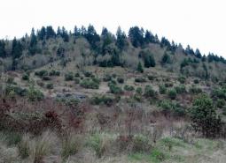
West Eugene Area [COA ID: 086]
Geographic boundaries of the COAs were updated for the 2026 State Wildlife Action Plan and the associated COA profiles are intended to provide additional information. Content of each COA profile is being refined and will be updated to reflect current conditions when feasible. Please help us by submitting information on Local Conservation Actions, Plans, or …
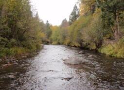
Whychus Creek [COA ID: 128]
Geographic boundaries of the COAs were updated for the 2026 State Wildlife Action Plan and the associated COA profiles are intended to provide additional information. Content of each COA profile is being refined and will be updated to reflect current conditions when feasible. Please help us by submitting information on Local Conservation Actions, Plans, or …
Willow Creek-Birch Creek Area [COA ID: 167]
Geographic boundaries of the COAs were updated for the 2026 State Wildlife Action Plan and the associated COA profiles are intended to provide additional information. Content of each COA profile is being refined and will be updated to reflect current conditions when feasible. Please help us by submitting information on Local Conservation Actions, Plans, or …
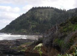
Yachats River Area [COA ID: 030]
Geographic boundaries of the COAs were updated for the 2026 State Wildlife Action Plan and the associated COA profiles are intended to provide additional information. Content of each COA profile is being refined and will be updated to reflect current conditions when feasible. Please help us by submitting information on Local Conservation Actions, Plans, or …
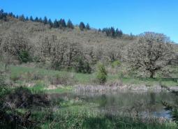
Yamhill Oaks-Willamina Oaks North [COA ID: 067]
Geographic boundaries of the COAs were updated for the 2026 State Wildlife Action Plan and the associated COA profiles are intended to provide additional information. Content of each COA profile is being refined and will be updated to reflect current conditions when feasible. Please help us by submitting information on Local Conservation Actions, Plans, or …
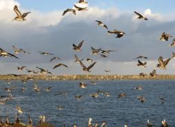
Yaquina Bay [COA ID: 026]
Geographic boundaries of the COAs were updated for the 2026 State Wildlife Action Plan and the associated COA profiles are intended to provide additional information. Content of each COA profile is being refined and will be updated to reflect current conditions when feasible. Please help us by submitting information on Local Conservation Actions, Plans, or …
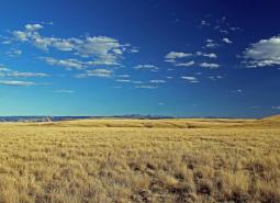
Zumwalt Prairie Plateau [COA ID: 162]
Geographic boundaries of the COAs were updated for the 2026 State Wildlife Action Plan and the associated COA profiles are intended to provide additional information. Content of each COA profile is being refined and will be updated to reflect current conditions when feasible. Please help us by submitting information on Local Conservation Actions, Plans, or …