
Description
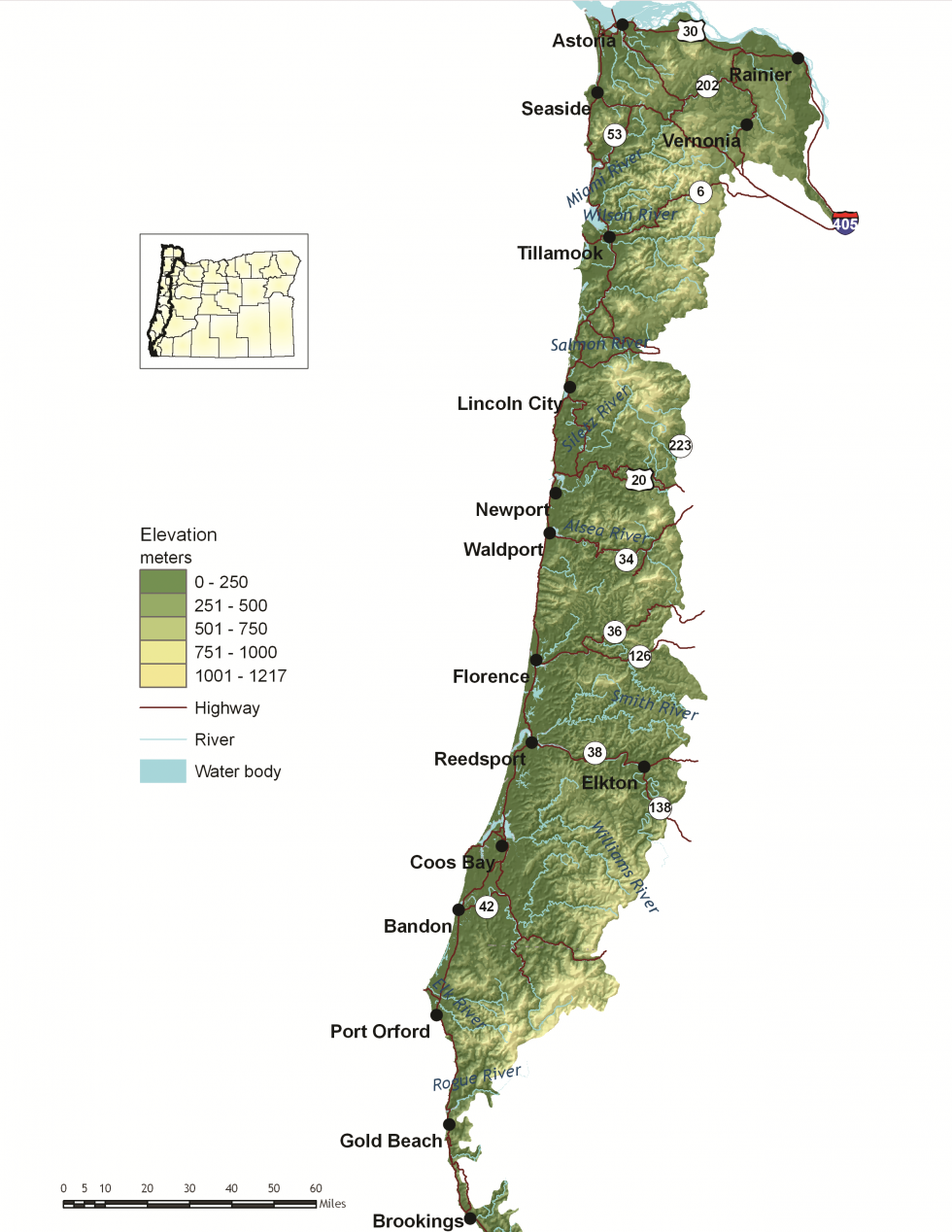
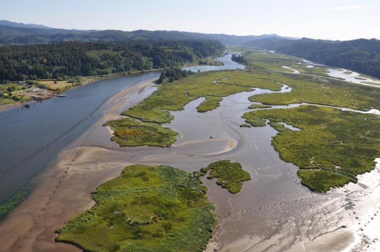
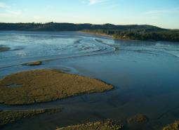
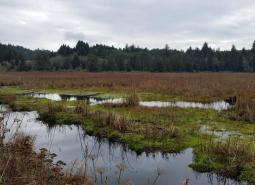
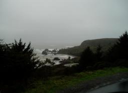
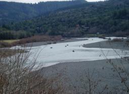
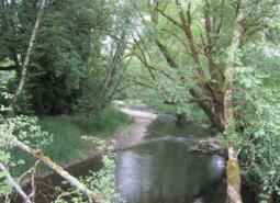
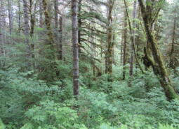
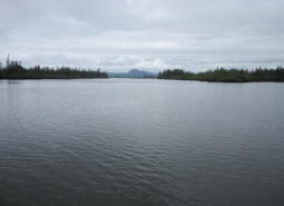
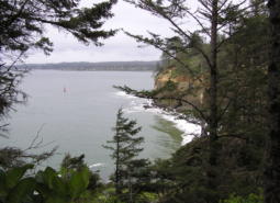
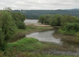
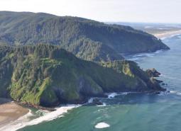
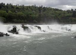
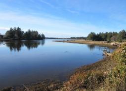
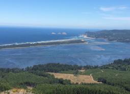
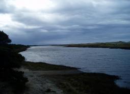
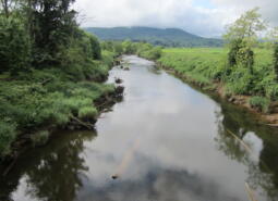
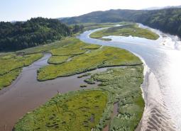
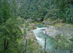
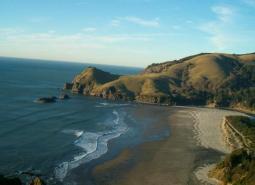
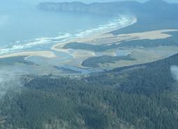
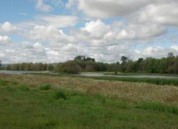
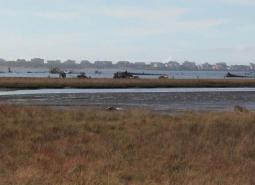
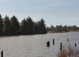
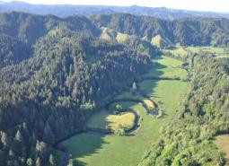
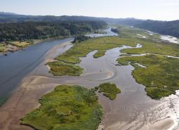
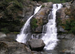
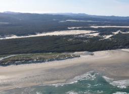
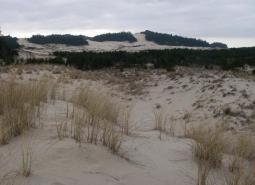
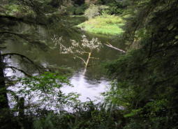
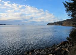
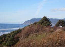
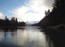
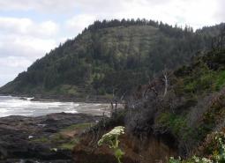
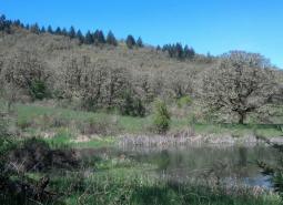
Oregon’s Coast Range ecoregion is known for its dramatic scenery. It is also extremely ecologically diverse, with habitats ranging from open sandy dunes to lush forests and from marshes to headwater streams. Along the coastline, habitats are directly influenced by the marine environment and include beaches, estuaries, and headlands. The Coast Range includes the highest density of streams found in the state, and deciduous riparian vegetation is distinct from surrounding coniferous forests. The Coast Range ecoregion includes the entire reach of the Oregon coastline, bordering the Nearshore ecoregion, and extends east through coastal forests to the border of the Willamette Valley and Klamath Mountains ecoregions.
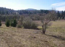
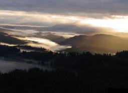
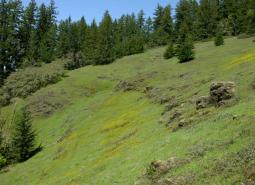
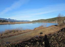
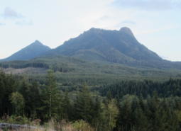
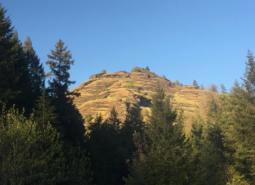
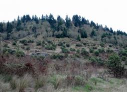
The topography is highly variable, from coastal mountain ranges characterized by steep mountain slopes and sharp ridges to coastal lowlands. Elevation varies from sea level to Marys Peak, which is roughly 4,100 feet high; however, main ridge summits are approximately 1,400-2,500 feet.
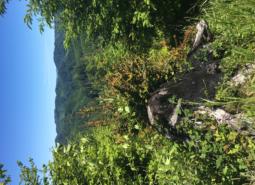
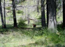
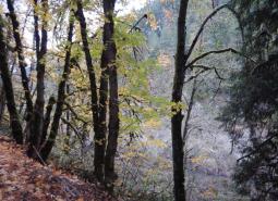
The Coast Range’s climate is influenced by its topography and cool, moist air from the ocean, making it the wettest and mildest in the state. These conditions are ideal for Oregon’s highly productive temperate rainforests, which are important ecologically and for local economies. Most of the ecoregion is dominated by coniferous forests. Large forest fires are historically infrequent but are severe when they occur. For example, the Tillamook Burn, a series of wildfires that occurred from 1939-1951, burned approximately 350,000 acres. Warming temperatures and changes in timing and patterns of precipitation due to climate change may increase fire frequency and severity in this ecoregion.
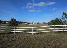
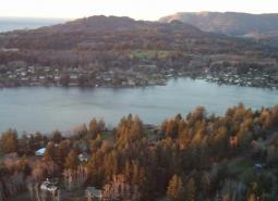
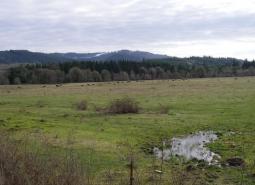
Some towns in Oregon’s Coast Range ecoregion include Astoria, Bandon, Brookings, Cannon Beach, Elkton, Florence, Gold Beach, Lincoln City, Newport, Tillamook, Waldport, and Yachats. The largest urban area on the coast is in Coos Bay/North Bend, which serves as a hub for fishing, shellfish, forest products, and transportation. Forestry remains the primary industry in the interior portion of the ecoregion. The Oregon coast offers excellent recreational opportunities, and tourism is important to local communities. Commercial and recreational fishing and fish processing are significant components of the economy. The Coast Range is a popular destination for retirees, so retirement services are important to coastal communities.
Characteristics
Important Industries
Forest products, agriculture, commercial fishing, fish processing, tourism and recreation, and retirement services
Major Agricultural Products
Livestock forage, timber, beef and dairy cattle
Important Nature-based Recreational Areas
Coos Bay, Tillamook Bay, Oregon Dunes National Recreation Area, Siuslaw National Forest, Clatsop and Tillamook State Forests, Elliot State Research Forest, Lower Rogue River, South Slough National Estuarine Research Reserve, Cape Kiwanda, Jewell Meadows Wildlife Area, Coquille Valley Wildlife Area
Elevation
From 0 to 4,100 feet
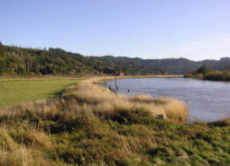
Important Rivers
Alsea, Chetco, Clastskanie, Coos, Coquille, Illinois, Lewis and Clark, Necanicum, Nehalem, Nestucca, Rogue, Siletz, Siuslaw, Trask, Umpqua, Wilson, Yaquina, Youngs
Conservation Issues and Priorities
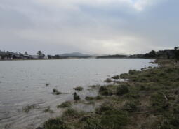
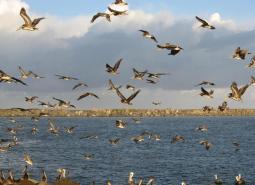
Demand for property development is increasing due to growing numbers of people recreating, relocating, and retiring along the Oregon coast. Development in many communities is putting higher demands on surface water in streams, reducing flows during critical time periods. Tidal and lowland habitats, which are important for rearing fish, are also being significantly impacted by coastal development and agriculture. Growth of communities along US Highway 101 creates barriers to wildlife movement between coastal and inland habitats, and new roadways needed to accommodate growth impact fish at stream crossings and increase mortality risks for wildlife. Tourism is greatly increasing fish and wildlife exposure to human presence, particularly for shorebirds and waterfowl that use bays and mudflats near towns to feed and rest during migration.
Careful resource planning helps to balance these increasing demands while maintaining coastal fish, wildlife, and habitats. Coordinated, broad-scale planning is especially important given the diversity of the Coast Range ecoregion. Although many plans currently exist, such as the Northwest Forest Plan, there is a continuing need to consider the unique requirements of transitional zones such as estuaries, and to integrate marine and inland conservation planning.
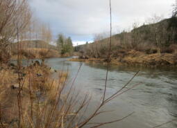
Much of the ecoregion is publicly owned and managed to balance recreation, tourism, and conservation. However, ownership in the northern part of the ecoregion is particularly fragmented. Restoration of watershed processes and functions (e.g., floodplain connectivity), and restoration of habitat complexity (e.g., woody debris) to stream and riparian areas are major concerns throughout the entire Coast Range ecoregion. Restoring flows to headwater streams maintains ecological connections important for many species.
Changing climate conditions, such as warming temperatures and altered timing and patterns of precipitation, are impacting weather patterns. Shifts in water availability throughout the year may contribute to habitat loss for fish and amphibians, and warmer, drier summers are expected to increase the risk of wildfire. Warming stream temperatures are limiting summer rearing of some anadromous fish species. Altered hydrology, changes in storm patterns, and warming temperatures may also impact stream flows and estuaries, which serve as important habitat for many invertebrates, fish, and marine and terrestrial wildlife species.
Key Conservation Issues of particular concern in the Coast Range ecoregion include Land Use Changes, Climate Change, and Invasive Species. In addition to the statewide issues, oil spills, loss of estuarine habitat, recreational use, and loss of habitat connectivity are of particular concern in coastal areas.
Climate
The Coast Range terrain is varied, with steeply sloping mountains, hills, sand dunes, and beaches. The climate is maritime with warm, dry summers and mild, very wet winters. Mean annual temperature and precipitation fluctuate considerably due to the large variation in latitudes and elevations.
Warming is projected in all seasons across the Coast Range ecoregion, with the largest increases projected for the summer. For a high emissions scenario (SSP585), summer average temperature is projected to increase by as much as 5°F for the 2040-2069 period and by as much as 8°F by the end of the century (Figure 1). Winters in the Coast Range are projected to be wetter, and summers are projected to be drier in the future. In late summer (July – September), total precipitation is projected to decrease by as much as 20% by the end of the century (Figure 2). For the cool season, projections show an increase in precipitation of 9%. The confidence in changes in cool season precipitation is greater than in late summer precipitation. For a high emissions scenario (SSP585), growing degree days are projected to double by the end of the century. Frost days are projected to decrease from an average of 63 per year to about 15–30 per year, on average, for the 2070-2099 period.


Limiting Factors and Recommended Approaches
Limiting Factor: Land Use Conversion and Urbanization
CMP Direct Threats 1, 2.1, 2.3, 7.2
Some areas of the Coast Range are developing rapidly, especially coastal communities, such as Cannon Beach, Lincoln City, and Newport. Steep slopes limit the amount of land available for development, and concentrate it in sensitive areas, particularly flatter lowlands and wetlands near rivers and estuaries. Residential development contributes to habitat loss and can contribute to loss of industry, such as agriculture and forestry. Historic draining of wetlands and marshes for agricultural use has also had significant impacts. Coastal rivers, wetlands, and estuaries were altered when side channels were diked, marshes drained, and channels deepened. These changes removed necessary habitat complexity, degraded water quality, and reduced estuarine habitat for fish and wildlife.
Recommended Approach
Work with community leaders and local governments to encourage planned, efficient growth. Support existing land use regulations to preserve farmland and forestland, open spaces, recreation areas, wildlife refuges, and natural habitats. Provide outreach about the benefits of wetland and tideland restoration. Support riparian buffers on all streams. Where possible, remove dikes and tide gates to restore estuarine habitats. Where tide gates need to be retained, replace older gates with side-hinged or aluminum gates that improve fish passage and hydrologic functions.
Limiting Factor: Water
CMP Direct Threats 7.2, 11.4
Water Quantity is a limiting factor for fish and wildlife. Changing climate conditions are leading to rising temperatures and altered patterns of precipitation, which affect water availability across different times of year. Surface water is the primary source of drinking water for nearly all municipal and community water providers along the coast. Some water providers currently face water shortages, and future shortages are anticipated due to decreasing supplies and increasing demand, especially during peak tourism season.
Water Quality can also limit species and habitats. Runoff from agricultural and urban areas can contaminate waterways. Landscape-scale application of herbicides in industrial timber operations can also negatively impact water quality. Warming temperatures, combined with higher nutrient levels due to agricultural runoff, are increasing the prevalence of toxic algal blooms, leading to shellfish fishery closures and fish and wildlife mortality. Timber harvest on steep slopes without control measures and agricultural grazing practices in moist soils along the coast contribute to increased sedimentation in streams, wetlands, and estuaries, causing changes in plant community composition, reducing habitat complexity, and altering water circulation and nutrient flows.
Recommended Approach
Provide incentives and information about water usage and sharing during low flow conditions (e.g., late summer). Promote water management actions that enable climate resilience and adaptation. Invest in watershed-scale projects for cold water and flow protection. Identify and protect cold water rearing and refugia habitat for aquatic species. Increase awareness and manage timing of applications of potential aquatic contaminants. Improve compliance with water quality standards and pesticide use labels administered by the DEQ and EPA. Work on implementing Senate Bill 1010 (Oregon Department of Agriculture) and DEQ Total Maximum Daily Load
water quality plans.
Limiting Factor: Habitat Fragmentation
CMP Direct Threats 1, 2.1, 2.3, 3.3, 8.1
Increasing traffic volumes, road density, recreational pressure, resource extraction, and aging water control structures contribute to habitat loss and fragmentation and create significant barriers to animal movements. In this ecoregion, US Highway 101 runs north to south, limiting connectivity between coastal dunes, estuaries, and other shoreline habitats to inland wetlands, grasslands, and forests. At the northern end of the Coast Range, US Highway 30 bisects the Columbia River floodplain marshes and upstream tidal rivers. While Oregon Forest Practices Act rules help to maintain some structural components and diversity on the landscape, commercial timber harvest can fragment forested habitats, reduce tree species diversity, and limit forest structural complexity. Many water control structures, such as culverts, are old and have not been well-maintained. These aging structures are often inundated with sediment and may be perched above water courses, preventing use by wildlife and blocking movement of fish. Older tide gates alter hydrologic functions, block fish passage, and reduce estuarine habitats.
Recommended Approach
Work with community leaders, agency partners, tribes, and forest managers to protect wildlife movement corridors and to fund and implement site-appropriate habitat enhancement and restoration efforts to facilitate wildlife movement. Promote the protection, restoration, and maintenance of Priority Wildlife Connectivity Areas, following the guidelines outlined in Oregon’s Wildlife Corridor Action Plan. Work with the Oregon Department of Transportation and county and city transportation departments to improve wildlife passage across roadways and replace aging water control structures to improve hydrologic function and permit fish passage. Prioritize timber harvest practices that retain a diversity of tree and shrub species and habitat structural components, with variable density thinning to help retain connections between forested areas.
Preserve existing farmland while restoring ecological functions that have been lost or degraded, particularly in tidal lowlands. Provide incentives (e.g., financial assistance, conservation easements) and information about the benefits of maintaining fish and wildlife habitat. Broad-scale conservation strategies will need to focus on restoring and maintaining more natural ecosystem processes and functions within areas that are managed primarily for other values. This may include an emphasis on more “conservation-friendly” management techniques for existing land uses, and restoration of some key ecosystem components such as estuarine function.
Limiting Factor: Invasive Species
CMP Direct Threat 8.1, 8.2
Non-native plant and animal invasions disrupt native communities, diminish populations of at-risk native species, and threaten the economic productivity of resource lands and waters. Invasive plants have increased substantially during the past several decades. In this ecoregion, Himalayan blackberry is widespread, with significant local impacts to meadows, riparian areas, and grasslands. Other invaders include reed canary grass, purple loosestrife, and yellow flag iris. Along the coast, European beach grass, introduced to stabilize shifting sands along roads, and gorse, introduced as an ornamental “living fence”, have substantial negative impacts. European beach grass alters dune formation and has narrowed beaches, drastically reducing open, sandy habitats that are critical to native species. Gorse crowds out native plants and chokes streams, reducing fish and wildlife habitat, and is also highly flammable, significantly increasing wildfire risk.
Invasive animals have also caused significant issues in the Coast Range. Non-native smallmouth bass have been illegally introduced to several areas in the ecoregion, including the Coquille Basin and Eel Lake, negatively impacting a variety of native fish species. American bullfrogs are rapidly expanding, competing with native species for limited resources or preying on native species and/or their eggs or young. Nutria degrade water quality and destabilize stream banks, while competing with native species, such as American beaver and muskrat, for food. Barred owls, expanding westward from their native range in the eastern US, compete directly with the native, threatened Northern spotted owl for food and habitat. Barred owls may also hybridize with spotted owls.
Emerging threats from invasive invertebrates are also becoming a concern in this ecoregion. The non-native emerald ash borer defoliates tree species characteristic of riparian habitats, such as Oregon ash, putting riparian areas, and in-stream habitats that depend on shading from bankside trees, at risk.
Recommended Approach
Emphasize prevention, risk assessment, early detection, and quick control to prevent new invasive species from becoming fully established. Prioritize management and control efforts to focus on key invasive species in high priority areas, particularly where Key Habitats and Species of Greatest Conservation Need occur. Where needed, use multiple site-appropriate tools (e.g., mechanical, chemical, and biological) to control the most damaging invasive species. Work with partners to implement measures to prevent unintentional introduction of non-native species (e.g., implement existing ballast water treatment regulations). Provide information to the public about the ecological and economic damage that invasive species cause. Work with the Oregon Invasive Species Council and other partners to educate people about invasive species issues and to prevent introductions of potentially high-impact species. Provide technical and financial assistance to landowners interested in controlling invasive species on their properties. Promote the use of native species for restoration and revegetation.
Limiting Factor: Recreational Activity
CMP Direct Threats 1.3, 4.1, 5.1, 5.2, 5.4, 6.1
Activities like hiking, biking, hunting, fishing, camping, jet boating, foraging, unmanned aerial vehicle (UAV), and off-road vehicle use can create sensory stressors for wildlife, with sound, light, and unusual smells that may disrupt behavior and deter species from moving through certain areas. Recreation contributes positively to the Coast Range’s economy and local communities and is managed carefully in many areas. However, increasing numbers of recreationists can impact sensitive areas, such as shorebird nesting areas, tidepool habitats, and haul out sites for marine mammals. There are concerns with off-leash dogs in some areas. Off-highway vehicle use and target shooting are increasing on public forestlands, especially in areas near cities. In many areas, off-highway vehicle and mountain bike use is not closely managed, leading to habitat destruction as users create new networks of unsanctioned, unregulated trails. Dispersed recreation can cause new roads and trails to fragment the landscape and can cause the spread of invasive species from other locations. As inland areas experience more very hot days and more lands in inland ecoregions are closed to the public due to wildfire, public lands in the Coast Range are experiencing greater use.
Recommended Approach
Work with state and federal forest management agencies to plan recreational use and to increase education and outreach for recreationists and associated businesses. Work with land management agencies such as the USFS to designate areas as high value recreation and low habitat impact areas. Institute road and/or area closures to protect species during sensitive times of year and decommission roads when possible. Monitor to ensure that OHV rules for use and public lands motor vehicle use maps are enforced by the managing agencies. Improve public awareness of sensitive areas through signage and kiosks. Follow guidelines for responsible recreation, such as Leave No Trace, to minimize impacts.
Limiting Factor: Oil Spills
CMP Direct Threats 4.1, 4.3, 9.2
Oil spills along the coast can have devastating effects on coastal habitats, fish, shellfish, and wildlife. Tidal flux can spread oil or other hazardous materials around sensitive habitats very quickly. Rapid response in the event of a spill is essential. Additionally, spills of hazardous materials or oil from vehicles traveling on roads along the coast could potentially impact nearby rivers, wetlands, estuaries, fish, and aquatic wildlife.
Recommended Approach
Ensure rapid response and preparedness for spills of hazardous substances. Oregon Department of Environmental Quality’s (DEQ) Marine Oil Spill Prevention Program and the Pacific States/British Columbia Oil Spill Task Force work with multiple parties and interested partners to address these concerns and quickly identify appropriate actions.
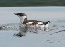
Species of Greatest Conservation Need

Black Tern
Chlidonias niger
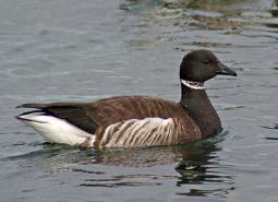
Brant
Branta bernicla
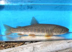
Bull Trout
Salvelinus confluentus

California Floater Mussel
Anodonta californiensis
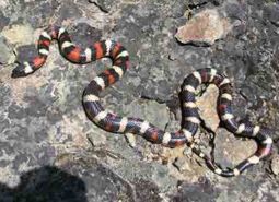
California Mountain Kingsnake
Lampropeltis zonata

California Myotis
Myotis californicus
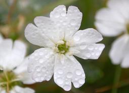
Cascade Head Catchfly
Silene douglasii var. oraria
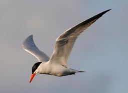
Caspian Tern
Hydroprogne caspia

Chinook Salmon – Fall Chinook – Lower Columbia SMU (Lower Columbia River ESU)
Oncorhynchus tshawytscha
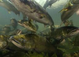
Chinook Salmon – Spring Chinook – Coastal SMU (Oregon Coast ESU)
Oncorhynchus tshawytscha
Chinook Salmon – Spring Chinook – Rogue SMU (Southern Oregon/Northern California Coasts ESU)
Oncorhynchus tshawytscha
Chum Salmon
Oncorhynchus keta
Chum Salmon – Coastal SMU (Pacific Coast ESU)
Oncorhynchus keta
Chum Salmon – Lower Columbia SMU (Columbia River ESU)
Oncorhynchus keta

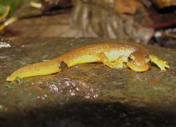
Clouded Salamander
Aneides ferreus
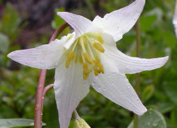
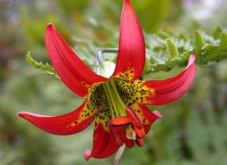
Coast Range Fawn Lily
Erythronium elegans

Coastal Cutthroat Trout
Oncorhynchus clarki clarki
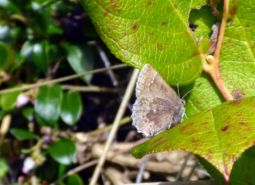
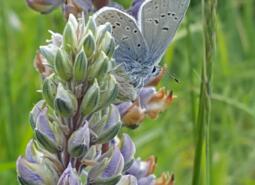
Coastal Greenish Blue Butterfly
Plebejus saepiolus littoralis

Coastal Tailed Frog
Ascaphus truei
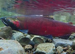
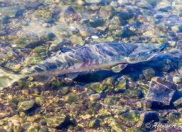
Coho Salmon
Oncorhynchus kisutch

Coho Salmon – Coastal SMU (Oregon Coast ESU)
Oncorhynchus kisutch
Coho Salmon – Lower Columbia SMU (SW Washington/Lower Columbia River ESU)
Oncorhynchus kisutch
Coho Salmon – Rogue-South Coast SMU (Southern Oregon/Northern California Coasts ESU)
Oncorhynchus kisutch
Columbia Pebblesnail
Fluminicola fuscus
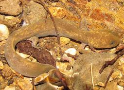
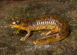
Columbia Torrent Salamander
Rhyacotriton kezeri
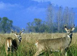
Columbian White-tailed Deer
Odocoileus virginianus leucurus
Cope’s Giant Salamander
Dicamptodon copei
Dalles Hesperian
Vespericola depressus
Dalles Mountainsnail
Oreohelix variabilis
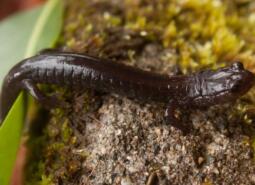
Del Norte Salamander
Plethodon elongatus
Dog Star Skipper (butterfly)
Polites sonora siris
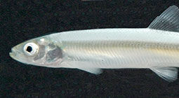
Eulachon
Thaleichthys pacificus
Foothill Yellow-legged Frog
Rana boylii

Fringed Myotis
Myotis thysanodes
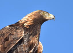
Golden Eagle
Aquila chrysaetos

Gray Wolf
Canis lupus
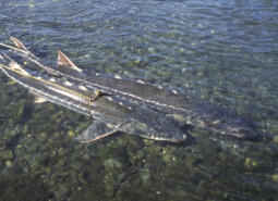
Green Sturgeon
Acipenser medirostris
Green Sturgeon – Northern DPS
Acipenser medirostris
Green Sturgeon – Southern DPS
Acipenser medirostris
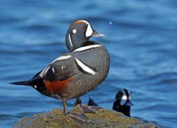
Harlequin Duck
Histrionicus histrionicus
Highcap Lanx
Lanx alta

Hoary Bat
Lasiurus cinereus
Johnson’s Hairstreak (butterfly)
Callophrys johnsoni
Large-flowered Goldfields
Lasthenia ornduffii
Little Brown Myotis
Myotis lucifugus

Long-legged Myotis
Myotis volans
Marbled Murrelet
Brachyramphus marmoratus
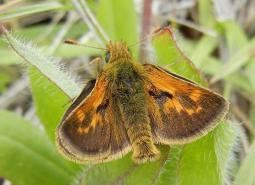
Mardon Skipper Butterfly
Polites mardon
Mendocino Coast Paintbrush
Castilleja mendocinensis
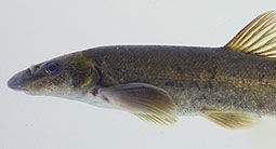
Millicoma Dace
Rhinichthys cataractae ssp
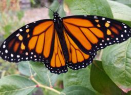
Monarch Butterfly
Danaus plexippus
Nelson’s Checkermallow
Sidalcea nelsoniana
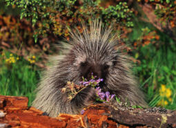
North American Porcupine
Erethizon dorsatum

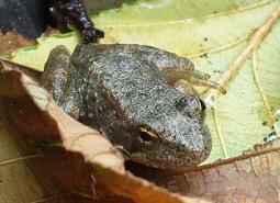
Northern Red-legged Frog
Rana aurora
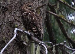
Northern Spotted Owl
Strix occidentalis caurina

Northwestern Pond Turtle
Actinemys marmorata

Olive-sided Flycatcher
Contopus cooperi
Oregon Floater Mussel
Anodonta oregonensis
Oregon Silverspot Butterfly
Argynnis zerene hippolyta
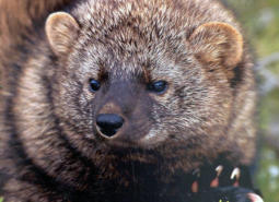
Pacific Fisher
Pekania pennanti

Pacific Lamprey
Entosphenus tridentatus
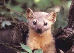
Pacific Marten
Martes caurina
Pacific Walker
Pomatiopsis californica

Pallid Bat
Antrozous pallidus

Pink Sandverbena
Abronia umbellata var. breviflora
Point Reyes Bird’s-beak
Chloropyron maritimum ssp. palustre
Red Tree Vole
Arborimus longicaudus

Ringtail
Bassariscus astutus
Robust Walker
Pomatiopsis binneyi
Rocky Mountain Fingernail Clam
Sphaerium patella
Seaside Gilia
Gilia millefoliata
Seaside Hoary Elfin Butterfly
Callophrys polios maritima

Silver-haired Bat
Lasionycteris noctivagans
Silvery Phacelia
Phacelia argentea
Sockeye Salmon
Oncorhynchus nerka
Southern Torrent Salamander
Rhyacotriton variegatus
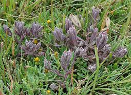
Stansell’s Daisy
Erigeron stanselliae
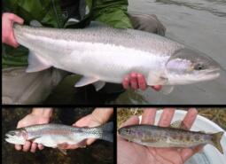
Steelhead / Rainbow / Redband Trout – Summer Steelhead/Coastal Rainbow Trout – Coastal SMU (Oregon Coast DPS)
Oncorhynchus mykiss/Oncorhynchus mykiss irideus
Steelhead / Rainbow / Redband Trout – Summer Steelhead/Coastal Rainbow Trout – Lower Columbia SMU (Lower Columbia River DPS)
Oncorhynchus mykiss/Oncorhynchus mykiss irideus
Steelhead / Rainbow / Redband Trout – Summer Steelhead/Coastal Rainbow Trout – Rogue SMU (Klamath Mountains Province DPS)
Oncorhynchus mykiss/Oncorhynchus mykiss irideus
Steelhead / Rainbow / Redband Trout – Winter Steelhead/Coastal Rainbow Trout – Lower Columbia SMU (Lower Columbia River DPS)
Oncorhynchus mykiss/Oncorhynchus mykiss irideus
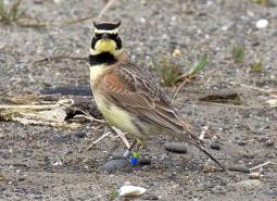
Streaked Horned Lark
Eremophila alpestris strigata
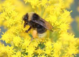
Suckley’s Cuckoo Bumblebee
Bombus suckleyi

Townsend’s Big-eared Bat
Corynorhinus townsendii
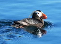
Tufted Puffin
Fratercula cirrhata
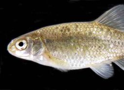
Umpqua Chub
Oregonichthys kalawatseti
Western Bumble Bee
Bombus occidentalis
Western Floater Mussel
Anodonta kennerlyi

Western Grebe
Aechmophorus occidentalis
Western Lily
Lilium occidentale
Western Long-eared Myotis
Myotis evotis

Western Painted Turtle
Chrysemys picta belli
Western Pearlshell Mussel
Margaritifera falcata

Western Purple Martin
Progne subis arboricola
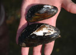
Western Ridged Mussel
Gonidea angulata

Western River Lamprey
Occidentis ayresii
Western Small-footed Myotis
Myotis ciliolabrum
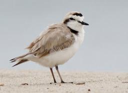
Western Snowy Plover
Anarhynchus nivosus nivosus

Western Toad
Anaxyrus boreas

White Sturgeon
Acipenser transmontanus
Conservation Opportunity Areas
Alsea Estuary-Alsea River [COA ID: 029]
Geographic boundaries of the COAs were updated for the 2026 State Wildlife Action Plan and the associated COA profiles are intended to provide additional information. Content of each COA profile is being refined and will be updated to reflect current conditions when feasible. Please help us by submitting information on Local Conservation Actions, Plans, or …
Beaver Creek [COA ID: 027]
Geographic boundaries of the COAs were updated for the 2026 State Wildlife Action Plan and the associated COA profiles are intended to provide additional information. Content of each COA profile is being refined and will be updated to reflect current conditions when feasible. Please help us by submitting information on Local Conservation Actions, Plans, or …
Cape Ferrelo [COA ID: 051]
Geographic boundaries of the COAs were updated for the 2026 State Wildlife Action Plan and the associated COA profiles are intended to provide additional information. Content of each COA profile is being refined and will be updated to reflect current conditions when feasible. Please help us by submitting information on Local Conservation Actions, Plans, or …
Chetco River-Winhchuck River Estuaries [COA ID: 052]
Geographic boundaries of the COAs were updated for the 2026 State Wildlife Action Plan and the associated COA profiles are intended to provide additional information. Content of each COA profile is being refined and will be updated to reflect current conditions when feasible. Please help us by submitting information on Local Conservation Actions, Plans, or …
Clatskanie River [COA ID: 008]
Geographic boundaries of the COAs were updated for the 2026 State Wildlife Action Plan and the associated COA profiles are intended to provide additional information. Content of each COA profile is being refined and will be updated to reflect current conditions when feasible. Please help us by submitting information on Local Conservation Actions, Plans, or …
Clatsop Plains [COA ID: 001]
Geographic boundaries of the COAs were updated for the 2026 State Wildlife Action Plan and the associated COA profiles are intended to provide additional information. Content of each COA profile is being refined and will be updated to reflect current conditions when feasible. Please help us by submitting information on Local Conservation Actions, Plans, or …
Clatsop State Forest-Jewel Meadows Area [COA ID: 007]
Geographic boundaries of the COAs were updated for the 2026 State Wildlife Action Plan and the associated COA profiles are intended to provide additional information. Content of each COA profile is being refined and will be updated to reflect current conditions when feasible. Please help us by submitting information on Local Conservation Actions, Plans, or …
Columbia River-Blind Slough Swamp [COA ID: 006]
Geographic boundaries of the COAs were updated for the 2026 State Wildlife Action Plan and the associated COA profiles are intended to provide additional information. Content of each COA profile is being refined and will be updated to reflect current conditions when feasible. Please help us by submitting information on Local Conservation Actions, Plans, or …
Coos Bay [COA ID: 043]
Geographic boundaries of the COAs were updated for the 2026 State Wildlife Action Plan and the associated COA profiles are intended to provide additional information. Content of each COA profile is being refined and will be updated to reflect current conditions when feasible. Please help us by submitting information on Local Conservation Actions, Plans, or …

Coos Mountain-Middle Creek [COA ID: 044]
Geographic boundaries of the COAs were updated for the 2026 State Wildlife Action Plan and the associated COA profiles are intended to provide additional information. Content of each COA profile is being refined and will be updated to reflect current conditions when feasible. Please help us by submitting information on Local Conservation Actions, Plans, or …
Deer Island [COA ID: 053]
Geographic boundaries of the COAs were updated for the 2026 State Wildlife Action Plan and the associated COA profiles are intended to provide additional information. Content of each COA profile is being refined and will be updated to reflect current conditions when feasible. Please help us by submitting information on Local Conservation Actions, Plans, or …
Depoe Bay Area [COA ID: 023]
Geographic boundaries of the COAs were updated for the 2026 State Wildlife Action Plan and the associated COA profiles are intended to provide additional information. Content of each COA profile is being refined and will be updated to reflect current conditions when feasible. Please help us by submitting information on Local Conservation Actions, Plans, or …
Devil’s Lake [COA ID: 020]
Geographic boundaries of the COAs were updated for the 2026 State Wildlife Action Plan and the associated COA profiles are intended to provide additional information. Content of each COA profile is being refined and will be updated to reflect current conditions when feasible. Please help us by submitting information on Local Conservation Actions, Plans, or …
Elliott State Forest [COA ID: 041]
Geographic boundaries of the COAs were updated for the 2026 State Wildlife Action Plan and the associated COA profiles are intended to provide additional information. Content of each COA profile is being refined and will be updated to reflect current conditions when feasible. Please help us by submitting information on Local Conservation Actions, Plans, or …
Forest Park [COA ID: 058]
Geographic boundaries of the COAs were updated for the 2026 State Wildlife Action Plan and the associated COA profiles are intended to provide additional information. Content of each COA profile is being refined and will be updated to reflect current conditions when feasible. Please help us by submitting information on Local Conservation Actions, Plans, or …
Gales Creek [COA ID: 013]
Geographic boundaries of the COAs were updated for the 2026 State Wildlife Action Plan and the associated COA profiles are intended to provide additional information. Content of each COA profile is being refined and will be updated to reflect current conditions when feasible. Please help us by submitting information on Local Conservation Actions, Plans, or …
Heceta Head [COA ID: 031]
Geographic boundaries of the COAs were updated for the 2026 State Wildlife Action Plan and the associated COA profiles are intended to provide additional information. Content of each COA profile is being refined and will be updated to reflect current conditions when feasible. Please help us by submitting information on Local Conservation Actions, Plans, or …
Kalmiopsis Area [COA ID: 100]
Geographic boundaries of the COAs were updated for the 2026 State Wildlife Action Plan and the associated COA profiles are intended to provide additional information. Content of each COA profile is being refined and will be updated to reflect current conditions when feasible. Please help us by submitting information on Local Conservation Actions, Plans, or …
Kings Valley-Woods Creek Oak Woodlands [COA ID: 080]
Geographic boundaries of the COAs were updated for the 2026 State Wildlife Action Plan and the associated COA profiles are intended to provide additional information. Content of each COA profile is being refined and will be updated to reflect current conditions when feasible. Please help us by submitting information on Local Conservation Actions, Plans, or …
Lower Coquille River [COA ID: 045]
Geographic boundaries of the COAs were updated for the 2026 State Wildlife Action Plan and the associated COA profiles are intended to provide additional information. Content of each COA profile is being refined and will be updated to reflect current conditions when feasible. Please help us by submitting information on Local Conservation Actions, Plans, or …

Lower Rogue River and Estuary [COA ID: 049]
Geographic boundaries of the COAs were updated for the 2026 State Wildlife Action Plan and the associated COA profiles are intended to provide additional information. Content of each COA profile is being refined and will be updated to reflect current conditions when feasible. Please help us by submitting information on Local Conservation Actions, Plans, or …
Lower Willamette River Floodplain [COA ID: 059]
Geographic boundaries of the COAs were updated for the 2026 State Wildlife Action Plan and the associated COA profiles are intended to provide additional information. Content of each COA profile is being refined and will be updated to reflect current conditions when feasible. Please help us by submitting information on Local Conservation Actions, Plans, or …
Luckiamute River and Tributaries [COA ID: 075]
Geographic boundaries of the COAs were updated for the 2026 State Wildlife Action Plan and the associated COA profiles are intended to provide additional information. Content of each COA profile is being refined and will be updated to reflect current conditions when feasible. Please help us by submitting information on Local Conservation Actions, Plans, or …
Mary’s Peak [COA ID: 028]
Geographic boundaries of the COAs were updated for the 2026 State Wildlife Action Plan and the associated COA profiles are intended to provide additional information. Content of each COA profile is being refined and will be updated to reflect current conditions when feasible. Please help us by submitting information on Local Conservation Actions, Plans, or …
McTimmons Valley – Airlie Savanna [COA ID: 076]
Geographic boundaries of the COAs were updated for the 2026 State Wildlife Action Plan and the associated COA profiles are intended to provide additional information. Content of each COA profile is being refined and will be updated to reflect current conditions when feasible. Please help us by submitting information on Local Conservation Actions, Plans, or …
Mill Creek [COA ID: 024]
Geographic boundaries of the COAs were updated for the 2026 State Wildlife Action Plan and the associated COA profiles are intended to provide additional information. Content of each COA profile is being refined and will be updated to reflect current conditions when feasible. Please help us by submitting information on Local Conservation Actions, Plans, or …
Necanicum Estuary [COA ID: 002]
Geographic boundaries of the COAs were updated for the 2026 State Wildlife Action Plan and the associated COA profiles are intended to provide additional information. Content of each COA profile is being refined and will be updated to reflect current conditions when feasible. Please help us by submitting information on Local Conservation Actions, Plans, or …

Necanicum River [COA ID: 004]
Geographic boundaries of the COAs were updated for the 2026 State Wildlife Action Plan and the associated COA profiles are intended to provide additional information. Content of each COA profile is being refined and will be updated to reflect current conditions when feasible. Please help us by submitting information on Local Conservation Actions, Plans, or …
Nehalem and Salmonberry River Headwaters [COA ID: 012]
Geographic boundaries of the COAs were updated for the 2026 State Wildlife Action Plan and the associated COA profiles are intended to provide additional information. Content of each COA profile is being refined and will be updated to reflect current conditions when feasible. Please help us by submitting information on Local Conservation Actions, Plans, or …
Nehalem River Estuary [COA ID: 009]
Geographic boundaries of the COAs were updated for the 2026 State Wildlife Action Plan and the associated COA profiles are intended to provide additional information. Content of each COA profile is being refined and will be updated to reflect current conditions when feasible. Please help us by submitting information on Local Conservation Actions, Plans, or …
Nestucca Bay [COA ID: 016]
Geographic boundaries of the COAs were updated for the 2026 State Wildlife Action Plan and the associated COA profiles are intended to provide additional information. Content of each COA profile is being refined and will be updated to reflect current conditions when feasible. Please help us by submitting information on Local Conservation Actions, Plans, or …
Nestucca River Watershed [COA ID: 017]
Geographic boundaries of the COAs were updated for the 2026 State Wildlife Action Plan and the associated COA profiles are intended to provide additional information. Content of each COA profile is being refined and will be updated to reflect current conditions when feasible. Please help us by submitting information on Local Conservation Actions, Plans, or …
Netarts Bay [COA ID: 014]
Geographic boundaries of the COAs were updated for the 2026 State Wildlife Action Plan and the associated COA profiles are intended to provide additional information. Content of each COA profile is being refined and will be updated to reflect current conditions when feasible. Please help us by submitting information on Local Conservation Actions, Plans, or …
New River Area [COA ID: 047]
Geographic boundaries of the COAs were updated for the 2026 State Wildlife Action Plan and the associated COA profiles are intended to provide additional information. Content of each COA profile is being refined and will be updated to reflect current conditions when feasible. Please help us by submitting information on Local Conservation Actions, Plans, or …
North Fork Nehalem River [COA ID: 010]
Geographic boundaries of the COAs were updated for the 2026 State Wildlife Action Plan and the associated COA profiles are intended to provide additional information. Content of each COA profile is being refined and will be updated to reflect current conditions when feasible. Please help us by submitting information on Local Conservation Actions, Plans, or …
North Fork Siuslaw River [COA ID: 032]
Geographic boundaries of the COAs were updated for the 2026 State Wildlife Action Plan and the associated COA profiles are intended to provide additional information. Content of each COA profile is being refined and will be updated to reflect current conditions when feasible. Please help us by submitting information on Local Conservation Actions, Plans, or …
North Fork Smith River [COA ID: 037]
Geographic boundaries of the COAs were updated for the 2026 State Wildlife Action Plan and the associated COA profiles are intended to provide additional information. Content of each COA profile is being refined and will be updated to reflect current conditions when feasible. Please help us by submitting information on Local Conservation Actions, Plans, or …
Pistol River Estuary [COA ID: 050]
Geographic boundaries of the COAs were updated for the 2026 State Wildlife Action Plan and the associated COA profiles are intended to provide additional information. Content of each COA profile is being refined and will be updated to reflect current conditions when feasible. Please help us by submitting information on Local Conservation Actions, Plans, or …
Red Prairie-Mill Creek-Willamina Oaks South [COA ID: 071]
Geographic boundaries of the COAs were updated for the 2026 State Wildlife Action Plan and the associated COA profiles are intended to provide additional information. Content of each COA profile is being refined and will be updated to reflect current conditions when feasible. Please help us by submitting information on Local Conservation Actions, Plans, or …
Rickreall Creek and Little Luckiamute River Headwaters [COA ID: 025]
Geographic boundaries of the COAs were updated for the 2026 State Wildlife Action Plan and the associated COA profiles are intended to provide additional information. Content of each COA profile is being refined and will be updated to reflect current conditions when feasible. Please help us by submitting information on Local Conservation Actions, Plans, or …
Rogue River [COA ID: 093]
Geographic boundaries of the COAs were updated for the 2026 State Wildlife Action Plan and the associated COA profiles are intended to provide additional information. Content of each COA profile is being refined and will be updated to reflect current conditions when feasible. Please help us by submitting information on Local Conservation Actions, Plans, or …
Saddle Mountain [COA ID: 005]
Geographic boundaries of the COAs were updated for the 2026 State Wildlife Action Plan and the associated COA profiles are intended to provide additional information. Content of each COA profile is being refined and will be updated to reflect current conditions when feasible. Please help us by submitting information on Local Conservation Actions, Plans, or …
Salmon River Estuary-Cascade Head [COA ID: 019]
Geographic boundaries of the COAs were updated for the 2026 State Wildlife Action Plan and the associated COA profiles are intended to provide additional information. Content of each COA profile is being refined and will be updated to reflect current conditions when feasible. Please help us by submitting information on Local Conservation Actions, Plans, or …
Sand Lake Area [COA ID: 015]
Geographic boundaries of the COAs were updated for the 2026 State Wildlife Action Plan and the associated COA profiles are intended to provide additional information. Content of each COA profile is being refined and will be updated to reflect current conditions when feasible. Please help us by submitting information on Local Conservation Actions, Plans, or …
Sauvie Island-Scappoose [COA ID: 054]
Geographic boundaries of the COAs were updated for the 2026 State Wildlife Action Plan and the associated COA profiles are intended to provide additional information. Content of each COA profile is being refined and will be updated to reflect current conditions when feasible. Please help us by submitting information on Local Conservation Actions, Plans, or …
Scoggins Valley-Mount Richmond [COA ID: 063]
Geographic boundaries of the COAs were updated for the 2026 State Wildlife Action Plan and the associated COA profiles are intended to provide additional information. Content of each COA profile is being refined and will be updated to reflect current conditions when feasible. Please help us by submitting information on Local Conservation Actions, Plans, or …
Siletz Bay [COA ID: 021]
Geographic boundaries of the COAs were updated for the 2026 State Wildlife Action Plan and the associated COA profiles are intended to provide additional information. Content of each COA profile is being refined and will be updated to reflect current conditions when feasible. Please help us by submitting information on Local Conservation Actions, Plans, or …
Siletz River [COA ID: 022]
Geographic boundaries of the COAs were updated for the 2026 State Wildlife Action Plan and the associated COA profiles are intended to provide additional information. Content of each COA profile is being refined and will be updated to reflect current conditions when feasible. Please help us by submitting information on Local Conservation Actions, Plans, or …
Siuslaw River [COA ID: 035]
Geographic boundaries of the COAs were updated for the 2026 State Wildlife Action Plan and the associated COA profiles are intended to provide additional information. Content of each COA profile is being refined and will be updated to reflect current conditions when feasible. Please help us by submitting information on Local Conservation Actions, Plans, or …
Siuslaw River Estuary [COA ID: 034]
Geographic boundaries of the COAs were updated for the 2026 State Wildlife Action Plan and the associated COA profiles are intended to provide additional information. Content of each COA profile is being refined and will be updated to reflect current conditions when feasible. Please help us by submitting information on Local Conservation Actions, Plans, or …
Sixes River-Elk River [COA ID: 048]
Geographic boundaries of the COAs were updated for the 2026 State Wildlife Action Plan and the associated COA profiles are intended to provide additional information. Content of each COA profile is being refined and will be updated to reflect current conditions when feasible. Please help us by submitting information on Local Conservation Actions, Plans, or …
South Fork Coquille [COA ID: 046]
Geographic boundaries of the COAs were updated for the 2026 State Wildlife Action Plan and the associated COA profiles are intended to provide additional information. Content of each COA profile is being refined and will be updated to reflect current conditions when feasible. Please help us by submitting information on Local Conservation Actions, Plans, or …
Sutton Lake Area [COA ID: 033]
Geographic boundaries of the COAs were updated for the 2026 State Wildlife Action Plan and the associated COA profiles are intended to provide additional information. Content of each COA profile is being refined and will be updated to reflect current conditions when feasible. Please help us by submitting information on Local Conservation Actions, Plans, or …
Tahkenitch-Siltcoos Lakes [COA ID: 036]
Geographic boundaries of the COAs were updated for the 2026 State Wildlife Action Plan and the associated COA profiles are intended to provide additional information. Content of each COA profile is being refined and will be updated to reflect current conditions when feasible. Please help us by submitting information on Local Conservation Actions, Plans, or …
Tenmile Area [COA ID: 092]
Geographic boundaries of the COAs were updated for the 2026 State Wildlife Action Plan and the associated COA profiles are intended to provide additional information. Content of each COA profile is being refined and will be updated to reflect current conditions when feasible. Please help us by submitting information on Local Conservation Actions, Plans, or …
Tenmile Lake [COA ID: 040]
Geographic boundaries of the COAs were updated for the 2026 State Wildlife Action Plan and the associated COA profiles are intended to provide additional information. Content of each COA profile is being refined and will be updated to reflect current conditions when feasible. Please help us by submitting information on Local Conservation Actions, Plans, or …
Tillamook Bay and Tributaries [COA ID: 011]
Geographic boundaries of the COAs were updated for the 2026 State Wildlife Action Plan and the associated COA profiles are intended to provide additional information. Content of each COA profile is being refined and will be updated to reflect current conditions when feasible. Please help us by submitting information on Local Conservation Actions, Plans, or …
Tillamook Head [COA ID: 003]
Geographic boundaries of the COAs were updated for the 2026 State Wildlife Action Plan and the associated COA profiles are intended to provide additional information. Content of each COA profile is being refined and will be updated to reflect current conditions when feasible. Please help us by submitting information on Local Conservation Actions, Plans, or …
Trask Mountain [COA ID: 018]
Geographic boundaries of the COAs were updated for the 2026 State Wildlife Action Plan and the associated COA profiles are intended to provide additional information. Content of each COA profile is being refined and will be updated to reflect current conditions when feasible. Please help us by submitting information on Local Conservation Actions, Plans, or …
Umpqua River [COA ID: 042]
Geographic boundaries of the COAs were updated for the 2026 State Wildlife Action Plan and the associated COA profiles are intended to provide additional information. Content of each COA profile is being refined and will be updated to reflect current conditions when feasible. Please help us by submitting information on Local Conservation Actions, Plans, or …
Umpqua River Estuary [COA ID: 038]
Geographic boundaries of the COAs were updated for the 2026 State Wildlife Action Plan and the associated COA profiles are intended to provide additional information. Content of each COA profile is being refined and will be updated to reflect current conditions when feasible. Please help us by submitting information on Local Conservation Actions, Plans, or …
Upper Siuslaw [COA ID: 089]
Geographic boundaries of the COAs were updated for the 2026 State Wildlife Action Plan and the associated COA profiles are intended to provide additional information. Content of each COA profile is being refined and will be updated to reflect current conditions when feasible. Please help us by submitting information on Local Conservation Actions, Plans, or …
Wassen Creek [COA ID: 039]
Geographic boundaries of the COAs were updated for the 2026 State Wildlife Action Plan and the associated COA profiles are intended to provide additional information. Content of each COA profile is being refined and will be updated to reflect current conditions when feasible. Please help us by submitting information on Local Conservation Actions, Plans, or …
West Eugene Area [COA ID: 086]
Geographic boundaries of the COAs were updated for the 2026 State Wildlife Action Plan and the associated COA profiles are intended to provide additional information. Content of each COA profile is being refined and will be updated to reflect current conditions when feasible. Please help us by submitting information on Local Conservation Actions, Plans, or …
Yachats River Area [COA ID: 030]
Geographic boundaries of the COAs were updated for the 2026 State Wildlife Action Plan and the associated COA profiles are intended to provide additional information. Content of each COA profile is being refined and will be updated to reflect current conditions when feasible. Please help us by submitting information on Local Conservation Actions, Plans, or …
Yamhill Oaks-Willamina Oaks North [COA ID: 067]
Geographic boundaries of the COAs were updated for the 2026 State Wildlife Action Plan and the associated COA profiles are intended to provide additional information. Content of each COA profile is being refined and will be updated to reflect current conditions when feasible. Please help us by submitting information on Local Conservation Actions, Plans, or …
Yaquina Bay [COA ID: 026]
Geographic boundaries of the COAs were updated for the 2026 State Wildlife Action Plan and the associated COA profiles are intended to provide additional information. Content of each COA profile is being refined and will be updated to reflect current conditions when feasible. Please help us by submitting information on Local Conservation Actions, Plans, or …