At the border of Baker and Grant Counties, following the North Fork Malheur River and adjacent to Monument Rock Wilderness
Ecoregions
Blue Mountains
Located in NE Oregon, the Blue Mountains ecoregion is the largest ecoregion in the state. It provides a diverse complex of mountain ranges, valleys, and plateaus that extend beyond Oregon into the states of Idaho and Washington.
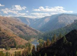
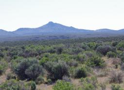
Northern Basin and Range
The Northern Basin and Range ecoregion covers the very large southeastern portion of the state, from Burns south to the Nevada border and from the Christmas Valley east to Idaho. It is largely a high elevation desert-like area dominated by sagebrush communities and habitats.
Key Habitats

Grasslands
Grasslands include a variety of upland grass-dominated habitats, such as upland prairies, coastal bluffs, and montane grasslands.
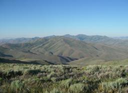
Late Successional Mixed Conifer Forests
Late successional mixed conifer forests provide a multi-layered tree canopy, including large-diameter trees, shade-tolerant tree species in the understory, and a high volume of dead wood, such as snags and logs.

Natural Lakes
Natural lakes are relatively large bodies of freshwater surrounded by land that were formed through geological processes, such as glacial scouring, tectonic movements, volcanic activity and river meander cutoffs. In Oregon, natural lakes are defined as standing water bodies larger than 20 acres, including some seasonal lakes. Depth is not a reference for characterization of …
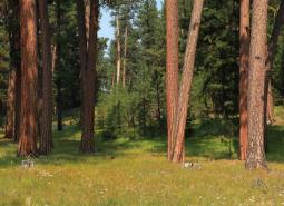
Ponderosa Pine Woodlands
Ponderosa pine woodlands are common in Oregon’s eastside ecoregions. While dominated by ponderosa pine, these woodlands may also have lodgepole pine, western juniper, aspen, western larch, grand fir, Douglas-fir, mountain mahogany, incense cedar, sugar pine, or white fir, depending on ecoregion and site conditions. Known for their open forest structure, these woodlands generally have fewer …

Flowing Water and Riparian Habitats
Flowing Water and Riparian Habitats include all naturally occurring flowing freshwater streams and rivers throughout Oregon as well as the adjacent riparian habitat.
Sagebrush Habitats
Sagebrush habitats include all sagebrush steppe- and shrubland-dominated communities found east of the Cascade Mountains.
Species of Greatest Conservation Need
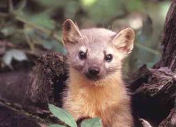
Pacific Marten (Observed)
Martes caurina

American Pika (Modeled Habitat)
Ochotona princeps
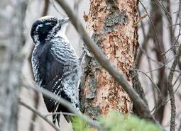
American Three-toed Woodpecker (Observed)
Picoides dorsalis
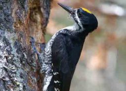
Black-backed Woodpecker (Observed)
Picoides arcticus
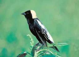
Bobolink (Modeled Habitat)
Dolichonyx oryzivorus
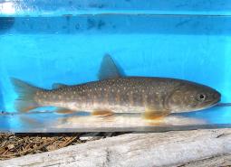
Bull Trout (Documented)
Salvelinus confluentus
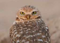
Western Burrowing Owl (Modeled Habitat)
Athene cunicularia hypugaea

California Myotis (Observed)
Myotis californicus
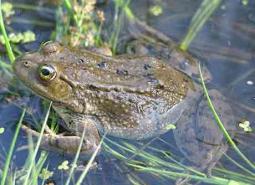
Columbia Spotted Frog (Observed)
Rana luteiventris
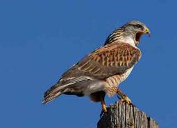
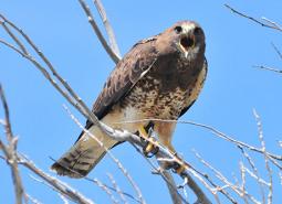
Ferruginous Hawk (Modeled Habitat)
Buteo regalis
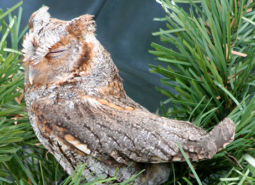
Flammulated Owl (Observed)
Psiloscops flammeolus

Fringed Myotis (Modeled Habitat)
Myotis thysanodes
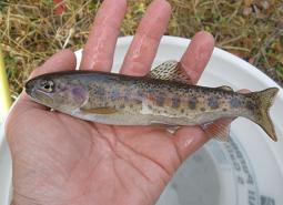
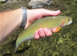
Great Basin Redband Trout (Documented)
Oncorhynchus mykiss newberrii
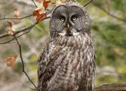
Great Gray Owl (Observed)
Strix nebulosa
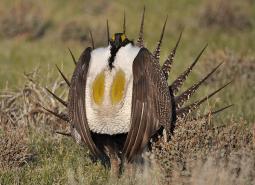
Greater Sage-Grouse (Observed)
Centrocercus urophasianus

Hoary Bat (Observed)
Lasiurus cinereus

Lewis’s Woodpecker (Observed)
Melanerpes lewis
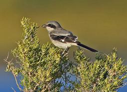
Loggerhead Shrike (Observed)
Lanius ludovicianus
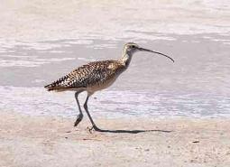
Long-billed Curlew (Observed)
Numenius americanus

Long-legged Myotis (Observed)
Myotis volans

Olive-sided Flycatcher (Observed)
Contopus cooperi

Pallid Bat (Modeled Habitat)
Antrozous pallidus
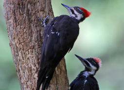
Pileated Woodpecker (Observed)
Dryocopus pileatus

Silver-haired Bat (Observed)
Lasionycteris noctivagans
Swainson’s Hawk (Observed)
Buteo swainsoni

Western Toad (Observed)
Anaxyrus boreas
Westslope Cutthroat Trout (Documented)
Oncorhynchus clarki lewisi

White-headed Woodpecker (Observed)
Dryobates albolarvatus albolarvatus
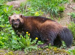
Wolverine (Observed)
Gulo gulo