Background
CMP Direct Threats 7, 8.1, 8.2, 10, 11
Many habitats are naturally maintained by disturbance. Disturbance in terrestrial, freshwater, and marine environments, including fire, floods, wind, storms, volcanic eruptions, earthquakes, landslides, and coastal upwelling, has historically played a key role in shaping many of Oregon’s native habitats. Natural disturbances shape Oregon’s landscapes by resetting plant succession, releasing nutrients, moving materials, creating new habitats, and maintaining native habitats, such as grasslands, savannas, and rocky intertidal zones. Many disturbance regimes, however, have been altered by human activities, impacting fish, wildlife, and their habitats. Development and habitat fragmentation, industrial logging, agriculture, energy development, and changing climate conditions have impacted disturbance regimes in both aquatic and terrestrial ecosystems.
Altered fire regimes have changed vegetation patterns, which affect wildlife species that rely on fire-adapted landscapes. Fires have become statewide issues as Oregon’s population has grown, placing homes and communities closer to where these disturbances occur. Fire suppression techniques were adopted to protect valuable timber as well as human life and property. The unintended consequences of fire suppression include altered plant species composition, distribution, and density, as well as increased fuel loads. By preventing more frequent, lower-intensity wildfires, suppression can lead to a greater likelihood of more intense, high-severity fires in the future.
Dams were constructed to control water for various purposes, such as protecting towns from flooding, producing electricity, storing water, and providing water for irrigation. Some unintended consequences of dam construction include impeded or blocked aquatic passage, as well as changes in hydrologic regimes that resulted in loss of floodplain function, loss of fish spawning and rearing areas, degraded riparian habitats, and alteration of nutrients and sediment introduced to marine environments. These disruptions to natural hydrologic regimes have all affected Oregon’s fish and wildlife populations.
Climate change has also impacted ecosystems across the Pacific Northwest. Climate change is leading to shifts in the frequency, intensity, and duration of natural disturbances like fires, floods, and insect outbreaks. Climate change interacts with other stressors, such as habitat loss and degradation, often amplifying effects and complicating management responses. Understanding these interactions is crucial for effective conservation and management strategies.
Many species have evolved in response to natural disturbance regimes, so mimicking these regimes can help maintain or restore their populations. By simulating natural disturbances, managers can ensure that ecosystems continue to function to support a variety of species and ecological processes, as well reduce risks to people.
Alteration of Oceanographic Regimes
Nearshore ecosystems depend on dynamic oceanographic processes such as coastal upwelling, sediment transport, and freshwater inputs. Alteration of oceanographic regimes can stem from both anthropogenic stressors (e.g., climate change or altered flow regimes from dams), or natural factors (e.g., El Niño and the Pacific Decadal Oscillation). In recent years, marine heatwaves have become common disturbances in the Pacific Ocean that have impacted Oregon’s nearshore environment and its species.
Coastal upwelling, driven by spring and summer northerly winds, provides cold, nutrient-rich waters to replace warmer surface waters. The surge of nutrients from upwelling has a profound effect on ocean productivity, with associated ecological and socioeconomic implications. The particular pattern of upwelling that starts in early spring and then occurs intermittently through the spring and summer is part of the reason Oregon’s nearshore ecosystem is so productive. There is growing evidence that, over time, upwelling will vary in intensity, be less intermittent, and start later in the year, primarily due to changes in wind patterns resulting from global climate change. As the climate warms, ocean mixing due to wind patterns will be less effective at bringing nutrients to the surface, thereby reducing primary productivity and disrupting food webs. These shifts in patterns of upwelling are expected to change nearshore ecosystems, but the exact nature and severity of changes is unknown. Water temperature is also a key factor in determining the strength of upwelling in the nearshore, with higher temperatures inhibiting mixing because layers of warm surface waters mix less easily with colder, deeper water.
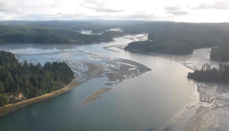
Sediment transport is also important for maintaining nearshore habitats. The Oregon coast has a naturally complex shoreline consisting of beaches, estuaries, and rocky shores. Jetties, breakwaters, and other man-made structures built out into the water can alter the depth and shape of nearby sand bottoms and can alter localized oceanographic characteristics such as patterns of currents and sediment transport. Shoreline stabilization structures, such as riprap and seawalls, have been constructed in many developed areas along the Oregon coast to protect coastal property from erosion due to wave action. These structures can block or alter the natural littoral drift of sand along the coast and can deprive some beaches of sand, while increasing the deposition of sand in other areas.
Changes to freshwater inputs, due to alteration of the hydrologic regimes in upper freshwater systems, can also impact estuarine and nearshore environments. Dams can change the amount and timing of freshwater influx into estuaries and the nearshore ocean. This may result in an alteration of river plume fronts within the marine environment, including changes in the direction of flow of the river plume, availability of nutrients and sediment being brought into the marine system, and changes in water chemistry composition from suppressed mixing of fresh and saltwater. These alterations can in turn affect the species that are dependent on river plume microhabitats and alter species composition within the area.
Altered Fire Regimes
Changes in Wildfire Frequency and Intensity
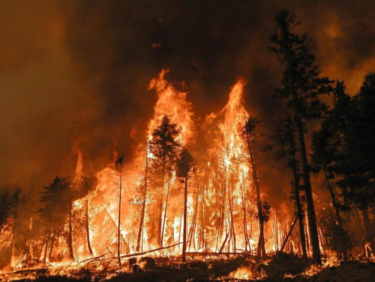
Since the early 2000s, Oregon has experienced a rapid escalation in the number of catastrophic wildfires and associated home and property losses, suppression costs, and worsening ecological conditions on the land. The total area of land burned by wildfire each year has also increased in Oregon since 1980, and wildfires have grown larger and have spread into higher elevations during this period. Warming temperatures lead to an increase in evaporative demand. When evaporative demand is high, the land loses more water to the atmosphere through evaporation and transpiration, leading to drier vegetation, exacerbating the risk of fire. Concurrent heat and drought have become more common, resulting in increased fuel loads as amounts of stressed or dead vegetation in many landscapes continue to increase. Climate change driven drought, increased aridity, and reduced relative humidity contribute to increased fire risk in Oregon. In the Pacific Northwest, the number of days with extreme wildfire danger have more than doubled since 1979. The length of the wildfire season and the potential for human-caused ignitions in all Pacific Northwest ecosystems are expected to increase as drought frequency, duration, and intensity increase.
Fire Suppression and Uncharacteristically Severe Wildfire
Oregon’s landscape consists of multiple natural fire regimes, varying by forest and vegetation types that occur across the state. The term ‘fire regime’ refers to the typical frequency, duration, size, severity, and seasonality of wildfire disturbance in a particular ecosystem, with reference to the historic range of variability for these disturbance patterns.
Fire regimes are influenced by factors such as forest type, climate, and ignition source. Differences in fire regimes have had a significant impact on the biodiversity, structure, and function of ecosystems. Understanding fire regimes is crucial for managing wildland fire, restoring ecosystems, and mitigating the impacts of climate change.
For thousands of years, Indigenous tribes across Oregon managed their lands with fire. With frequent low intensity burns, the land was stewarded to improve hunting and gathering of traditional foods and medicinal plants. With the arrival of Euro-American settlers, these fires were prohibited, and wildfires were aggressively extinguished. This loss of regular low intensity fires has had profound effects across the landscape.
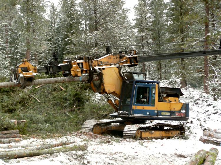
Human intervention to prevent and extinguish wildfires over the last hundred years has altered the historical fire regimes in many of Oregon’s landscapes. This has resulted in a cascade of unintended consequences for ecological health, wildlife populations, and people. Past forest practices and fire suppression have resulted in young, dense stands where open, park-like assemblages of mature trees once dominated, especially in eastern Oregon. These denser forests are at increased risk of forest-destroying crown fires, disease, and damage by insects.
Shading from encroaching trees and fire suppression has also reduced the vigor of shrubs and other understory vegetation, altering understory habitats and forage availability for many species. Coupled with warmer, drier conditions caused by climate change, the consequences of fire suppression are expected to lead to more landscape-scale, higher-severity fires in Oregon. Active forest management (e.g., prescribed burns, fuels reduction, thinning) can help lower wildfire risk, improve forest health, and protect timber assets.
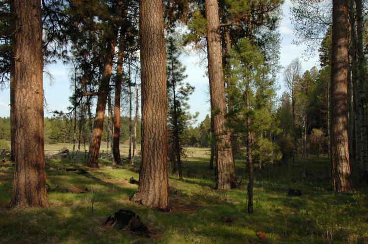
Photo Credit: USFS. Ponderosa pine mixed with aspen trees, both of which are Strategy Habitats.
Forested Landscapes
In forested areas, vegetation changes following fire suppression have increased the likelihood of wildfires that are uncharacteristically large, severe, or both. The extent of change in natural fire regimes varies considerably among forest types.
For the purpose of discussing fire, forests are typically grouped into three broad categories based on historic conditions:
- Drier forests that are or were dominated by species like ponderosa pine, Douglas-fir, and larch that historically experienced frequent fires (average intervals between fires of less than 25 years) that burned small trees and shrubs, but had limited effects on overstory trees with thick, fire-resistant bark. This pattern of frequent, low-severity fires is often referred to as an understory fire regime.
- Intermediate environments, such as mid-elevation areas supporting forests comprised of a variety of conifer species, that had average fire return intervals ranging from around 25 to 100 years. The impact of fire on overstory trees could vary from minimal to severe (depending largely on weather and topography). This pattern of fires is often referred to as a mixed fire regime.
- Forests in moist, cold areas (or at least with cool summers, as in the Coast Range or high elevation mountains) that tended to experience infrequent fires (average intervals of more than 100 years) that killed most or all the dominant trees. This pattern is referred to as a stand-replacement fire regime.
The forest types experiencing the greatest departure from natural fire regimes in Oregon are ponderosa pine and some mixed conifer forest types in the East Cascades, Blue Mountains, and eastern (interior) portion of the Klamath Mountains ecoregions. Human intervention, particularly fire suppression, selective logging of large overstory trees, and high reforestation stocking standards associated with modern silvicultural practices have shifted the historical fire regime from an understory fire regime with frequent, low-intensity fires to a stand-replacing fire regime with less frequent, high intensity fires. Additionally, extreme fire weather is driving more large, high severity fires in all forest types, even those that experienced low intensity burns under historical conditions.
The elimination of frequent, low-intensity fires resulted in increased fuel loads in the form of dead and downed wood, smaller trees, and increased stand densities. Increased stand densities favor understory trees like Douglas-fir and grand fir. Dense understory trees serve as “ladder fuels” that link surface fuels and overstory fuels. Selective logging removes the larger, more fire-tolerant trees and opens the canopy, allowing smaller, fire-sensitive trees to grow in the understory. Increased fuel loads and stand densities makes it more likely that when fire does occur, it will reach the forest canopy and spread as a crown fire. As a result of increased stand densities, larger trees become stressed due to competition with other vegetation for water and becoming more vulnerable to crown fires and more prone to insect infestation and disease.
Because of their large size and intensity, severe fires are more likely to cause adverse economic and environmental impacts. Fire has negative economic impacts on rural communities in Oregon whose economy and culture are based on timber product manufacturing and distribution. Fire-fighting activities are a major expense for the state. The cost of fighting fires has increased dramatically, with fire suppression costs exceeding $120 million in 2020 and 2021 and $250 million in 2024.
Uncharacteristically severe wildfires also pose higher risks to species and habitats because such fires can involve large areas and often result in complete mortality of overstory and understory vegetation (i.e., stand-replacing events). In September 2020, wildfires burned almost as much forest west of the Cascade Mountain crest in two weeks as in the previous five decades. These large-scale fires can impact habitats, soils, and watersheds beyond their adaptive limits. Uncharacteristically severe wildfires also impact aquatic habitats by removing riparian vegetation, which results in higher stream temperatures, decreased bank stability, and increased sedimentation in stream channels.
Many Oregon forests at a higher risk of severe wildfires contain Key Habitats or other important habitats for Species of Greatest Conservation Need (SGCN). Many of the Late Successional Reserves (LSRs) designated under the Northwest Forest Plan for management to preserve and produce late-successional forests are located in high risk areas. These LSRs address the habitat needs of late-successional and old-growth forest-related species, such as the Northern Spotted Owl or Marbled Murrelet. Many riparian areas that provide habitat for fish species listed under the Endangered Species Act (ESA), including Chinook salmon, coho salmon, steelhead, and bull trout, are also potentially at risk.

Sagebrush, Grassland, Oak, and Aspen Habitats
Fire historically maintained many sagebrush habitats, grasslands, oak savannas, oak woodlands, and aspen woodlands by removing competing vegetation and stimulating regeneration of native fire-associated plants. Fire suppression has allowed shrubs and conifers to encroach into grasslands, oak woodlands, and oak savannas. Similarly, it has allowed western juniper to encroach into aspen woodlands, some riparian areas, and mountain big sagebrush habitats. Maintenance of these habitats over time will require the careful reintroduction of natural fire regimes using site-appropriate prescriptions, accounting for the area size and vegetation characteristics that affect resiliency and resistance to disturbance. In some areas, other techniques, such as mowing or controlled grazing, can be used to mimic the effects of fire.
Vegetation in sagebrush steppe ecosystems is adapted to arid conditions and strongly influenced by fire and by drought. Drought, defined as two growing seasons with below average precipitation, significantly impacts shrubs, grasses, and forbs. Drought can reduce sagebrush growth and affect grasses and insect populations, which can result in impacts to Species of Greatest Conservation Need such as Greater Sage-Grouse.
Altered fire regimes and invasive species interact to create unnatural fire cycles in eastern Oregon, particularly in the Northern Basin and Range ecoregion. The introduction of invasive annuals, particularly cheatgrass and medusahead, can increase the frequency, intensity, and spread of fires. Breaking this cycle will require proactive management to prevent the introduction of annual invasive species, minimizing the spread of cheatgrass, controlling wildfires in invasive-dominated areas, avoiding prescribed fire in cheatgrass-dominated areas, and conducting research on how to better restore areas dominated by invasive species. Habitats formerly dominated by sagebrush and native grasses that are now dominated by invasive annuals do not always meet the habitat needs of native wildlife.
Altered Fire Regimes: Goals and Actions
Goal 1. Reduce uncharacteristically severe wildfire and restore fire or ecologically equivalent action in fire-dependent ecosystems to reestablish vegetative structure and species composition representative of a typical disturbance regime for forested and other systems.
Action 1.1. Use wildfire mapping tools to identify local zones with greatest risk of uncharacteristically severe wildfire and prioritize further action. Refer to restoration needs assessments to prioritize local zones for restoration action.
Mapping tools, such as the US Forest Service’s Wildfire Crisis Strategy Landscapes, can identify areas at highest risk of catastrophic wildfire and prioritize local sites for management actions to reduce risks. Setting priorities is essential, due to the magnitude of the areas requiring restoration and the limited resources allocated for their treatment. The risk of losing key ecosystem components is a factor that should be considered, with priority given to areas that are currently at moderate or high risk of losing key ecosystem components.
In identifying priorities for fuels reduction techniques, consider both local site-specific conditions and the broader landscape context. Site-specific considerations should include identifying particular values at risk of loss from uncharacteristically severe wildfire, such as remnant large-diameter ponderosa pine, oak, and madrone, as well as dead snags. Larger-scale considerations should include factors such as the extent to which an area’s landscape context makes it highly valuable to wildlife (e.g., the presence of Priority Wildlife Connectivity Areas, winter range, or breeding locations) or more likely to be vulnerable to fire or contribute to fire spread. Similarly, proximity to human residences or high-value watersheds needs to be considered.

Action 1.2. Work with landowners, managers, and other partners in these zones to lower risk of wildfires while maintaining wildlife habitat values, and to choose the sites and landscapes for fuel reduction and forest restoration.
Community-based forest health collaboratives are well-established and widespread across Oregon. These collaborative partnerships have provided review and recommendations for federal forest management activities occurring near their communities. These groups identify local forest health priorities through a community-based process, develop landscape-scale forest restoration plans, and develop agreement on active management and restoration approaches. Collaboratives bring together representatives from federal, state, and local governments, conservationists, timber interests, tribes, and other local groups to develop a clearly defined vision and strategic goals for cooperative restoration. The work of local forest collaborative partnerships has proven important for establishing local support and agreement for forest restoration treatments, increasing the potential for an acceleration in the pace and scale of forest restoration. For example, the Rogue Forest Partners have implemented cohesive restoration projects in the dry Southwest zone.
To provide guidance on addressing the threat of wildland fires to communities and natural resources, the U.S. Forest Service has developed the U.S. Forest Service’s Wildfire Crisis Strategy (Strategy). The Strategy increases the scale and pace of forest health treatments on federal, state, tribal, and private lands by prioritizing sites and landscapes for treatment. In 2024, the Collaborative Wildfire Risk Reduction Program was announced as part of a larger initiative to expand the Strategy and to provide funding for wildfire risk reduction efforts. The Oregon Department of Forestry (ODF) is also leading development of Oregon’s 20-year Landscape Resiliency Strategy with private, local, tribal, state, and federal partners to improve forests and rangelands to reduce wildfire risk. Partners can use the priorities outlined in ODF’s Resiliency Strategy to align priority actions and investments to the places of greatest need. Additionally, OSU’s Oregon Forest Management Planning site provides guidance and resources to small woodland owners and forestry professionals who are writing forest management plans.
For thousands of years, native peoples and tribes used fire to manage landscapes. A challenge for land managers today is to incorporate the Traditional Ecological Knowledge of indigenous peoples and tribes into standard fire management plans to reduce fire risk without harm to culturally significant resources. Partnerships among tribal leaders, agency and tribal land managers, and other interested parties to develop forest management plans will help move landscapes closer to resilient conditions. Co-development of management plans will ensure that all priorities are included and addressed in an all-lands approach.
There are a variety of management practices, tools, and regulatory mechanisms that private landowners can employ to reduce the probability and/or effects of large fires. Active forest management (e.g., thinning, prescribed burns) can reduce fire risk on private lands. Additionally, private land managers can help mitigate the negative effects of drought and improve overall forest stand health by planting more fire tolerant native conifer species, maintaining required tree spacing densities, and managing for pest/disease outbreaks.
Action 1.3. Seek and support cost-effective methods for reducing fuels, especially innovative approaches that increase the pace and scale of forest restoration and contribute to local economies.
Social acceptance for fuels management and other wildfire reduction efforts is likely to be greatest where various interests and values overlap (for example, in an accessible area of dry forest types where restoration would protect residences, restore or conserve habitats of concern, and provide commercially valuable timber by-products that could be processed in a local mill). Given the great disparity between the extent of areas needing treatment and the limited resources to accomplish the necessary treatments, careful consideration of factors related to social acceptance, as well as fire risk and other ecological elements, should help identify areas where projects can both provide substantial benefits and have a high likelihood of being successfully implemented.
In some areas, carefully removing understory biomass can restore habitats with historically open understories while reducing the risk of uncharacteristically severe wildfire by reducing fuel loads and removing ladder fuels. Developing markets for these small-diameter trees can create jobs, contribute to local economies, and help pay for restoration. The USFS’s Stewardship Contracting Program offers opportunities to implement and fund certain habitat restoration and management projects.
Site-by-site decisions are needed on the type and extent of fuels reduction treatments that will be conducted. At some sites, treatments are key to reducing the long-term risk of losing key ecosystem components to uncharacteristically severe fire. However, fuels reduction treatments can impact species and habitat by disturbing soil or eliminating key habitat components, such as canopy cover, hiding cover, snags, large woody debris, or large live trees. These impacts will vary depending on the extent, pattern, and level of fuels reduction treatments. Decisions on fuels reduction treatments must balance the need to maintain these key ecosystem components with management needed to reduce risk of long-term damage to wildlife and habitats from wildfires.
In high priority zones, use active management techniques to reduce surface, understory, and crown fuels. Fuels reduction treatments typically involve mechanical treatments combined with the use of prescribed fire, if appropriate. The most common mechanical treatment is the removal of smaller trees by understory thinning or thinning from below, although other forms of thinning may be employed, as well as mowing and crushing to reduce shrubs and surface fuels. Maintenance treatments will be essential to supporting desired future conditions and successional trajectories.
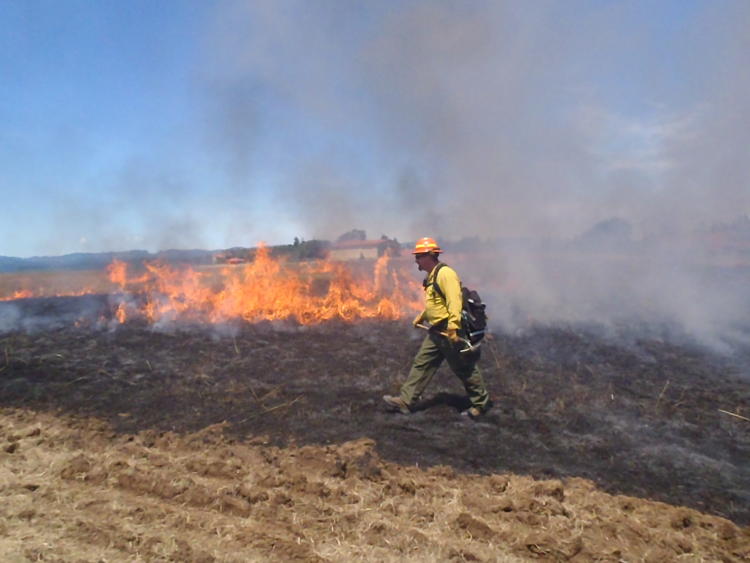
Action 1.4. Using site-appropriate prescriptions, carefully reintroduce natural fire regimes as part of an overall wildfire risk reduction and habitat restoration program in locations where conflicts, such as smoke and safety concerns, can be minimized.
Forested Landscapes
Because of high fuel loads in many areas, a common approach will involve mechanical treatments followed by prescribed fire. A fire management strategy where natural or prescribed fires are allowed to burn under controlled conditions with minimal suppression may be used to achieve risk reductions and restoration goals. A program of active fire suppression, however, will continue to be necessary when fires pose risks to firefighters or threaten local communities, private property, and cultural resources.
Management actions, such as active thinning and prescribed burning, in at-risk green stands will reduce the amount of effort and funding needed for fire suppression in those areas, although stands may need multiple treatments to maintain beneficial outcomes. However, the overall goal should be the restoration of conditions where natural fire can perform its historical ecological role across more of the landscape and where compatible with existing land uses. Planning for wildfire risk reduction and habitat restoration should evaluate if it would be feasible, ecologically appropriate, and socially desirable to allow the historical fire regime to return once high fuel loads are addressed.
Unforested Landscapes
Prescribed fire can be a useful tool when tailored to local conditions. However, prescribed fire is not suitable for all situations. In the Northern Basin and Range and Blue Mountains ecoregions, low productivity plant communities are extremely slow to recover from prescribed fire and other disturbances. For example, low sagebrush communities have poor, shallow soils and take time (150-300 years) to recover from significant soil disturbance or fire. Both wildfires and prescribed fire can increase dominance of invasive plants, depending on the site conditions.
In the Klamath Mountains and Willamette Valley ecoregions, prescribed fire poses challenges, such as conflicts with surrounding land use, smoke management and air quality, and public safety. In the Coast Range ecoregion, prescribed fire is difficult due to high precipitation and wet conditions. When conditions are dry enough to use prescribed fire in coastal grasslands, there are usually concerns with risk to surrounding forests.
To address these issues, carefully evaluate individual sites to determine if prescribed fire is appropriate. Be particularly cautious in low productivity sites where recovery times are prolonged or in sites with invasive annual grasses. If determined to be ecologically beneficial, reintroduce natural fire regimes using site-appropriate prescriptions and consider conflicts, such as smoke and safety concerns. If prescribed fire is not appropriate or feasible, consider alternative methods that mimic the effects of fire (see Action 1.5 below).
Action 1.5. Use site-appropriate tools, such as mowing, brush removal, tree cutting, and controlled grazing, to mimic effects of fire in fire-dependent habitats.
Use multiple site-appropriate tools to maintain open structure habitats. These may include mowing, controlled grazing, hand-removal of encroaching shrubs and trees, or thinning. For all tools, minimize ground disturbance and impacts to native species. Vary treatment types, timing, and spatial distribution to produce a mosaic of different habitats. Use mechanical treatment methods (e.g., chipping, cutting for firewood) to control encroaching conifers. In aspen habitats, reintroducing a disturbance regime may be necessary to reinvigorate aspen reproduction after mechanical removal of conifers. In areas where western junipers are expanding into sagebrush habitats, maintain older juniper trees, which are important for wildlife.
Action 1.6. Develop tools that evaluate trade-offs between short-term loss of wildlife habitat values and long-term damage to habitat from wildfires and evaluate effects of forest management practices that reduce wildfire risk to wildlife habitat values.
Efforts to reduce wildfire risk and restore habitats need to occur within an adaptive management framework in which actions are monitored and modified in response to results and changing conditions. In some cases, wildlife habitat elements, such as hiding cover, snags, and downed wood, will be reduced by fuels reduction activities. However, inaction could result in complete habitat loss through severe wildfire. Thus, analytical tools are needed to evaluate and compare the short-term risk of fuels reduction treatments to species and habitats against the long-term risk to species and habitats posed by uncharacteristically severe wildfire. In landscape-scale restoration projects, these tools should also assess habitat connectivity that allows at-risk wildlife species to move away from disturbed areas, as well as move back into rehabilitated areas. Such tools would assist landowners and land managers in determining appropriate actions for individual sites.
Fire suppression and fuels reduction techniques need to be monitored to determine short-term impacts on species and habitat, and the long-term effectiveness in reducing the risk of uncharacteristically severe fire. Furthermore, research is needed to better understand the effects of historical fire regimes, severe wildfire, and fire suppression on wildlife. Also, historical disturbance regimes are not well-understood for all habitat types, so research is needed to determine the historical frequency and severity of disturbance that maintained Key Habitats. Formulate management approaches, including use of prescribed fire, accordingly.
Action 1.7. Use herbicides to minimize colonization of invasive annual grasses after wildfire in shrub-steppe communities.
After catastrophic wildfires in sagebrush-dominated communities in drier parts of the state, like the Northern Basin and Range ecoregion, herbicides can be used to kill invasive annual grasses (e.g., cheatgrass and medusahead) so they do not dominate the post-fire landscape. This can greatly improve the ability of native grasses and shrubs to re-colonize and establish. Supplemental seeding and/or replanting with native species after large-scale wildfires will further improve the reestablishment of desired species and limit or reduce the spread of invasive plants.
ALTERED WATERWAY AND FLOODPLAIN FUNCTION
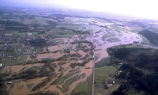
From time to time, Oregon’s waterways, filled by rain, snowmelt, and groundwater discharge, overflow their banks and spread across the landscape. Minor floods occur relatively frequently and on most Oregon streams at one time or another. Many streams flood once or more each season. Floods on rivers in eastern Oregon are more often the result of spring snowmelt. The central and eastern areas of the state are also subject to summer thunderstorms that drop large amounts of rain in short periods, overwhelming the soil’s capacity to absorb the moisture and river systems to transport it, resulting in flash floods. In western Oregon, winter storms and spring rain-on-snow events contribute to seasonal flooding.
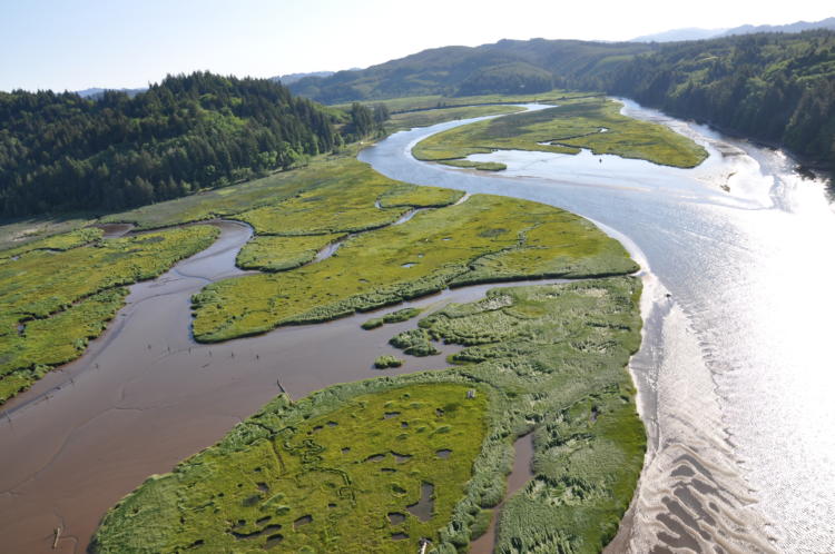
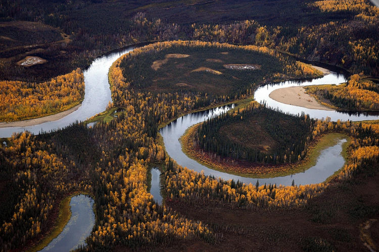
The area of land adjacent to the river that absorbs overflow during floods is the river’s floodplain. Rivers often carve new courses during floods. Over time, rivers gradually move across the landscape, creating oxbows and excavating new channels and alcoves. This makes naturally flowing rivers good habitat for aquatic species and floodplains fertile habitat for terrestrial species.
Many naturally flowing rivers, however, have been modified in several ways. Water withdrawals have altered flow regimes, including groundwater discharge to flowing waters. Dams alter river dynamics with significant effects on aquatic and terrestrial communities. In addition, rivers have been channelized for a variety of reasons. Rivers have been dredged and deepened to improve their use for transportation, flood control, and irrigation needs, as well as to increase the area available for agriculture. The placement of riprap, levees, and deflectors harden and stabilize banks and redirect river flow in an attempt to prevent localized erosion and channel movement. These structures constrain rivers to a single course, disconnecting them from their floodplains and increasing the erosive potential downstream.
Climate change is also causing impacts to Oregon’s hydrology, leading to altered precipitation patterns, reduced snowpack, and increased risks of both floods and droughts. Increased precipitation falling in fewer events will likely increase flooding risks, especially in highly populated ecoregions. Warmer temperatures are causing more precipitation to fall as rain instead of snow, resulting in earlier snowmelt and potentially higher peak flows, as well as reduced summer low flows. This, in turn, affects water supplies for various users, including agriculture, municipal consumption, and aquatic ecosystems.
History of Dams on Oregon’s River Systems
Oregon’s first dams were built in the late 1800s to supply electricity to cities and water-powered flour mills. Significant dam building took place between the turn of the last century and the 1960s. Many splash dams were built to transport logs from forest to mill, but they were so damaging to streams they were outlawed in 1958. The federal government also erected dams to provide irrigation water for farmers. The first of these projects in Oregon (under the 1902 Reclamation Act and managed by the Bureau of Reclamation) was the Klamath Project, a complex of dams and canals that drained extensive wetlands and diverted lake water to irrigate 225,000 acres of former rangeland. The Flood Control Act of 1936 declared that flood prevention was in the public interest and shifted the emphasis to multiple-purpose dams to improve flood control. By 1940, over 70 percent of Oregon’s current water storage capacity was in place behind eight Bureau of Reclamation dams.
The U.S. Army Corps of Engineers currently operates roughly 20 dams in Oregon, 11 of them west of the Cascades. Those constructed on the Columbia River (i.e., Bonneville, The Dalles, John Day, and McNary) were built to generate electricity, rather than provide water storage. Today, the greater percentage of dams across the state are operated by cities, local districts, or individual landowners for a variety of purposes, including flood control.
Effects of Modification on River Dynamics, Floodplain Function, and Fish and Wildlife Habitats
The loss of a river or a stream’s connection to its floodplain reduces its ability to absorb floodwaters. When small streams and creeks reach flood stage and overflow onto adjacent lands, the pulse of floodwater slows before reaching larger rivers. The speed and severity of modern floods is increasing with the loss of this floodplain “sponge effect”. In developed areas, modifications have been made throughout river and stream systems. Paved surfaces significantly limit infiltration into the ground and instead concentrate stormwater into pipes and directly into streams. In rural areas, agricultural ditches move water off the land quickly.
One of the important habitat functions of flooding is to move gravel from uplands to lower sections of the stream. Clean gravel is an essential streambed surface for healthy salmon spawning beds. When water flows through gravel, it can cool and change chemistry, improving conditions for cold-water anadromous species. In modified streams, dams trap gravel and silt and constrain major floods that would normally move gravel downstream.
Channelization can contribute to greater streambank scouring and erosion as loss of stream complexity (e.g., bends, pools, eddies) destabilizes banks and interferes with gravel transport and deposition. Within a floodplain, modified flow can limit channel migration, which in turn limits the creation of off-channel habitat, such as oxbow lakes, backwaters, and sloughs that provide important habitat for Species of Greatest Conservation Need such as the Oregon chub or foothill yellow-legged frog. Side channels and off-channel habitat also provide sheltered settings outside the main river current where young fish and other small aquatic creatures can rest or feed. Since natural river channels are maintained by a dynamic equilibrium between erosion and deposition of gravel and silt, water moving without silt or through straightened channels can cause riverbed and riverbank erosion.
In natural systems, large floods send logs and boulders tumbling into mountain streams and topple trees along riverbanks. The force of floodwater moves submerged logs and boulders into new locations. These actions rearrange the river habitat, flushing out sediment and setting up new complex structures necessary for healthy aquatic habitat. Removal of wood, and lack of large wood recruitment from the landscape, often leads to channel simplification and a loss of in-stream habitat. Dams temper the force of floodwater, diminishing the power of streams and rivers to move large wood, thus depriving streams of new structures that are important for fish habitat. Channelization removes the complexity of existing stream structures, which straightens and speeds flows, thereby depriving streams of potential locations for large wood debris recruitment and retention.
Water temperature cycles are altered by impounding water behind dams, resulting in disruption of temperature-dependent life cycles of anadromous fish, wildlife, and their food sources. Flowing water in streams is full of nutrients and oxygen, while riparian vegetation provides important shade to keep water cool. Conversely, water held behind dams warms in the summer sun. The surface temperature of the water increases while cold water sinks, and suspended material settles to the bottom. Phytoplankton, single-celled plants that make up the base of the food chain, proliferate at the top, releasing oxygen. When they die, they sink to the bottom where bacteria consume them and use oxygen. Over the course of the summer, the water at the top of a reservoir is warm and full of oxygen and food. The water at the bottom is cold and low in organic matter and oxygen. This is significant for fish because their life cycles, and those of their food sources, are triggered by temperature. Over time, dammed rivers behave more like lake ecosystems, losing their capacity to support riverine fish species. Some water releases from larger reservoirs with bottom outlets can be controlled to maintain appropriate temperatures for fish, amphibians, and reptiles, but these decisions are made with a variety of other factors to consider like electricity generation and irrigation needs.
Dams and other flood control structures/modifications have also affected river floodplain habitats. Floods that used to occur every 10 years or so now occur every 100 years or more. Former floodplains no longer receive regular deposits of waterborne sediment. Disconnected from their rivers and drained, they no longer provide wetland and seasonally flooded habitats. In addition, annual high-flow events have become “flashy” (e.g., shorter in duration and greater in intensity) in some areas where there has been extensive channelization and loss of floodplain function.
ALTERED FLOODPLAIN FUNCTION: Goals and Actions
Goal 2. Maintain and restore waterway and floodplain functions, such as groundwater recharge, water quality improvements, natural nutrient and sediment movements, resilient riparian corridors, habitat connectivity, and habitat variation.
Action 2.1. Restore floodplain function by reconnecting rivers and streams to their floodplains, restoring stream channel location and complexity, removing dikes and revetments, allowing seasonal flooding, restoring and maintaining wetland and riparian habitats, and supporting beaver habitat.
Work with local communities, watershed councils, tribes, landowners, and other partners to restore and reconnect natural stream channels and floodplains. Explore opportunities for broad-scale floodplain restoration on main rivers and their tributaries. While restoration of entire rivers may not be feasible, seek opportunities to restore critical mainstem or tributary habitats, floodplain function, and critical off-channel habitats adjacent to the main channels. Use subbasin plans and similar efforts for key information on floodplain issues and opportunities. Identify areas of cold-water discharge and prioritize protection.
Action 2.2. Provide outreach about the ecological benefits of allowing rivers to meander back and forth across the floodplain.
Facilitate discussions within urban and residential communities regarding building or development within the floodplain and riparian areas. Provide outreach about the dynamic, meandering nature of rivers and streams. Allowing rivers to meander back and forth across the floodplain reduces bank erosion and offers ecological benefits for local species. The Federal Emergency Management Agency (FEMA) works with local governments to address floodplain issues and offers tools and resources to help manage floodplain risk while permitting floodplains to function naturally.
Action 2.3. Work with power companies, agencies, irrigation districts, and municipalities to time water releases to replicate natural flood cycles.
Work with power companies and municipalities to develop a schedule of releases timed to replicate natural flood cycles, while continuing to provide essential hydroelectric power and water storage services. Work with FEMA and other floodplain managers to minimize potential for impacts from new development and redevelopment in the channel migration zone, and to consider ways to maintain or incentivize floodplain protection.
Action 2.4. Identify and restore important off-channel habitats and oxbows cut off by previous channel modification.
While revetments or impact-resistant material (e.g., stone, concrete, sandbags, or wooden piles) applied to a streambank protect riverside property, they also simplify or eliminate the side channels, alcoves, seasonal wetlands, and islands that provide essential complex habitat structure for aquatic species. These are critical areas for fish, such as juvenile salmonids and Oregon chub, amphibians, birds, and reptiles. Reconnect these habitats to rivers where feasible. Use bioengineering instead of riprap on bank-stabilization projects. Update floodplain and channel migration maps, including projected floodways associated with climate change, and integrate them into the land-use planning process.
Action 2.5. Support the use of green infrastructure in place of hard barriers to support stormwater management and respond to flooding concerns.
Green or natural infrastructure is a water management strategy that maintains or mimics the natural water cycle. Examples include increasing vegetation cover on roofs, use of permeable surfaces to allow infiltration of water runoff, or planting rain gardens to help reduce and treat water where it falls. Green infrastructure can help maintain floodplain function, manage stormwater, and mediate some of the impacts from climate change. Communities may also benefit from cost-savings, improvements in public safety, and increased opportunities for recreation. Successful examples include the Clean Water Services Stormwater Program and the City of Portland Stormwater Management Program.
Action 2.6. Remove artificial barriers and infrastructure impacts such as undersized culverts and at-risk structures in the floodplain.
Reduce head-cutting of streams resulting from stormwater discharges by replacing culverts that are not at stream grade, reducing run-off to streams, and maintaining or replanting stream banks and riverbanks with native vegetation. When re-development is planned, explore opportunities to remove structures or pavement from floodplains and restore native vegetation. Coordinate with ODFW Fish Passage on appropriate approvals for structures.
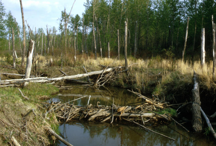
Action 2.7. Support and encourage beaver occupancy and dam-building activity.
Beaver dams can help restore floodplain function, reduce sedimentation, improve water quality and fish habitat, restore wetlands, and improve habitat for many species of birds, amphibians, and other wildlife. Beaver dams can prolong the benefits of off-channel habitats, especially during summer months, and help lessen the impacts of wildfires in riparian areas. Where beavers and beaver dams are present, work with cities, municipalities, and landowners to implement co-existence strategies that reduce the likelihood of beaver damage and maintain beaver on the landscape.
Limiting development adjacent to streams and sloughs and planting with early floodplain successional plants such as willow can allow beavers to maintain dams and limit flooding to private property or damage to streamside agriculture. Further outreach and informational materials about the potential role of beaver in restoration projects may be useful for landowners, land managers, and conservation organizations. For example, see the Beaver Restoration Guidebook: Working with Beaver to Restore Streams, Wetlands, and Floodplains, a guidance document produced in collaboration by several federal agencies, including the USFWS, NOAA, USFS, and Portland State University. ODFW also provides guidance on living with beaver.
REFERENCES
Barth, J.A., S.D. Pierce, B.R. Carter, F. Chan, A.Y. Erofeev, J.L. Fisher, R.A. Feely, K.C. Jacobson, A.A. Keller, C.A. Morgan, and J.E. Pohl. 2024. Widespread and increasing near-bottom hypoxia in the coastal ocean off the United States Pacific Northwest. Scientific Reports, 14(1), p.3798.
Reilly, M. J., A. Zuspan, J.S. Halofsky, C. Raymond, A. McEvoy, A.W. Dye, D.C. Donato, J. B. Kim, B. E. Potter, N. Walker, R.J. Davis, C.J. Dunn, D.M. Bell, M.J. Gregory, J.D. Johnston, B.J. Harvey, J.E. Halofsky, and B.K. Kerns. 2022. Cascadia Burning: The historic, but not historically unprecedented, 2020 wildfires in the Pacific Northwest, USA. Ecosphere. 13(6): 6383-6403.
Schmidt, K. M., J.P. Menakis, C.C. Hardy, W.J. Hann, and D.L. Bunnell. 2002. Development of coarse-scale spatial data for wildland fire and fuel management. Gen. Tech. Rep. RMRS-GTR-87. Fort Collins, CO: U.S. Department of Agriculture, Forest Service, Rocky Mountain Research Station. 41 p.