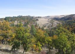
Description
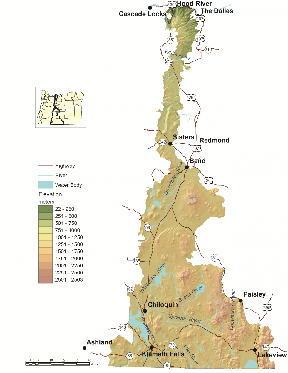
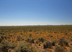
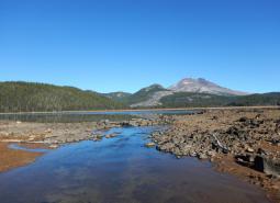
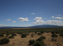
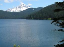
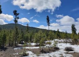
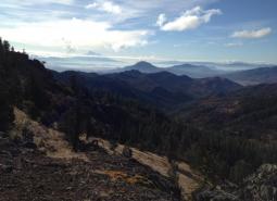
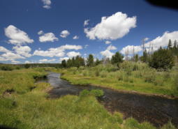
The East Cascades ecoregion extends from just east of the Cascade Mountains’ summit to the warmer, drier high desert to the east. Stretching the full north-to-south length of the state, the East Cascades is narrow at the Columbia River but becomes wider toward the California border. This ecoregion varies dramatically from its cool, moist border with the West Cascades ecoregion to its dry eastern border with the Northern Basin and Range ecoregion. The climate is generally dry, with wide variations in temperature. The East Cascades ecoregion includes several peaks and ridges in the 6,000-7,000 foot range, but overall the slopes on the east side of the Cascade Mountain Range are less steep and cut by fewer streams than the West Cascades ecoregion. The East Cascades’ volcanic history is evident through numerous buttes, lava flows, craters, and lava caves, and in the extensive deep ash deposits created by the explosion of historical Mt. Mazama during the creation of Crater Lake.
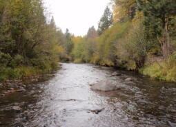
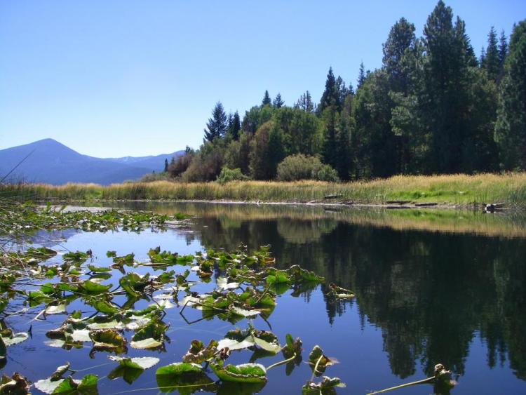
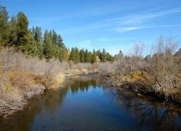
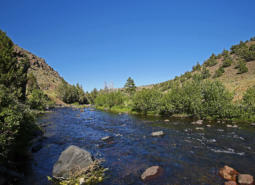
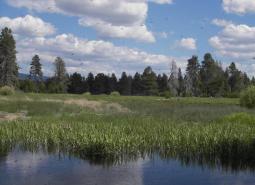
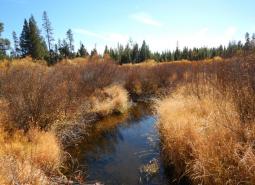
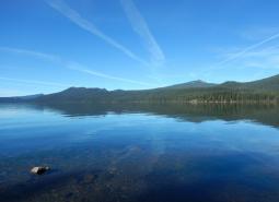
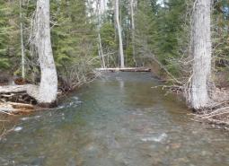
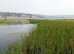
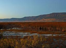
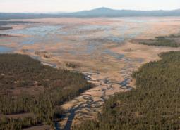
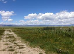
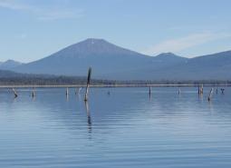
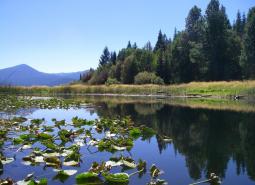
The terrain ranges from forested uplands to marshes and agricultural fields at lower elevations. The northern two-thirds of the East Cascades ecoregion is drained by the Deschutes River, ultimately flowing into the Columbia River. Most of the southern portion of the East Cascades ecoregion is drained by the Klamath River, with a small portion draining into Goose Lake, a closed basin. In general, the East Cascades is drier than the West Cascades, with fewer rivers flowing over the mountain slopes. However, the East Cascades is characterized by many lakes, reservoirs, and marshes, providing exceptional habitat for aquatic species and wildlife closely associated with water, including waterbirds, amphibians, fish, aquatic plants, and aquatic invertebrates. In fact, the East Cascades ecoregion supports some of the most remarkable biological diversity in the world.
When compared to Oregon’s other ecoregions, the East Cascades has the second-highest average income (the Willamette Valley ecoregion supports the highest per-capita income). Much of this income is related to tourism and recreation, but forestry and agriculture also provide important roles. Towns include Bend, Klamath Falls, Lakeview, and Hood River; many of these towns are experiencing rapid population growth. Most of the Warm Springs Indian Reservation is found in the East Cascades ecoregion.
Characteristics
Important Industries
Recreation (tourism and hospitality), forest products, agriculture
Major Agricultural Products
Fruit (Hood River Valley), carrot seed (Jefferson County), wood, onions, potatoes, strawberries, barley (Klamath Basin), alfalfa, and cattle (Lake County)
Important Nature-based Recreational Areas
Klamath Basin National Wildlife Refuge Complex, Goose Lake, Newberry Crater National Monument, high Cascade lakes along Century Drive, Pine Mountain, Warner Mountains, Gearhart and Badger Creek Wilderness Areas, Metolius and Deschutes sub-basins, White River Wildlife Area
Elevation
70 feet (in the Columbia River Gorge area) to over 8,000 feet (peaks in the southeastern portion of the ecoregion)
Important Rivers
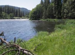
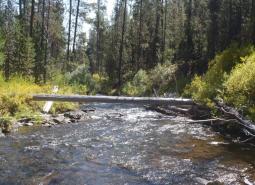
Deschutes, Hood, Klamath, Metolius, Link, Williamson, Sycan, and Sprague
Climate
The East Cascades terrain includes sloping mountains and high plateaus. The climate is more continental with greater temperature extremes and less precipitation. Summers are warm and dry; winters are cold. The frost-free period is typically short, especially on the high peaks, and the mean annual precipitation varies considerably with elevation. With increased temperatures, the frost-free period in the East Cascades will lengthen.
Warming is projected in all seasons across the East Cascades, with the greatest increases projected for the summer. The average summer temperature is projected to increase by as much as 7°F for the 2040-2069 period, and as much as 12°F for the 2070-2099 period under a high emissions scenario (SSP585; Figure 1). Late summer total precipitation is projected to decrease in the north and increase in the south of the ecoregion; however, confidence is low in the projected changes in summer precipitation after 2039 (Figure 2). Projections of cool season precipitation show an increase of as much as 9% under a high emissions scenario (SSP585) for the 2070-2099 period. Under a high (SSP585) scenario, growing degree days are projected to double by the 2070-2099 period and frost days are projected to decrease from over 200 per year to 120 per year, on average, by the end of the century.
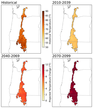
Figure 1. Model median historical (1950-2010) and future projections of summer maximum temperature change for three periods (2010-2039, 2040-2069, 2070-2099) under a high emission scenario (SSP585) for the East Cascades. Future projections show increasing temperatures over the next century, with slightly less warming in the western section of the region with higher elevation (Raymond and Fusco, 2024).
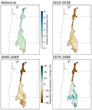
Figure 2. Model median historical (1950-2010) total late summer precipitation and projected percent change for three future periods (2010-2039, 2040-2069, 2070-2099) under a high emission scenario (SSP585) for the East Cascades. Future projections show decreasing late summer precipitation across the north through the century and an increase for the south for the end of the century. Confidence is low in projected changes in late summer precipitation after the 2010-2039 period (Raymond and Fusco, 2024).
Limiting Factors and Recommended Approaches
Limiting Factor: Land Use Conversion and Urbanization
CMP Direct Threats 1, 2.1, 2.3, 7.2
The East Cascades ecoregion includes some of the fastest growing areas of the state (e.g., Bend, Klamath Falls). Rapid urban and rural residential development contributes to habitat loss, and can threaten traditional land uses, such as agriculture and forestry. Residential development can also fragment habitat into small patches, isolating wildlife populations. Residential development is increasing in sensitive habitats, such as wetlands, riparian areas, and cliffs and rims, where raptors nest. Some agricultural uses contribute to habitat degradation for native wildlife species. For example, open grazing allotments in forests have significantly damaged understory and riparian habitat in many areas.
Recommended Approach
Cooperative approaches with both large and small private landowners are critical. Work with community leaders and local governments to encourage planned, efficient growth. Support existing land use regulations to preserve forestland, farmland, rangeland, open spaces, recreation areas, wildlife refuges, and natural habitats. Work with community leaders and agency partners to protective wildlife movement corridors and to fund and implement site-appropriate habitat enhancement and restoration efforts to facilitate wildlife movement. Encourage condensing development and utilize pre-existing disturbance footprints for new developments when possible. Work with counties to update Wildlife Inventories.
Limiting Factor: Altered Fire Regimes
CMP Direct Threats 7.1, 11.3, 11.4
Past forest practices and fire suppression have resulted in young, dense mixed-species stands where open, park-like stands of ponderosa pine once dominated. Shading from encroaching trees as a result of fire suppression has reduced the vigor of shrubs, particularly bitterbrush, an important forage plant for many wildlife species. Forest crowding and reduced fire resiliency is also a significant issue in oak habitat, as large legacy oaks have become surrounded by dense stands of younger trees.
Wildfire risk is further exacerbated by warming climate conditions and changes to patterns of precipitation, and more frequent, higher intensity megafires are becoming more common. Young, dense, mixed conifer forests are also at increased risk of forest-destroying crown fires, disease, and damage by insects. Additionally, past forest practices have contributed to forests that are lacking in mature trees and snags that serve as critical wildlife habitat for some species. Efforts to reduce fire danger and improve forest health may help to restore habitats but require careful planning to provide sufficient habitat features that are important to wildlife (e.g., snags, downed logs, hiding cover).
Increasing residential and resort development in forested habitats makes prescribed fire difficult in some areas and increases risk of high-cost wildfires. Although many residential interface “fireproofing” measures can be implemented with minimal effects to wildlife habitat, proper planning is necessary to avoid unintentionally and unnecessarily harming habitat.
Recommended Approach
Use an integrated approach to forest health issues that considers historical conditions, wildlife conservation, natural fire intervals, and silvicultural techniques. Evaluate individual stands to determine site-appropriate actions, such as monitoring in healthy stands or thinning, mowing, and prescribed fire in at-risk stands. Where appropriate, thin smaller trees in the understory and develop markets for small-diameter trees.
Implement fuels reduction projects to reduce the risk of forest-destroying wildfires, considering site-specific conditions and goals. Fuels reduction strategies need to consider the habitat structures that are required by wildlife, such as snags and downed logs, and try to maintain them at a level to sustain wood-dependent species. Design frequency and scale of prescribed fire to meet the habitat needs of a diversity of species. Monitor forest health initiatives and use adaptive management techniques to ensure efforts are meeting habitat restoration and forest-destroying fire prevention objectives with minimal impacts on wildlife. Work with homeowners and resort operators to reduce vulnerability of properties to wildfire while maintaining habitat quality. Highlight successful, environmentally sensitive fuels management programs. In the case of post-wildfire recovery, maintain high snag densities and replant with native tree, shrub, grass, and forb species. Manage reforestation after wildfire to create species and structural diversity, based on local management goals.
Limiting Factor: Water
CMP Direct Threats 7.2, 11.4
Water Quantity is a limiting factor for fish and wildlife, and water availability is a significant issue in this ecoregion. Changing climate conditions are leading to rising temperatures and altered patterns of precipitation, which affect water availability across different times of year, and drought conditions are occurring more frequently. In high elevation areas, loss of snowpack due to warming climate conditions is affecting habitat for many species along the Cascade crest and is leading to reduced stream flow and peak flow rates that are occurring earlier in the year. In streams, seasonal low flows can limit habitat suitability and reproductive success for many fish and wildlife species. In areas where urbanization is increasing, particularly around Bend and Klamath Falls, the demand for water, along with regular droughts, has led to a decrease in the supply of groundwater. This reduces groundwater discharge of cold water to rivers and streams, subsequently reducing the availability of both cold water refugia and suitable habitat for cold-water dependent species. Dwindling groundwater supplies further contribute to wetland loss and altered timing in the availability of water in seasonal wetlands, impacting habitat for many fish and wildlife species.
Water quality can also limit species and habitats. Runoff from agricultural areas can contaminate waterways. Warming temperatures, combined with higher nutrient levels due to agricultural runoff, are increasing the prevalence of toxic cyanobacterial blooms.
Recommended Approach
Provide incentives and information about water usage and sharing during low flow conditions (e.g., late summer). Promote water management actions that enable climate resilience and adaptation. Invest in watershed-scale projects for cold water and flow protection. Identify and protect cold water rearing and refugia habitat for aquatic species. Increase awareness and manage timing of applications of potential aquatic contaminants. Improve compliance with water quality standards and pesticide use labels administered by the DEQ and EPA. Work on implementing Senate Bill 1010 (Oregon Department of Agriculture) and DEQ Total Maximum Daily Load water quality plans. Work with NRCS and other partners to support water-smart practices, like conversion from flood to piped irrigation, on working lands.
Limiting Factor: Habitat Fragmentation
CMP Direct Threats 1, 2.1, 2.3, 3.3, 8.1
Increasing traffic volumes, road density, and recreational pressure associated with development is contributing to habitat loss and fragmentation and creates barriers to animal movements, especially in National Forest and Wilderness Areas near urban centers and along US Highway 20 and US Highway 97. In non-forested areas, habitats for at-risk native plants and some animal species are largely confined to small and often isolated fragments, such as roadsides and sloughs. These remaining parcels have potential to be converted to agriculture or developed for solar energy production, and there are few opportunities for large-scale protection or restoration of native landscapes. Existing land use and land ownership patterns in many areas, particularly the Klamath Basin, present challenges to large-scale ecosystem restoration. In-stream barriers to movement, such as dams and undersized or poorly maintained culverts and bridges, may limit passage of fish and aquatic wildlife.
Recommended Approach
Work with community leaders and local governments to protect wildlife movement corridors and to fund and implement site-appropriate habitat enhancement and restoration efforts to facilitate wildlife movement. Promote the protection, restoration, and maintenance of Priority Wildlife Connectivity Areas, following the guidelines outlined in Oregon’s Wildlife Corridor Action Plan.
Remove barriers to movement wherever possible. Ensure that waterways remain passable for fish and aquatic wildlife at culverts and bridges. Inventory fencing locations and conditions. Remove fencing that is no longer needed or in poor condition; modify needed fencing to be wildlife friendly. Work with the Oregon Department of Transportation and county and city transportation departments to improve wildlife passage across roadways. In forested habitats, maintain vegetation to provide screening along open roads, prioritize roads for closure based on transportation needs and wildlife goals, and/or manage road use during critical periods.
Provide incentives (e.g., financial assistance, conservation easements) and information about the benefits of maintaining bird and other wildlife habitat. Broad-scale conservation strategies will need to focus on restoring and maintaining more natural ecosystem processes and functions within areas that are managed primarily for other values. This may include an emphasis on more “conservation-friendly” management techniques for existing land uses, and restoration of some key ecosystem components such as riparian function.
Limiting Factor: Invasive Species
CMP Direct Threat 8.1, 8.2
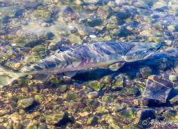
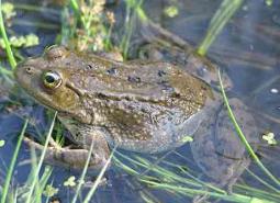
Non-native plant and animal invasions disrupt native communities, diminish populations of at-risk native species, and threaten the economic productivity of resource lands. Non-native annual grasses, particularly cheatgrass, have infiltrated perennial grass systems in the eastern portion of the East Cascades ecoregion, displacing desirable forage for wildlife and livestock. Non-native fish and wildlife species are also causing detrimental impacts. In the East Cascades, the Pokegama horse herd has increased substantially, well above Appropriate Management Levels and outside of the established Herd Management Area. Unregulated horse herds have significant negative impacts, competing with native wildlife for vegetation and access to water, increasing soil erosion, and trampling sensitive habitats. American bullfrogs are rapidly expanding, competing with native species for limited resources or preying on native species and/or their eggs or young. Non-native fish, introduced to many high elevation lakes, have similar impacts, particularly for native amphibians.
Recommended Approach
Emphasize prevention, risk assessment, early detection, and quick control to prevent new invasive species from becoming fully established. Use multiple site-appropriate tools (e.g., mechanical, chemical, and biological) to control the most damaging invasive species. Prioritize efforts to focus on key invasive species in high priority areas, particularly where Key Habitats and Species of Greatest Conservation Need occur. Promote the use of native species for restoration and revegetation.
Limiting Factor: Energy Development
CMP Direct Threat 3.3
Climate change and global economies are increasing pressure for renewable energy development, including solar energy. Solar energy potential is especially high in the East Cascades. Solar energy projects offer environmental benefits but also have significant impacts on wildlife and their habitat. Many solar energy facilities have large footprints. Federal requirements for facilities to be fully fenced make any remaining habitat within a solar field inaccessible to most terrestrial wildlife species, which results in lost habitat and may disrupt critical movement and migration pathways. Solar facilities are also a collision risk for birds, as reflection of sunlight off the panels may cause solar fields to resemble large water bodies. In addition to solar, hydropower production is also prevalent, and geothermal production is increasing. The area is increasingly challenged with the need to balance the state’s interest in clean energy development with local natural resource conservation needs.
Recommended Approach
Plan energy projects utilizing all available resources, including the ODFW Solar Sitting Guidelines. Work with prospective energy developers to incorporate interior project designs to offer potential habitat services for pollinator and avian species, where appropriate. See the Key Conservation Issue on Land Use Changes. Consider the broader landscape context when planning new facilities, including habitat connectivity, cumulative impacts, fish and wildlife species presence, and mapped or modeled suitable habitat. Ensure new facilities minimize negative impacts to fish and wildlife. For example, establish fish ladders or bypass channels to reduce fish passage barriers at dams, and use wildlife-permeable fencing or allow egress to permit passage for medium-sized animals through solar fields.
Limiting Factor: Recreational Activity
CMP Direct Threats 1.3, 4.1, 5.1, 5.2, 5.4, 6.1
Increasing demands for year-round recreational activity, including new mountain bike trails, ski lifts, and skill parks, can disturb wildlife. Activities like hiking, biking, hunting, fishing, camping, skiing, and off-road vehicle use can create sensory stressors for wildlife, with sound, light, and unusual smells that may deter species from moving through certain areas. Recreational pressure is increasingly significant in the East Cascades along the Cascade crest as residential communities grow. This region offers access to many trail systems across several National Forests and Wilderness Areas.
Recreational pressure can lead to an increase in wildlife stress response and behavioral changes that ultimately impact reproductive rates and population abundance. Human recreation may contribute to destruction of sensitive vegetation, harassment of wildlife from off-leash pets, spread of invasive species, and contamination of areas with refuse. Many species will avoid areas near trails, campgrounds, and access roads when humans are present. New winter tire and headlamp technologies are allowing mountain bicyclists access to important wildlife areas that were previously inaccessible due to snow. Trail riding can now occur day or night throughout the year, which can disturb wildlife during critical life stages. Rock climbing too close to cliff-nesting birds such as Golden Eagles can result in nest abandonment. Expanded road and trail systems developed to help accommodate higher numbers of visitors are increasing habitat fragmentation and risks of behavioral impacts to wildlife.
Recommended Approach
Ensure that large patches of unfragmented habitat remain free from recreational pressure. Plan new recreational trail systems carefully and with consideration for native wildlife and their habitats. For example, limit night riding to certain areas to minimize disturbance to wildlife, avoiding areas more sensitive to damage such as wetlands. Take advantage of abandoned or closed roads, rail lines, or previously impacted areas for conversion into trails. Identify user-created roads and trails and decommission or enforce closures of these areas. Work with land management agencies such as the USFS to designate areas as high value recreation and low habitat impact areas. Institute road, area, and/or seasonal closures to protect species during sensitive times of year and decommission roads when possible. In high use areas, establish permitted entry systems to decrease recreational pressure. Research recreation impacts, including growing use of vehicles such as electric bicycles, and incorporate findings into recreation planning and habitat conservation. Engage in outreach and education to increase public awareness of recreation impacts to fish and wildlife species; develop messaging to communicate the need for “responsible recreation”.
Species of Greatest Conservation Need
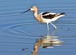
American Avocet
Recurvirostra americana
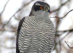
American Goshawk
Accipiter atricapillus

American Pika
Ochotona princeps
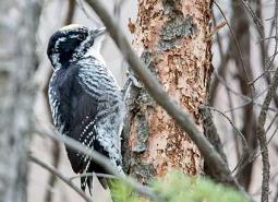
American Three-toed Woodpecker
Picoides dorsalis
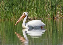
American White Pelican
Pelecanus erythrorhynchos
Applegate’s milkvetch
Astragalus applegatei
Archimedes Springsnail
Pyrgulopsis archimedis
Beller’s Ground Beetle
Agonum belleri

Black Tern
Chlidonias niger
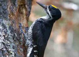
Black-backed Woodpecker
Picoides arcticus
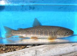
Bull Trout – Coastal Recovery Unit
Salvelinus confluentus
Bull Trout – Klamath Recovery Unit
Salvelinus confluentus

California Floater Mussel
Anodonta californiensis
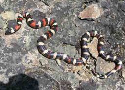
California Mountain Kingsnake
Lampropeltis zonata

California Myotis
Myotis californicus
Canyon Bat
Parastrellus hesperus
Cascades Frog
Rana cascadae
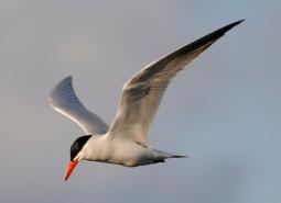
Caspian Tern
Hydroprogne caspia
Chum Salmon – Lower Columbia SMU
Oncorhynchus keta

Coastal Tailed Frog
Ascaphus truei
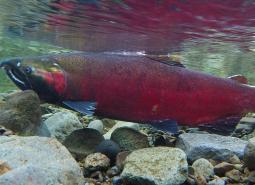
Coho Salmon – Klamath SMU
Oncorhynchus kisutch
Columbia Pebblesnail
Fluminicola fuscus
Columbia Spotted Frog
Rana luteiventris
Columbia yellowcress
Rorippa columbiae
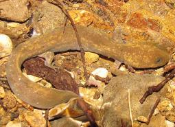
Cope’s Giant Salamander
Dicamptodon copei
Coronis Fritillary (butterfly)
Argynnis coronis coronis
Dalles Hesperian
Vespericola depressus

Fall Chinook Salmon – Mid Columbia SMU
Oncorhynchus tshawytscha
Fall Chinook Salmon – Upper Klamath SMU
Oncorhynchus tshawytscha
Flammulated Owl
Psiloscops flammeolus

Fringed Myotis
Myotis thysanodes
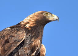
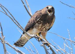
Golden Eagle
Aquila chrysaetos

Goose Lake Sucker
Catostomus occidentalis lacusanserinus

Gray Wolf
Canis lupus
Great Basin Ramshorn
Helisoma newberryi
Great Basin Redband Trout – Goose Lake SMU
Oncorhynchus mykiss newberrii/stonei
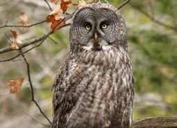
Great Gray Owl
Strix nebulosa
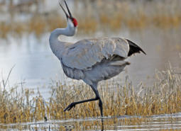
Greater Sandhill Crane
Antigone canadensis tabida
Highcap Lanx
Lanx alta

Hoary Bat
Lasiurus cinereus
Klamath Largescale Sucker
Catostomus snyderi
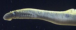
Klamath River Lamprey
Entosphenus similis
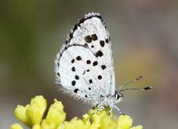
Leona’s Little Blue Butterfly
Philotiella leona

Lewis’s Woodpecker
Melanerpes lewis
Little Brown Myotis
Myotis lucifugus
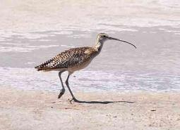
Long-billed Curlew
Numenius americanus

Long-legged Myotis
Myotis volans
Lost River Sucker
Deltistes luxatus
Miller Lake Lamprey
Entosphenus minimus
Modoc Pebblesnail
Fluminicola modoci
Modoc Sucker
Catostomus microps
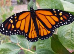
Monarch Butterfly
Danaus plexippus
Montane Peaclam
Pisidium ultramontanum
Morrison Bumble Bee
Bombus morrisoni
Mountain Mahogany Hairstreak (butterfly)
Satyrium tetra
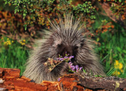
North American Porcupine
Erethizon dorsatum
Northern Roach
Hesperoleucus mitrulus
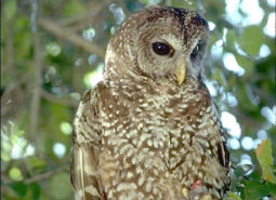
Northern Spotted Owl
Strix occidentalis caurina

Northwestern Pond Turtle
Actinemys marmorata

Olive-sided Flycatcher
Contopus cooperi
Oregon Floater Mussel
Anodonta oregonensis
Oregon semaphore grass
Pleuropogon oregonus
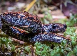
Oregon Slender Salamander
Batrachoseps wrighti
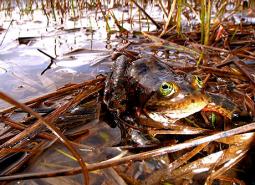
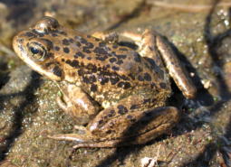
Oregon Spotted Frog
Rana pretiosa
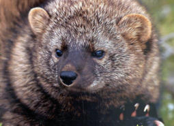
Pacific Fisher
Pekania pennanti

Pacific Lamprey
Entosphenus tridentatus
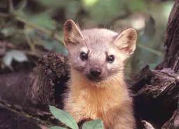
Pacific Marten
Martes caurina

Pallid Bat
Antrozous pallidus
Peck’s milkvetch
Astragalus peckii
Pinyon Jay
Gymnorhinus cyanocephalus
Pit Sculpin
Cottus pitensis
Pumice grape-fern
Botrychium pumicola
Red-necked Grebe (Holboell)
Podiceps grisegena holbollii

Ringtail
Bassariscus astutus
Rocky Mountain Fingernail Clam
Sphaerium patella
Scott’s Apatanian Caddisfly
Allomyia scotti
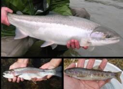
Shortnose Sucker
Chasmistes brevirostris
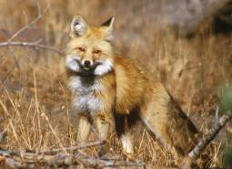
Sierra Nevada Red Fox
Vulpes vulpes necator

Silver-haired Bat
Lasionycteris noctivagans
Sockeye Salmon
Oncorhynchus nerka
Spotted Bat
Euderma maculatum
Spring Chinook Salmon – Mid Columbia SMU
Oncorhynchus tshawytscha
Spring Chinook Salmon – Upper Klamath SMU
Oncorhynchus tshawytscha
Subarctic Darner
Aeshna subarctica
Suckley’s Cuckoo Bumblebee
Bombus suckleyi
Summer Steelhead/Columbia Basin Redband Trout – Mid Columbia SMU
Oncorhynchus mykiss/Oncorhynchus mykiss gairdneri
Summer Steelhead/Redband Trout – Upper Klamath Basin SMU
Oncorhynchus mykiss
Swainson’s Hawk
Buteo swainsoni

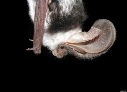
Townsend’s Big-eared Bat
Corynorhinus townsendii
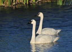
Trumpeter Swan
Cygnus buccinator
Wahkeena Falls Flightless Stonefly
Nanonemoura wahkeena
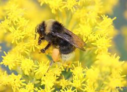
Western Bumble Bee
Bombus occidentalis
Western Floater Mussel
Anodonta kennerlyi

Western Grebe
Aechmophorus occidentalis
Western Long-eared Myotis
Myotis evotis

Western Painted Turtle
Chrysemys picta belli
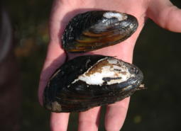
Western Pearlshell Mussel
Margaritifera falcata
Western Ridged Mussel
Gonidea angulata

Western River Lamprey
Occidentis ayresii
Western Small-footed Myotis
Myotis ciliolabrum
Conservation Opportunity Areas
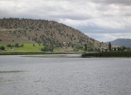
Big Marsh Creek [COA ID: 133]
Area includes river headwaters near Crescent Lake Junction and flows into Oregon Cascades National Recreation Area.
Brothers-North Wagontire [COA ID: 184]
The northern extent of this COA includes the Bear Creek Buttes and Rodman Rim area in the Ochoco Mountain foothills. South of US Highway 20, the COA encompasses Pine Mountain and a large area of sagebrush steppe dotted by numerous buttes north of Christmas Valley. Heading east it covers Elk Mountain and Rams Butte before …
Central Cascades Crest, Southeast [COA ID: 116]
Directly adjacent to the Upper Deschutes River COA.
Chewaucan River [COA ID: 141]
Area includes the Chewaucan River and surrounding habitats

Dry Valley [COA ID: 144]
Area includes important stretches of Dry Creek, Drews Creek and Dog Lake
Gearhart Mountain-North Fork Sprague [COA ID: 140]
Includes the North Fork Sprague river and its surrounding habitat; includes the area surrounding Gearhart Wilderness Area
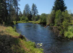
Hood River [COA ID: 106]
The Hood River COA (40 mi2) extends from the confluence with the Columbia River upstream to where the river leaves the Mt Hood National Forest, and includes the floodplains and associated uplands of the lower Hood River. This COA is adjacent to the Mt Hood Area COA. Recommended Conservation Actions Work with partners to exclude …
Klamath Marsh-Williamson River [COA ID: 134]
Large natural marsh with adjacent Ponderosa Pine forest habitat. Williamson River area spans Klamath Marsh National Wildlife Refuge and Sycan Marsh.
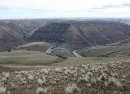
Klamath River Canyon [COA ID: 142]
Area follows the Klamath River to the California border
Little Deschutes River [COA ID: 132]
Area includes the Little Deschutes River, a tributary of the Deschutes River. The Little Deschutes drains a rural area on the eastside of the Cascade Range.
Long Creek-Coyote Creek-Silver Creek [COA ID: 135]
Area comprised of three major sub-watersheds immediately adjacent to Sycan Marsh, including river confluence.
Lost River Area [COA ID: 143]
Includes the Lost River Basin and surrounding native habitats
Lower Deschutes River [COA ID: 148]
Follows the Lower Deschutes River Corridor and includes surrounding habitat.
Metolius Bench-Mutton Mountains Wildlife Movement Corridor [COA ID: 150]
This long narrow COA spans two ecoregions. Within the East Cascades, it begins on the south side of the Metolius River, northwest of Lake Billy Chinook, and crosses over the river and into the Warm Springs Reservation. Heading north east, the COA crosses into the Blue Mountains ecoregion, across US Highway 26, and at its …
Metolius River Area [COA ID: 127]
Includes Metolius River basin, includes Green Ridge, and extends to include nearby valleys. Nationally known scenic recreation area that provides high quality habitat for fish and wildlife in Central Oregon.
Mt Hood Area [COA ID: 107]
The Mt Hood Area COA (143 mi2) is located within Mount Hood National Forest and includes the headwater streams of Hood, Clackamas, Sandy and White Rivers. The area is a late successional mixed conifer forest with wetlands, open meadows, alpine lakes, flowing rivers and riparian habitats. This COA is adjacent to the Hood River COA. …

Newberry Crater [COA ID: 130]
Includes Newberry Crater and areas immediately west (accessible from Hwy 97). Nationally important geologic and recreation area. Includes Paulina Lake and East Lake.
Odell Lake-Davis Lake [COA ID: 117]
Includes Davis Lake and surrounding habitat, continuing west to Salt Creek and encompassing the Crescent Lake Airport
Pelican Butte-Sky Lakes Area [COA ID: 123]
At the ecoregion boundary adjacent to the East Cascades, and immediately adjacent to the Upper Klamath Lake COA in the East Cascades
Quartz Mountain [COA ID: 131]
Includes significant wetland and wet meadow areas. Immediately adjacent to NB COA “Brothers – North Wagontire”.
Soda Mountain Area [COA ID: 124]
This area is a transition zone at the nexus of three ecoregions and as a results has a high diversity of species in unique assemblages.
Sprague River [COA ID: 139]
Includes the Sprague River and its surrounding habitat.
Summer Lake Area [COA ID: 189]
This area is comprised of Summer Lake and the surrounding high desert wetlands subregion, including much of the Diablo Mountain Wilderness Study Area.
Sycan Marsh [COA ID: 136]
Includes the Sycan River, a tributary of the Sprague River with headwaters in the Fremont National Forest south of Summer Lake. Area includes surrounding areas east of Sycan Marsh.
Sycan River [COA ID: 137]
Area covers the Sycan River and surrounding area just east of Sycan Marsh
Thomas Creek-Goose Lake [COA ID: 145]
Area includes Goose Lake and surrounding habitat; and Thomas Creek and its surrounding riparian habitat. Thomas Creek is the largest tributary of Goose Lake
Upper Deschutes River [COA ID: 129]
Follows the Upper Deschutes River closely from the Cascade Crest.
Upper Klamath Lake Area [COA ID: 138]
Includes Upper Klamath Lake, the largest freshwater lake west of the Rocky Mountains. Area includes surrounding habitat to the north and adjacent to the Sky Lakes area
Warm Springs River [COA ID: 126]
Area includes the Warm Springs River (a tributary to the Deschutes River) and surrounding habitat. River flows eastward with headwaters in the Cascade Crest
Warner Mountains [COA ID: 146]
Area located east of Lakeview along the eastern border of the ecoregion

Warner West [COA ID: 198]
This COA includes portion of Abert Rim Wilderness Study Area, Fish Creek Rim Wilderness Study Area, Lake Abert Area of Critical Environmental Concern, and the Fish Creek Rim Research Natural Area. It encompasses an area between Abert Rim and the Warner Mountains on the western edge to South Warner Rim and Lynches Rim to the …
Wasco Oaks [COA ID: 125]
Area extends from the Columbia River up through the Mt. Hood National Forest and has served as an important emphasis for conservation and restoration efforts.