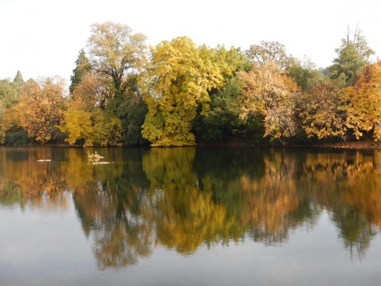
The South Fork Umpqua River and Tributaries COA (224 mi2) follows the winding course of the South Umpqua River and many of its tributaries. Area boundaries occur near the towns of Roseburg, Winston, Dillard, Riddle, and Tiller. This area is a priority for coho recovery, with many collaborative stream and water quality restoration projects occurring in the area. This COA is adjacent to the Umpqua Headwaters, North Umpqua River Area, and Umpqua River COAs.
Ecoregions
Klamath Mountains
The Klamath Mountains ecoregion covers much of southwestern Oregon, including the Klamath Mountains, Siskiyou Mountains, the interior valleys and foothills between these and the Cascade Range, and the Rogue and Umpqua river valleys. Several popular and scenic rivers run through the ecoregion, including the Umpqua, Rogue, Illinois, and Applegate rivers. Historically, this ecoregion is known …

West Cascades
The West Cascades ecoregion extends from east of the Cascade Mountains summit to the foothills of the Willamette, Umpqua, and Rogue Valleys, and spans the entire length of the state of Oregon. It is largely dominated by conifer forests, moving into alpine parklands and dwarf shrubs at higher elevations.
Key Habitats

Grasslands
Grasslands include a variety of upland grass-dominated habitats, such as upland prairies, coastal bluffs, and montane grasslands.
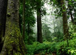
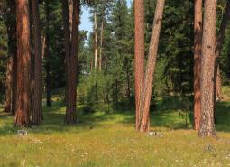
Late Successional Mixed Conifer Forests
Late successional mixed conifer forests provide a multi-layered tree canopy, including large-diameter trees, shade-tolerant tree species in the understory, and a high volume of dead wood, such as snags and logs.

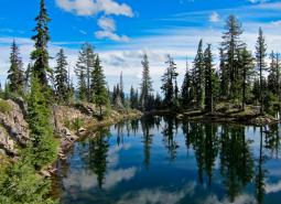
Natural Lakes
Natural lakes are relatively large bodies of freshwater surrounded by land that were formed through geological processes, such as glacial scouring, tectonic movements, volcanic activity and river meander cutoffs. In Oregon, natural lakes are defined as standing water bodies larger than 20 acres, including some seasonal lakes. Depth is not a reference for characterization of …
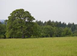
Oak Habitats
There are several oak habitat types in Oregon, where oaks comprise most of the canopy. These can include oak woodlands, oak forest, oak chaparral, and riparian oak. Oak savanna is covered in the Grasslands Key Habitat. Oaks may also co-dominate a canopy in oak/fir, oak pine, and oak hardwood habitats.
Ponderosa Pine Woodlands
Ponderosa pine woodlands are common in Oregon’s eastside ecoregions. While dominated by ponderosa pine, these woodlands may also have lodgepole pine, western juniper, aspen, western larch, grand fir, Douglas-fir, mountain mahogany, incense cedar, sugar pine, or white fir, depending on ecoregion and site conditions. Known for their open forest structure, these woodlands generally have fewer …

Flowing Water and Riparian Habitats
Flowing Water and Riparian Habitats include all naturally occurring flowing freshwater streams and rivers throughout Oregon as well as the adjacent riparian habitat.
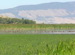
Wetlands
Wetlands are habitats that are inundated or saturated by surface water or ground water at a frequency and duration sufficient to support vegetation typically adapted for life in sodden soil conditions. While dominated by periods of inundation, the natural ecological cycle may also include dry intervals. Permanently wet habitats include backwater sloughs, oxbow lakes, peatlands, …
Species of Greatest Conservation Need
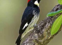
Acorn Woodpecker (Observed)
Melanerpes formicivorus
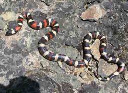
California Mountain Kingsnake (Modeled Habitat)
Lampropeltis zonata

California Myotis (Modeled Habitat)
Myotis californicus
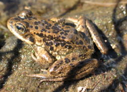
Cascades Frog (Observed)
Rana cascadae

Clouded Salamander (Observed)
Aneides ferreus

Coastal Cutthroat Trout (Documented)
Oncorhynchus clarki clarki

Coastal Tailed Frog (Modeled Habitat)
Ascaphus truei
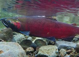
Coho Salmon (Documented)
Oncorhynchus kisutch

Common Nighthawk (Observed)
Chordeiles minor

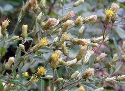
Crinite mariposa lily (Observed)
Calochortus coxii
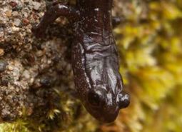
Del Norte Salamander (Observed)
Plethodon elongatus
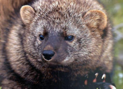
Pacific Fisher (Observed)
Pekania pennanti
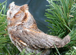
Flammulated Owl (Modeled Habitat)
Psiloscops flammeolus
Foothill Yellow-legged Frog (Observed)
Rana boylii
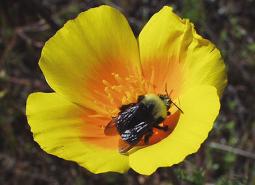
Franklin’s Bumble Bee (Observed)
Bombus franklini

Fringed Myotis (Observed)
Myotis thysanodes
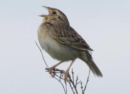
Western Grasshopper Sparrow (Observed)
Ammodramus savannarum perpallidus
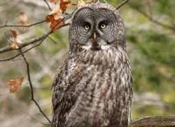
Great Gray Owl (Observed)
Strix nebulosa
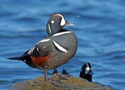
Harlequin Duck (Modeled Habitat)
Histrionicus histrionicus

Hoary Bat (Modeled Habitat)
Lasiurus cinereus
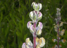
Kincaid’s lupine (Observed)
Lupinus oreganus

Lewis’s Woodpecker (Observed)
Melanerpes lewis

Long-legged Myotis (Observed)
Myotis volans
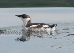
Marbled Murrelet (Modeled Habitat)
Brachyramphus marmoratus
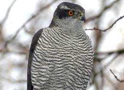
American Goshawk (Modeled Habitat)
Accipiter atricapillus

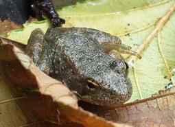
Northern Red-legged Frog (Observed)
Rana aurora
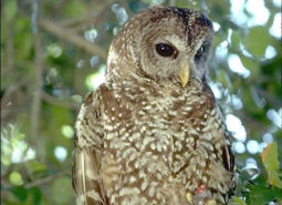
Northern Spotted Owl (Observed)
Strix occidentalis caurina

Olive-sided Flycatcher (Observed)
Contopus cooperi
Oregon Shoulderband (Observed)
Helminthoglypta hertleini
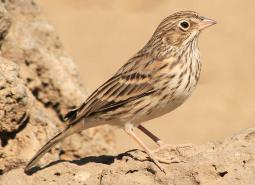
Oregon Vesper Sparrow (Observed)
Pooecetes gramineus affinis

Pallid Bat (Observed)
Antrozous pallidus

Western Purple Martin (Observed)
Progne subis arboricola
Red Tree Vole (Observed)
Arborimus longicaudus

Ringtail (Observed)
Bassariscus astutus

Silver-haired Bat (Modeled Habitat)
Lasionycteris noctivagans

Townsend’s Big-eared Bat (Observed)
Corynorhinus townsendii
Wayside aster (Observed)
Eucephalus vialis

Northwestern Pond Turtle (Observed)
Actinemys marmorata
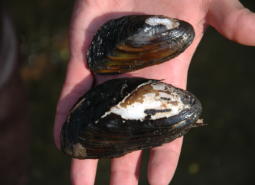
Western Ridged Mussel (Observed)
Gonidea angulata

Western Toad (Modeled Habitat)
Anaxyrus boreas
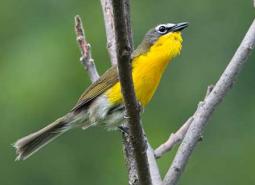
Yellow-breasted Chat (Observed)
Icteria virens auricollis