Geographic boundaries of the COAs were updated for the 2026 State Wildlife Action Plan and the associated COA profiles are intended to provide additional information. Content of each COA profile is being refined and will be updated to reflect current conditions when feasible. Please help us by submitting information on Local Conservation Actions, Plans, or Potential Partners to: OCS.revision@odfw.oregon.gov.
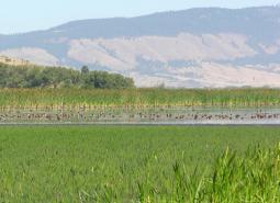
The Red Prairie – Mill Creek – Willamina Oaks South COA (35 mi2) is located south of Highway 19 along Highway 22 in the foothills of the Coast Range. This area includes tributaries of the South Yamhill River and associated lowland habitats. This COA is adjacent to the Mill Creek and Baskett Butte COAs.
Ecoregions
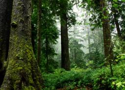
Coast Range
Oregon's Coast Range, known for its dramatic scenery, is extremely diverse, with habitats ranging from open sandy dunes to lush forests and from tidepools to headwater streams. It follows the coastline and extends east through coastal forest to the border of the Willamette Valley and Klamath Mountains ecoregions
Willamette Valley
The Willamette Valley ecoregion is bounded on the west by the Coast Range and on the east by the Cascade Range. This long mostly level alluvial plain has some scattered areas of low basalt, and contrasts with productive farmland and large urban areas. It has the fastest-growing human population in the state resulting in challenges due to land-use changes.
Key Habitats

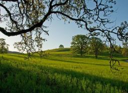
Grasslands
Grasslands include a variety of upland grass-dominated habitats, such as upland prairies, coastal bluffs, and montane grasslands.
Late Successional Mixed Conifer Forests
Late successional mixed conifer forests provide a multi-layered tree canopy, including large-diameter trees, shade-tolerant tree species in the understory, and a high volume of dead wood, such as snags and logs.

Natural Lakes
Natural lakes are relatively large bodies of freshwater surrounded by land that were formed through geological processes, such as glacial scouring, tectonic movements, volcanic activity and river meander cutoffs. In Oregon, natural lakes are defined as standing water bodies larger than 20 acres, including some seasonal lakes. Depth is not a reference for characterization of …
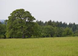
Oak Habitats
There are several oak habitat types in Oregon, where oaks comprise most of the canopy. These can include oak woodlands, oak forest, oak chaparral, and riparian oak. Oak savanna is covered in the Grasslands Key Habitat. Oaks may also co-dominate a canopy in oak/fir, oak pine, and oak hardwood habitats.

Flowing Water and Riparian Habitats
Flowing Water and Riparian Habitats include all naturally occurring flowing freshwater streams and rivers throughout Oregon as well as the adjacent riparian habitat.
Wetlands
Wetlands are habitats that are inundated or saturated by surface water or ground water at a frequency and duration sufficient to support vegetation typically adapted for life in sodden soil conditions. While dominated by periods of inundation, the natural ecological cycle may also include dry intervals. Permanently wet habitats include backwater sloughs, oxbow lakes, peatlands, …
Species of Greatest Conservation Need
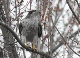
American Goshawk (Modeled)
Astur atricapillus

California Myotis (Modeled)
Myotis californicus
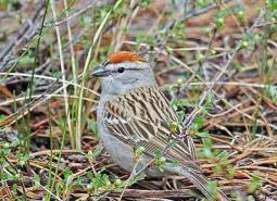
Chipping Sparrow (Observed)
Spizella passerina

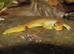
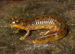
Clouded Salamander (Modeled)
Aneides ferreus

Coastal Cutthroat Trout (Modeled)
Oncorhynchus clarki clarki

Coastal Tailed Frog (Modeled)
Ascaphus truei
Columbia Torrent Salamander (Modeled)
Rhyacotriton kezeri

Common Nighthawk (Observed and Modeled)
Chordeiles minor
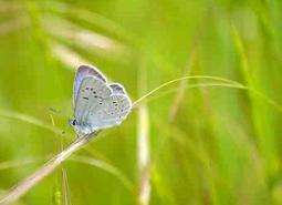
Fender’s Blue Butterfly (Observed)
Icaricia icarioides fenderi

Fringed Myotis (Modeled)
Myotis thysanodes

Hoary Bat (Modeled)
Lasiurus cinereus
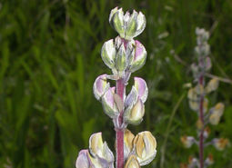
Kincaid’s Lupine (Observed)
Lupinus oreganus

Lewis’s Woodpecker (Modeled)
Melanerpes lewis

Little Brown Myotis (Modeled)
Myotis lucifugus

Long-legged Myotis (Modeled)
Myotis volans
Marbled Murrelet (Modeled)
Brachyramphus marmoratus
Nelson’s Checkermallow (Observed)
Sidalcea nelsoniana

Northern Red-legged Frog (Modeled)
Rana aurora
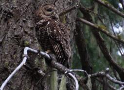
Northern Spotted Owl (Observed and Modeled)
Strix occidentalis caurina

Northwestern Pond Turtle (Observed and Modeled)
Actinemys marmorata

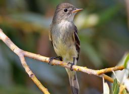
Olive-sided Flycatcher (Observed and Modeled)
Contopus cooperi
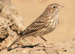
Oregon Vesper Sparrow (Observed and Modeled)
Pooecetes gramineus affinis
Pacific Brook Lamprey (Modeled)
Occidentis pacifica

Pacific Lamprey (Modeled)
Entosphenus tridentatus

Pallid Bat (Modeled)
Antrozous pallidus
Red Tree Vole (Observed and Modeled)
Arborimus longicaudus
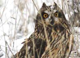
Short-eared Owl (Modeled)
Asio flammeus flammeus

Silver-haired Bat (Modeled)
Lasionycteris noctivagans
Southern Torrent Salamander (Modeled)
Rhyacotriton variegatus
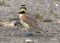
Streaked Horned Lark (Observed)
Eremophila alpestris strigata
Thin-leaved Pea (Observed)
Lathyrus holochlorus

Townsend’s Big-eared Bat (Modeled)
Corynorhinus townsendii
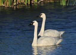
Trumpeter Swan (Modeled)
Cygnus buccinator
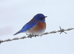
Western Bluebird (Observed and Modeled)
Sialia mexicana occidentalis
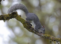
Western Gray Squirrel (Observed and Modeled)
Sciurus griseus

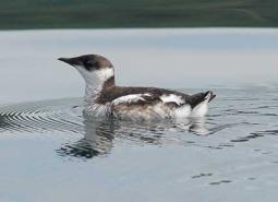
Western Grebe (Modeled)
Aechmophorus occidentalis
Western Long-eared Myotis (Modeled)
Myotis evotis
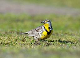
Western Meadowlark (Observed and Modeled)
Sturnella neglecta

Western Painted Turtle (Observed and Modeled)
Chrysemys picta belli

Western Purple Martin (Modeled)
Progne subis arboricola
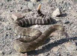
Western Rattlesnake (Modeled)
Crotalus oreganus oreganus
Western Small-footed Myotis (Modeled)
Myotis ciliolabrum
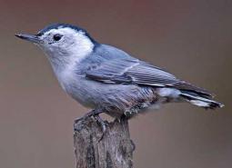
White-breasted Nuthatch (Pacific) (Modeled)
Sitta carolinensis aculeata

Willamette Daisy (Observed)
Erigeron decumbens
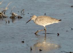
Willet (Modeled)
Tringa semipalmata inornata
Willow Flycatcher (Observed and Modeled)
Empidonax traillii
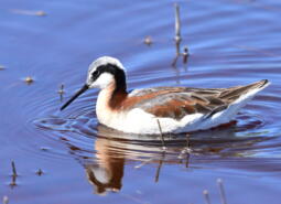
Wilson’s Phalarope (Modeled)
Phalaropus tricolor
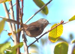
Wrentit (Observed and Modeled)
Chamaea fasciata
Yuma Myotis (Modeled)
Myotis yumanensis