Description
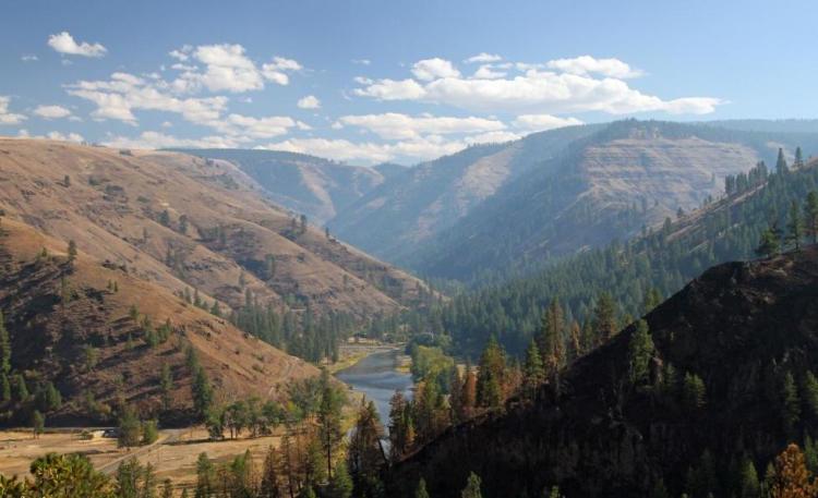
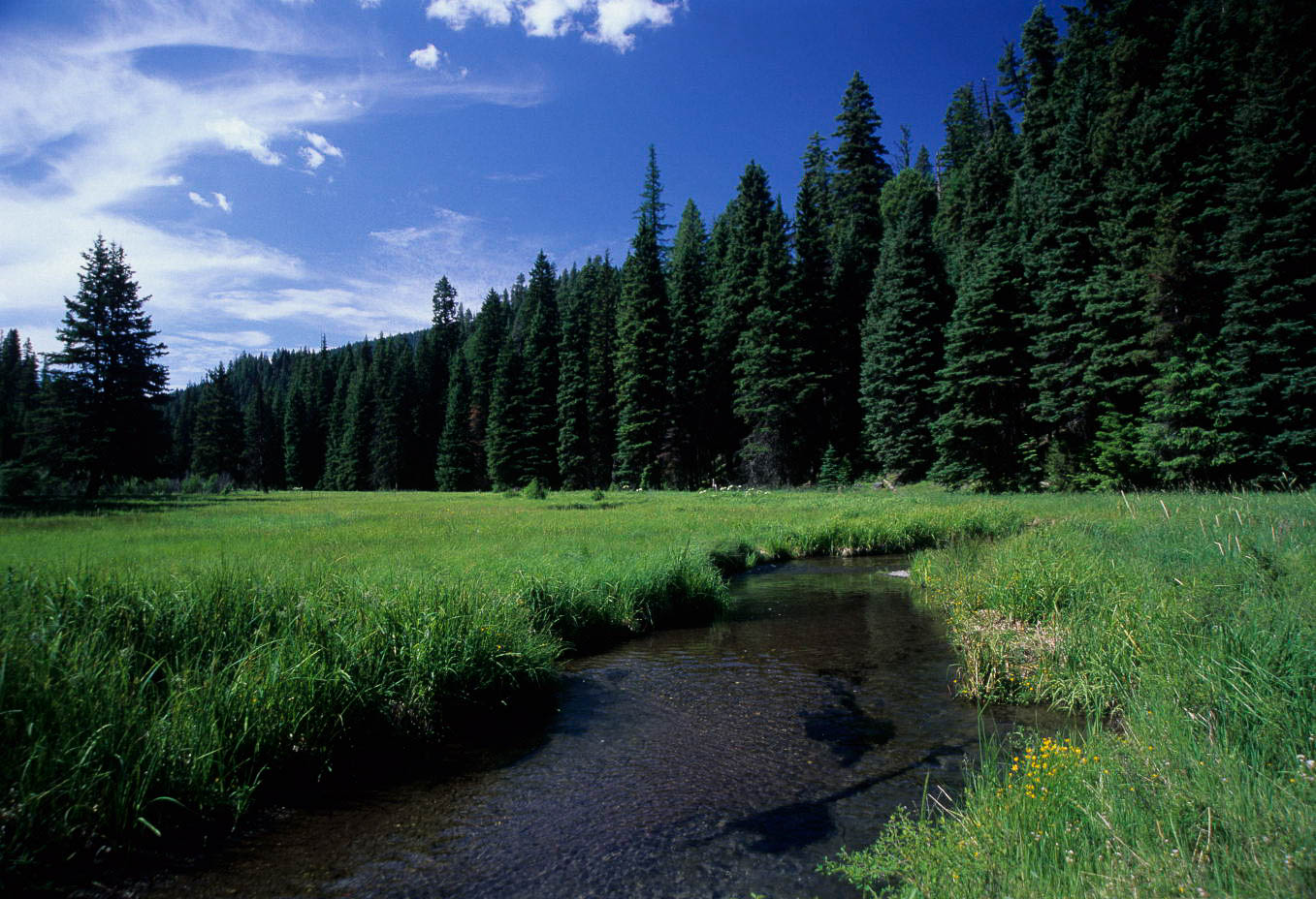
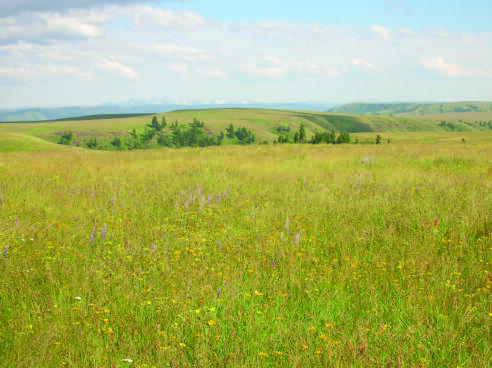
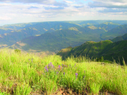
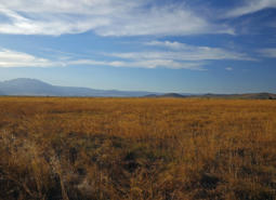
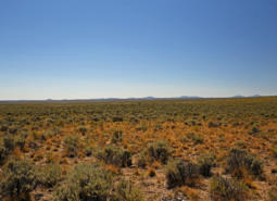
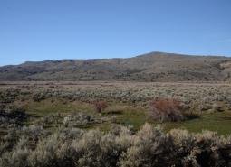
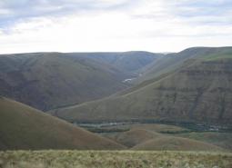
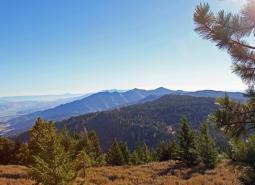
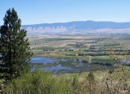
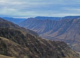
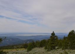
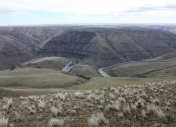
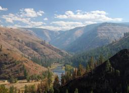
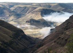
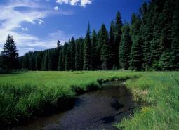
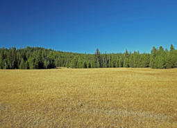
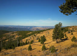
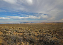
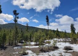
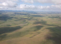
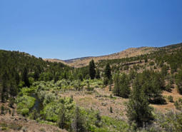
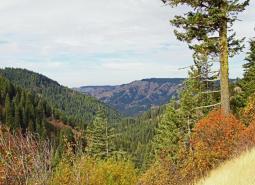
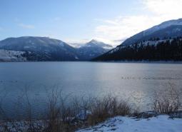
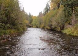
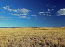
At 23,984 square miles, the Blue Mountains ecoregion is the largest ecoregion in Oregon. The Blue Mountains ecoregion is a diverse complex of mountain ranges, valleys, and plateaus that extends beyond Oregon into the states of Idaho and Washington. This ecoregion contains deep rock-walled canyons, glacially cut gorges, sagebrush steppe, juniper woodlands, mountain lakes, forests, and meadows. Broad alluvial-floored river valleys support ranches surrounded by irrigated hay meadows and agricultural fields. The climate varies because of elevational differences but, overall, the ecoregion has short, dry summers and long, cold winters. Because much of the precipitation falls as snow, snow melt gives life to the rivers and irrigated areas.
Wood products and cattle production dominate the economy of the ecoregion, but agriculture along river valleys supports a variety of crops. The ecoregion sustains some of the most robust ungulate populations in the state and attracts tourists year-round, offering scenic lakes and rivers, geologic features, alpine areas, and numerous wildlife viewing opportunities. It includes the Prineville-Bend-Redmond metropolitan area, one of the fastest growing areas in the state, along with the cities of La Grande, Baker, Enterprise, and John Day.
Characteristics
Important Industries
Agriculture, livestock (e.g., beef cattle, dairy cattle, sheep), forest products, manufacturing, outdoor recreation (e.g., hunting, fishing, skiing, camping, wildlife viewing)
Major Agricultural Products
Wheat, alfalfa, grass seed, meadow hay, potatoes, onions, sugar beets, field corn
Important Nature-based Recreational Areas
John Day Fossil Beds National Monument, Hells Canyon National Recreational Area and Hells Canyon Wilderness, Wallowa Lake, Crooked River National Grasslands. Umatilla National Wildlife Refuge, John Day and Grande Ronde Rivers, Lake Billy Chinook, and Smith Rock State Park. Black Canyon, Mill Creek, Eagle Cap, Strawberry Mountain, North Fork John Day and Wenaha-Tucannon Wilderness Areas. Philip W. Schneider, Bridge Creek, Ladd Marsh, Wenaha, Elkhorn, and Minam Wildlife Areas.
Elevation
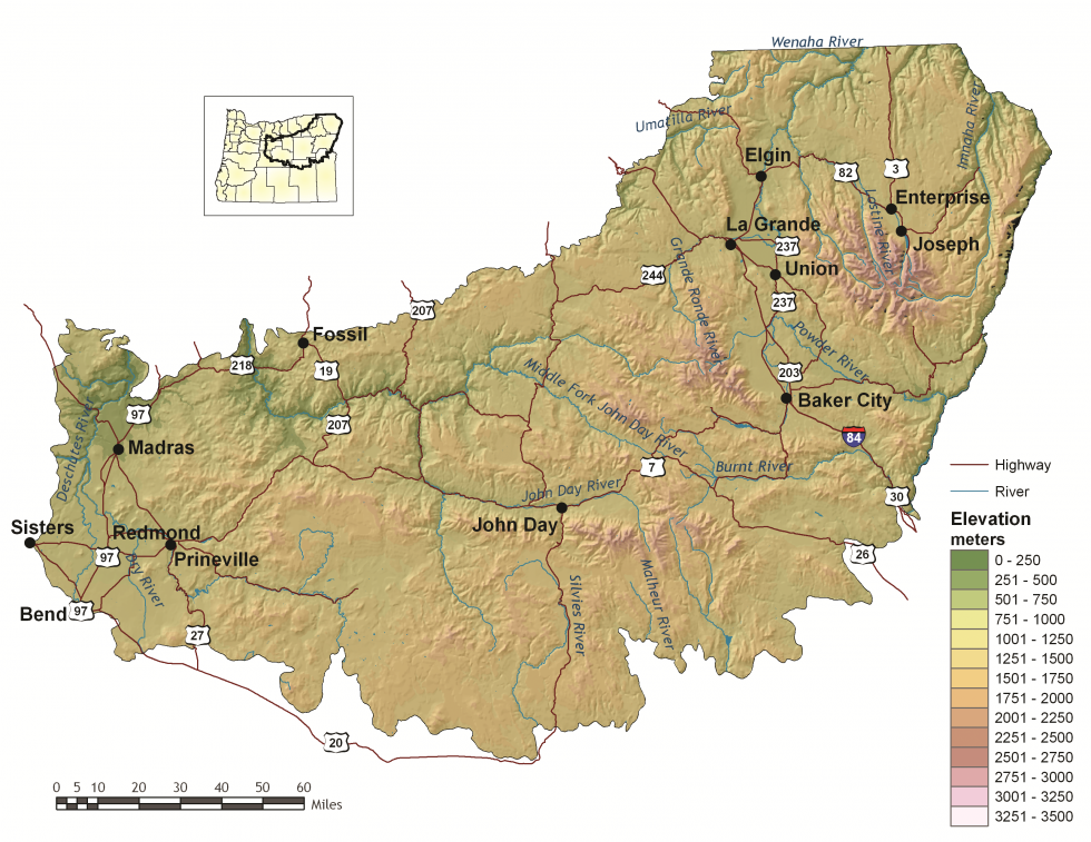
1,000 feet (Snake River) – 9,838 feet (Sacajawea Peak)
Important Rivers
Deschutes, Crooked, Burnt, Grande Ronde, Imnaha, John Day, Malheur, Powder, Silvies, Snake, Umatilla, Wallowa
Conservation Issues and Priorities
The Blue Mountains ecoregion contains some of the largest intact native grasslands in the state and several large areas managed for conservation values. Nonetheless, habitats have been impacted by interrelated changes in ecological processes due to fire suppression, selective harvest practices, and unsustainable grazing. These changes have increased the vulnerability of habitats to invasive species, disease, and uncharacteristically severe wildfire.
Habitat loss has been the most severe in lower elevation valley bottom habitats, such as riparian areas, wetlands, and shrublands. These low-elevation habitats are highly fragmented where native vegetation has been converted to agricultural or urban land uses. Therefore, maintaining connectivity and corridors for wildlife is especially important in these areas. Other limiting factors, such as increasing recreational pressure and invasive species, have the potential to impact all habitats in this ecoregion.
Key Conservation Issues of particular concern in the Blue Mountains ecoregion include Climate Change, Disruption of Disturbance Regimes (fire), Land Use Changes, Water Quality and Quantity, Barriers to Animal Movement, and Invasive Species. In addition to statewide issues, uncontrolled off-highway recreational vehicle use and unregulated horse herds are of increasing concern in this ecoregion.
Climate
The Blue Mountains climate has both continental and Mediterranean influences, with warm, dry summers and cold winters. Mean annual temperature and precipitation vary widely depending upon elevation.
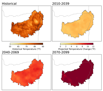
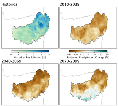
Warming is projected in all seasons across the Blue Mountains, with the largest increases projected in the summer. Summer average temperature is projected to increase by as much as 8°F for the 2040-2069 period, and as much as 12°F by the end of the century under a high emissions scenario (SSP585; Figure 1). Winters in the Blue Mountains are also projected to become warmer, and summers drier. Late summer total precipitation is projected to decrease by as much as 12% for the 2069-2099 period (Figure 2). Cool season precipitation projections show an increase in precipitation of 16%, with more of it falling as rain instead of snow. Growing degree days are projected to more than double by the 2069-2099 period under the high emission scenario (SSP585). Frost days are projected to decrease from 210 per year to fewer than 150 per year, on average, by the end of the century.
Limiting Factors and Recommended Approaches
Limiting Factor: Land Use Conversion and Urbanization
CMP Direct Threats 1, 2.1, 2.3, 7.2
The western portion of the Blue Mountains ecoregion includes the cities of Madras, Redmond, Prineville, and eastern Bend, one of the fastest growing metropolitan areas of the state. Rapid conversion to urban land uses threatens habitats and traditional land uses such as agriculture. Impacts to mule deer winter range are of particular concern. Northeast Oregon is increasingly popular with travelers, and habitat fragmentation due to rural development and recreation is a concern in some areas. While important economically, some agricultural uses contribute to habitat degradation for native fish and wildlife species. For example, open grazing allotments in forests have significantly damaged understory and riparian habitat in several areas.
Although many acres in this ecoregion are managed for wildlife and recreational values, these areas are primarily limited to higher mountain forests and alpine areas, or steep canyonlands. Lower elevation vegetation types, such as valley bottom grasslands, riparian areas, wetlands, and shrublands, are mostly on private lands. Most remnant low-elevation native habitats occur as fragmented patches with poor connectivity.
Recommended Approach
Because important low-elevation habitats are primarily privately-owned, working with private landowners and local governments on voluntary cooperative approaches to improve habitat is the key to long-term conservation. Tools such as financial incentives, regulatory assurance agreements, and conservation easements may help landowners take actions to benefit species and habitats. Where feasible, maintain and restore habitats using a landscape approach to increase connectivity between habitat patches. Work with community leaders and local governments to ensure ecologically and environmentally conscientious growth. Support and implement existing land use regulations to preserve farmland and rangeland, open spaces, recreation areas, and natural habitats. Coordinate with local SWCDs, watershed councils, NRCS, and NGOs to communicate the importance of managing fish and wildlife habitats on private lands.
On public lands, unsustainable grazing should be curtailed. Federal land managers should develop adaptive grazing management plans that limit stocking rates based on ecological conditions and implement rotational grazing among allotments to allow for vegetation recovery. Incorporating emerging technologies like virtual fencing can help manage herd distribution more precisely, keeping animals out of riparian zones or other sensitive ecological areas without the need for physical barriers. Restoration activities can also improve habitat on degraded rangelands through removal of invasive species and reseeding with native vegetation.
Limiting Factor: Altered Fire Regimes
CMP Direct Threats 7.1, 11.3, 11.4
In ponderosa pine habitat types, fire suppression and past forest practices have resulted in young, dense mixed-species stands where open, park-like stands of ponderosa pine once dominated. Increasing encroachment by smaller Douglas-firs and true firs places the forest at greater risk of severe wildfire, disease, and damage by insects. The spread of native junipers and non-native annual grasses throughout the ecoregion has also significantly increased fuel loads. Wildfire risk is further exacerbated by warming climate conditions and changes to patterns of precipitation, resulting in more frequent, higher intensity megafires. Dense understories and insect-killed trees make it difficult to reintroduce natural fire regimes because hazardous fuel levels increase the risk of stand-replacing fires. Additionally, young forests are often lacking in mature trees and snags that serve as critical wildlife habitat for some species. Efforts to reduce fire danger and improve forest health may help to restore habitats but require careful planning to provide sufficient habitat features that are important to fish (e.g., large woody debris, riparian vegetation) and wildlife (e.g., snags, downed logs, hiding cover). Similarly, wildfire reforestation efforts should be strategically planned to create stands with a diversity of tree age classes, understory vegetation, and natural forest openings.
Recommended Approach
Use an integrated approach to forest health issues that considers historical conditions, fish and wildlife conservation, natural fire intervals, and silvicultural techniques. Encourage forest management at a broad scale to address limiting factors. Implement fuel reduction projects to reduce the risk of forest-destroying wildfires, considering site-specific conditions and goals. Fuel reduction strategies need to address the habitat structures that are important to wildlife, such as snags and downed logs, and work to maintain them at a level to sustain wood-dependent species. Reintroduce fire where feasible; prioritize sites and applications where intervention is likely to be most successful. Use prescribed burns to enhance quality of forage and cover for a diversity of species. Where fire is not feasible, explore alternatives, such as thinning and masticating, that can help mimic natural disturbance. Monitor forest health initiatives and use adaptive management techniques to ensure efforts are meeting habitat restoration and wildfire prevention objectives with minimal impacts on fish and wildlife. In the case of post-wildfire recovery, maintain high snag densities and replant with native tree, shrub, grass, and forb species. Manage reforestation after wildfire to create species and structural diversity, based on local management goals.
Limiting Factor: Water
CMP Direct Threats 7.2, 11.4
Water quantity is a limiting factor for fish and wildlife. Changing climate conditions are leading to rising temperatures and altered patterns of precipitation, which affect water availability across different times of year. High demands for water, including for use in irrigation, can drastically reduce water availability. In streams, seasonal low flows due to changing climate conditions and over-allocation of water for agricultural uses can limit habitat suitability and reproductive success for many fish and wildlife species. In areas where urbanization is increasing, particularly in central Oregon around Bend, Madras, and Redmond, the demand for water is contributing to a decrease in the supply of groundwater. This reduces groundwater discharge of cold water to rivers and streams, subsequently reducing the availability of both cold water refugia and suitable habitat for cold-water dependent species. Water quality can also limit species and habitats. Runoff from agricultural areas can contaminate waterways. Warming temperatures, combined with higher nutrient levels due to agricultural runoff, is increasing the prevalence of toxic cyanobacterial blooms.
Recommended Approach
Provide incentives and information about water usage and sharing during low flow conditions (e.g., late summer). Promote water management actions that enable climate resilience and adaptation. Invest in watershed-scale projects for cold water and flow protection. Identify and protect cold water rearing and refugia habitat for aquatic species. Increase awareness and manage timing of applications of potential aquatic contaminants. Improve compliance with water quality standards and pesticide use labels administered by the DEQ and EPA. Work on implementing Senate Bill 1010 (Oregon Department of Agriculture) and DEQ Total Maximum Daily Load water quality plans.

Limiting Factor: Invasive Species
CMP Direct Threat 8.1
Invasive plants and animals disrupt and degrade native communities, diminish populations of at-risk native species, and threaten the economic productivity of resource lands. Invasive plants, particularly noxious weeds, are easily spread and may quickly outcompete native species. While not as disruptive, invasive animals have caused problems for native fish and wildlife species and have become a nuisance and impacted people economically. In this ecoregion, unregulated horse herds, including the Murderers Creek herd and Big Summit herd, are of particular concern, competing with native wildlife for vegetation and access to water, and trampling sensitive riparian habitats. In aquatic habitats, smallmouth bass, walleye, brook trout and American bullfrogs are problematic invasives. Several mussel species, including zebra, quagga, and golden mussels, pose significant threats to aquatic systems. Non-native annual grasses, including cheatgrass, ventenata, and medusahead have rapidly expanded in perennial grass systems, displacing desirable forage for wildlife. Invasion of these species can also increase fuel loads by establishing in interspaces between sagebrush or other shrubs and perennial grasses, which were historically bare of vegetation.
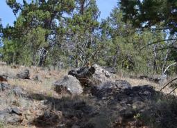
Changing climate conditions and fire suppression have also led to the expansion of western juniper throughout the ecoregion. Western juniper is a native species, and old growth juniper trees in rocky outcrops offer benefits to native wildlife. However, the expansion of western juniper in the Blue Mountains has degraded some grassland, sagebrush, riparian, large-diameter juniper, and aspen habitats. Western juniper expansion may reduce water availability in many seasonal and some perennial streams. In riparian areas, junipers replace deciduous shrubs and trees that are more beneficial to riparian wildlife. In many of the grassland and sagebrush habitats, 20–30-year-old juniper trees form dense stands that are not suitable for many wildlife species that require the open sagebrush or grassland habitats that are now in decline. These dense stands also act as fuel for wildfire, contributing to large, high-intensity fires that destroy sagebrush habitat.
Recommended Approach
Promote dialogue between fish and wildlife managers, landowners, and land managers to develop management plans based on common priorities. Engage in outreach to educate the public on the negative impacts of invasive species and provide information on how to prevent invasions. Emphasize prevention, risk assessment, early detection, and quick control to prevent new invasive species from becoming fully established. Use multiple site-appropriate tools (e.g., mechanical, chemical, biological) to control the most damaging invasive species. Emphasize efforts to focus on key invasive species in high priority areas, particularly where Key Habitats and Species of Greatest Conservation Need occur. Cooperate with partners through habitat programs to reduce noxious weeds and other invasive species and to educate people about invasive species issues. Promote the use of native plants for restoration and revegetation. At some sites in sagebrush communities, it may be desirable to use “assisted succession” strategies, using low seed rates of non-invasive non-native plants in conjunction with native plant seeds as an intermediate step in rehabilitating disturbances.
Limiting Factor: Recreational Activity
CMP Direct Threats 1.3, 6.1
Activities like hiking, biking, hunting, fishing, camping, skiing, and off-road vehicle use can create sensory stressors for wildlife, with sound, light, and unusual smells that may deter species from moving through certain areas. Many species will avoid areas near trails, campgrounds, and access roads when humans are present. Human recreation may contribute to destruction of sensitive vegetation, harassment of wildlife from off-leash pets, and contamination of areas with refuse. Dispersed recreation can cause new roads and trails to fragment the landscape and can cause the spread of invasive species from other locations.
Recommended Approach
Plan new recreational trail systems carefully and with consideration for native wildlife and their habitats. Take advantage of abandoned or closed roads, rail lines, or previously impacted areas for conversion into trails. Work with land management agencies, such as the USFS, to designate areas as high value recreation and low habitat impact areas. Limit the use of motorized vehicles in sensitive areas, including off-road vehicles and electric bicycles. Institute road and/or area closures to protect species during sensitive times of year and decommission roads when possible. In high use areas, establish permitted entry systems to decrease recreational pressure. Engage in outreach to educate the public on the negative impacts of recreational activities and provide information on prevention. Follow guidelines for responsible recreation, such as Leave No Trace, to minimize impacts.
Species of Greatest Conservation Need
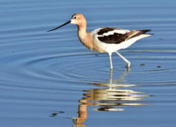
American Avocet
Recurvirostra americana

American Pika
Ochotona princeps
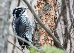
American Three-toed Woodpecker
Picoides dorsalis
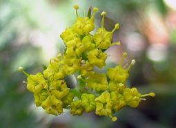
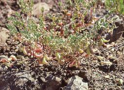
Arrow-leaf thelypody
Thelypodium eucosmum
Banded Juga
Juga newberryi

Black Tern
Chlidonias niger
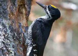
Black-backed Woodpecker
Picoides arcticus
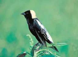
Bobolink
Dolichonyx oryzivorus
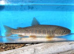
Bull Trout – Coastal Recovery Unit
Salvelinus confluentus
Bull Trout – Mid Columbia Recovery Unit
Salvelinus confluentus
Bull Trout – Upper Snake Recovery Unit
Salvelinus confluentus

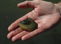
California Floater Mussel
Anodonta californiensis

California Myotis
Myotis californicus
Canyon Bat
Parastrellus hesperus
Columbia Pebblesnail
Fluminicola fuscus
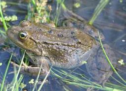
Columbia Spotted Frog
Rana luteiventris
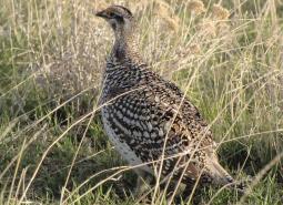
Columbian Sharp-tailed Grouse
Tympanuchus phasianellus columbianus
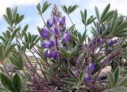
Cusick’s lupine
Lupinus lepidus var. cusickii
Fall Chinook Salmon – Mid Columbia SMU
Oncorhynchus tshawytscha
Fall Chinook Salmon – Snake SMU
Oncorhynchus tshawytscha
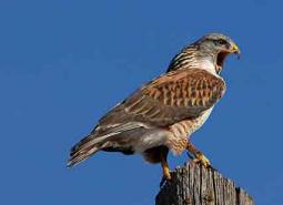
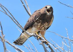
Ferruginous Hawk
Buteo regalis
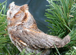
Flammulated Owl
Psiloscops flammeolus
Franklin’s Spruce Grouse
Canachites canadensis franklinii

Fringed Myotis
Myotis thysanodes
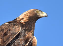
Golden Eagle
Aquila chrysaetos

Gray Wolf
Canis lupus
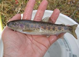
Great Basin Redband Trout – Malheur Lakes SMU
Oncorhynchus mykiss newberrii
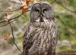
Great Gray Owl
Strix nebulosa
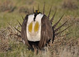
Greater Sage-Grouse
Centrocercus urophasianus
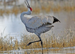
Greater Sandhill Crane
Antigone canadensis tabida
Greenman’s desert parsley
Lomatium greenmanii

Hoary Bat
Lasiurus cinereus
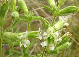
Howell’s spectacular thelypody
Thelypodium howellii ssp. spectabilis
Johnson’s Hairstreak (butterfly)
Callophrys johnsoni

Lewis’s Woodpecker
Melanerpes lewis
Little Brown Myotis
Myotis lucifugus
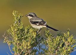
Loggerhead Shrike
Lanius ludovicianus
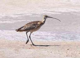
Long-billed Curlew
Numenius americanus

Long-legged Myotis
Myotis volans
Macfarlane’s four o’clock
Mirabilis macfarlanei
Misfortunate Crayfish
Pacifastacus malheurensis
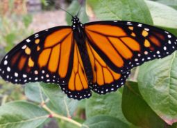
Monarch Butterfly
Danaus plexippus
Morrison Bumble Bee
Bombus morrisoni
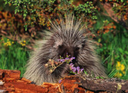
North American Porcupine
Erethizon dorsatum

Northwestern Pond Turtle
Actinemys marmorata
Ochoco lomatium
Lomatium ochocense

Olive-sided Flycatcher
Contopus cooperi
Oregon Floater Mussel
Anodonta oregonensis
Oregon semaphore grass
Pleuropogon oregonus

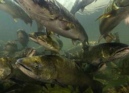
Pacific Lamprey
Entosphenus tridentatus
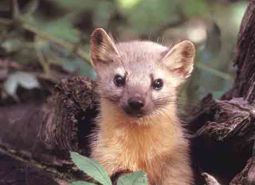
Pacific Marten
Martes caurina

Pallid Bat
Antrozous pallidus
Peck’s milkvetch
Astragalus peckii
Pinyon Jay
Gymnorhinus cyanocephalus
Pygmy Rabbit
Brachylagus idahoensis
Red-fruited lomatium
Lomatium erythrocarpum
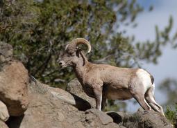
Rocky Mountain Bighorn Sheep
Ovis canadensis canadensis
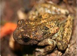
Rocky Mountain Tailed Frog
Ascaphus montanus
Rough goldenweed
Pyrrocoma scaberula
Shortface Lanx
Fisherola nuttalli
Silver-bordered Fritillary (butterfly)
Boloria myrina

Silver-haired Bat
Lasionycteris noctivagans

Snake River goldenweed
Pyrrocoma radiata
Sockeye Salmon
Oncorhynchus nerka
South Fork John Day milkvetch
Astragalus diaphanus var. diurnus
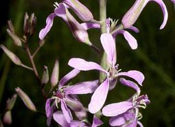
Spalding’s campion
Silene spaldingii
Spotted Bat
Euderma maculatum
Spring Chinook Salmon – Lower Snake SMU
Oncorhynchus tshawytscha
Spring Chinook Salmon – Mid Columbia SMU
Oncorhynchus tshawytscha
Spring Chinook Salmon – Upper Snake SMU
Oncorhynchus tshawytscha
Suckley’s Cuckoo Bumblebee
Bombus suckleyi
Summer Steelhead/Columbia Basin Redband Trout – Lower Snake SMU
Oncorhynchus mykiss/Oncorhynchus mykiss gairdneri
Summer Steelhead/Columbia Basin Redband Trout – Mid Columbia SMU
Oncorhynchus mykiss/Oncorhynchus mykiss gairdneri
Summer Steelhead/Columbia Basin Redband Trout – Upper Snake SMU
Oncorhynchus mykiss/Oncorhynchus mykiss gairdneri
Swainson’s Hawk
Buteo swainsoni

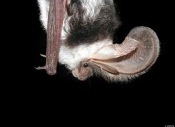
Townsend’s Big-eared Bat
Corynorhinus townsendii
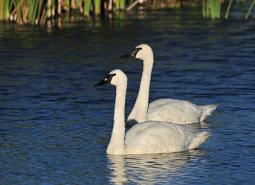
Trumpeter Swan
Cygnus buccinator
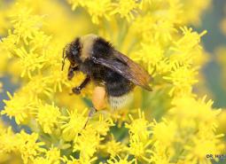
Western Bumble Bee
Bombus occidentalis
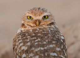
Western Burrowing Owl
Athene cunicularia hypugaea
Western Floater Mussel
Anodonta kennerlyi
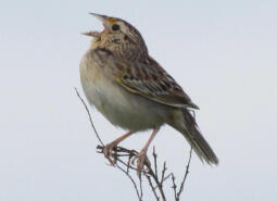
Western Grasshopper Sparrow
Ammodramus savannarum perpallidus

Western Grebe
Aechmophorus occidentalis
Western Long-eared Myotis
Myotis evotis

Western Painted Turtle
Chrysemys picta belli
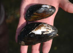
Western Pearlshell Mussel
Margaritifera falcata
Western Ridged Mussel
Gonidea angulata

Western River Lamprey
Occidentis ayresii
Western Small-footed Myotis
Myotis ciliolabrum

Western Toad
Anaxyrus boreas
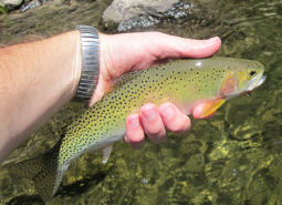
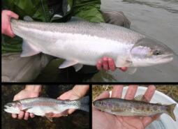
Westslope Cutthroat Trout
Oncorhynchus clarki lewisi

White Sturgeon – Mid-Snake River Reservoirs SMU
Acipenser transmontanus
White Sturgeon – Middle Snake River SMU
Acipenser transmontanus

White-headed Woodpecker
Dryobates albolarvatus albolarvatus
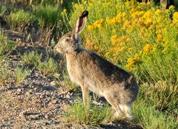
White-tailed Jackrabbit
Lepus townsendii
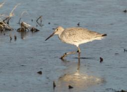
Willet
Tringa semipalmata inornata
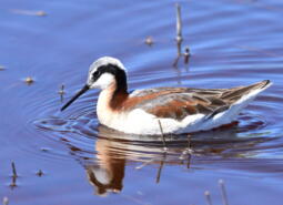
Wilson’s Phalarope
Phalaropus tricolor
Winged Floater Mussel
Anodonta nuttalliana
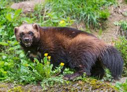
Wolverine
Gulo gulo
Yuma Myotis
Myotis yumanensis
Yuma Skipper (butterfly)
Ochlodes yuma
Conservation Opportunity Areas
Baker Valley Wetlands [COA ID: 165]
Located in the Powder River Basin immediately northwest of Baker City and including the town of Haines
Bear Valley [COA ID: 177]
Located south of John Day, along the Silvies River and including the town of Seneca. Area encompasses important wetland and riparian habitats in the valley.
Brothers-North Wagontire [COA ID: 184]
The northern extent of this COA includes the Bear Creek Buttes and Rodman Rim area in the Ochoco Mountain foothills. South of US Highway 20, the COA encompasses Pine Mountain and a large area of sagebrush steppe dotted by numerous buttes north of Christmas Valley. Heading east it covers Elk Mountain and Rams Butte before …
Bully Creek Area [COA ID: 183]
Adjacent to North Fork Malheur – Monument Rock area, including significant stretches of Clover Creek and Bully Creek

Burnt River [COA ID: 166]
Includes important stretch of the Burnt River and adjacent riparian habitat. Includes the town of Bridgewater.
Deschutes River [COA ID: 149]
Mainly located on the Warms Springs Reservation, this narrow COA includes a section of the Deschutes River from above the confluence with the Warms Springs River, north to approximately 1.5 miles below White Horse Rapids. From east to west the COA runs from the east side of the Deschutes River, adjacent to White Horse rapids, …
East Madras-Trout Creek Sagebrush and Grassland Area [COA ID: 172]
Adjacent to Lower John Day COA, just east of the town of Madras.
Fields Peak [COA ID: 176]
Just north of Bear Valley COA and east of the South John day River COA
Grande Ronde Valley [COA ID: 159]
This COA encompasses the Ladd Marsh Wildlife Area and a buffered area adjacent to the Grande Ronde River from La Grande to several miles below Elgin.
Imnaha [COA ID: 161]
Follows canyons along the Snake River from Hwy 86 north to the ecoregion boundary
Lawrence Grasslands [COA ID: 152]
In the southwest corner of the ecoregion just west of Antelope.
Logan Valley-John Day River Headwaters [COA ID: 179]
Area just west of John Day and including the town of Prairie. Area encompasses the John Day River headwaters and a variety of diverse Strategy Habitats
Lower Deschutes River [COA ID: 148]
Follows the Lower Deschutes River Corridor and includes surrounding habitat.
Lower Grande Ronde [COA ID: 158]
This COA follows the Grande Ronde River from the Oregon/Washington border to its confluence with the Wallowa River, then continues up the Wallowa to Highway 82 and the Minam River confluence. It includes many of the smaller tributaries and significant portions of larger tributaries.
Lower John Day River [COA ID: 153]
Area follows the lower John Day River and surrounding habitats.
Malheur River Headwaters [COA ID: 180]
The Malheur River Headwaters COA spans two ecoregions. Within the BM ecoregion, the COA includes Logan Valley and part of the Strawberry Mountain Wilderness and continues south to Battle Mountain (just north of Highway 306). Within the NBR, the COA is comprised of land associated with the Malheur River south of Battle Mountain to approximately …
Metolius Bench-Mutton Mountains Wildlife Movement Corridor [COA ID: 150]
This long narrow COA spans two ecoregions. Within the East Cascades, it begins on the south side of the Metolius River, northwest of Lake Billy Chinook, and crosses over the river and into the Warm Springs Reservation. Heading north east, the COA crosses into the Blue Mountains ecoregion, across US Highway 26, and at its …
Middle Fork John Day River [COA ID: 170]
Includes significant stretch of Middle Fork John Day River, Long Creek, and part of the North Fork John Day River.
North Fork John Day River 1 [COA ID: 168]
Located at the border of Umatilla and Grant Counties, including the town of Ukiah, significant stretches of the North Fork of the John Day River, and Camas Creek
North Fork John Day River 2 [COA ID: 169]
To the east of North Fork John Day River 1, this area encompasses high quality habitat for Strategy Species surrounding John Day Wilderness Area and near the town of Granite.
North Fork Malheur-Monument Rock Area [COA ID: 182]
At the border of Baker and Grant Counties, following the North Fork Malheur River and adjacent to Monument Rock Wilderness
Ochoco Mountains [COA ID: 173]
Immediately adjacent to John Day River area, at the border of Wheeler and Crook Counties
Powder River Sage-Grouse Core Area [COA ID: 164]
Located immediately north of Pleasant valley, adjacent to Wallowa Mountains COA, including a significant stretch of the Powder River.
Quartz Mountain [COA ID: 131]
Includes significant wetland and wet meadow areas. Immediately adjacent to NB COA “Brothers – North Wagontire”.
Rattlesnake Creek-Calamity Creek Area [COA ID: 181]
At the border of Grant and Harney County, area encompasses important sections of Rattlesnake Creek and Calamity Creek, immediately adjacent to the Silvies River COA
Rock Creek-Butter Creek Grasslands [COA ID: 155]
This is the largest COA within the Columbia Plateau Ecoregion extending from Rock Creek to Butter Creek, totaling 809 square miles.
Silver Creek Area [COA ID: 175]
Located at the southern edge of the Blue Mountains Ecoregion, just west of the Silvies River. Area includes ecologically significant stretch of Silver Creek and its surrounding habitat
South Fork Crooked River Area [COA ID: 174]
At the southern edge of the ecoregion, adjacent to several COAs and slightly west of the town of Burns
South John Day River [COA ID: 171]
Includes the mainstem John Day River and surrounding high quality fish and wildlife habitat. Southern part of area begins near Silvies River and continues north to the confluence near the town of Kimberly.
Upper Grande Ronde River Area [COA ID: 160]
The edge of this COA includes the Starkey Experimental Forest northwest of US Highway 244 and Camp Elkanah; and Starkey to the east before spreading south and encompassing the Fly Creek and upper Grande Ronde River watersheds.
Upper Silvies River [COA ID: 178]
Includes significant stretch of the Silvies River and surrounding habitat. Spans Blue Mountains (bounded at the north by the town of Seneca) and Northern Basin & Range Ecoregion (starting at Malheur Lake to the south), passing through the town of Burns
Walla Walla Headwaters [COA ID: 157]
This COA is mainly located within the Blue Mountains ecoregion of Umatilla, Union, and Wallowa Counties, but enters into a small section of the Columbia Plateau ecoregion along its northwest corner. Characterized by extensive mixed conifer forest, this rugged landscape also contains important native perennial grasslands, abundant springs, and abuts the North Fork Umatilla Wilderness …
Wallowa Mountains [COA ID: 163]
Located in northeastern Oregon adjacent to the Wallowa-Whitman National Forest.
Warm Springs River [COA ID: 126]
Area includes the Warm Springs River (a tributary to the Deschutes River) and surrounding habitat. River flows eastward with headwaters in the Cascade Crest
Whychus Creek [COA ID: 128]
Willow Creek-Birch Creek Area [COA ID: 167]
Located between the towns of Brogan and Huntington, at the eastern border of the ecoregion adjacent to the Snake River
Zumwalt Prairie Plateau [COA ID: 162]
At the eastern edge of the ecoregion northeast of Enterprise and Joseph, the area builds from TNC Zumwalt Prairie and extends northwest to include significant canyon and riparian habitat