Description
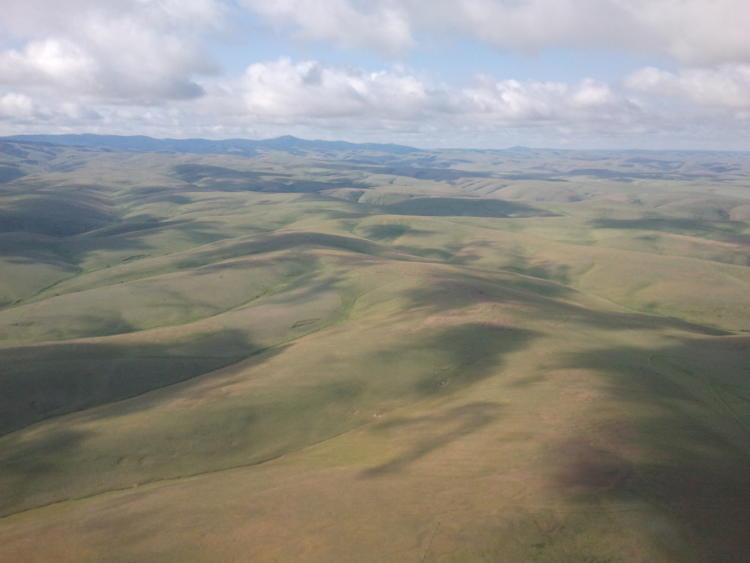
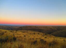
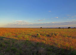
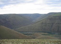
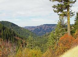
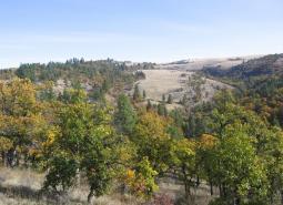
The Oregon portion of the Columbia Plateau ecoregion extends from the eastern slopes of the Cascade Mountains to the border of the Blue Mountains ecoregion. The Columbia River delineates the northern border of the ecoregion in Oregon and has greatly influenced the surrounding area with cataclysmic floods and large deposits of wind-borne silt and sand. Over time, winds scoured the floodplain, depositing silt and sand across the landscape and creating ideal conditions for agriculture: rolling lands, deep soil, and plentiful flowing rivers. The ecoregion is made up of lowlands, with an arid climate, cool winters, and hot summers.
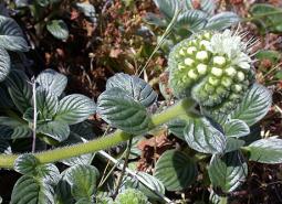
The Columbia Plateau ecoregion is characterized by sagebrush steppe and grassland habitats with extensive areas of dryland farming and irrigated agriculture. The Columbia Plateau produces the vast majority of Oregon’s grain, and grain production is the heart of the agricultural economy. The Columbia Plateau is second only to the Willamette Valley for agricultural production in Oregon. More than 80 percent of the ecoregion’s population and employment is located in Umatilla County, which includes the cities of Pendleton and Hermiston. Other population centers include The Dalles, Condon, and Heppner. Most of the Umatilla Indian Reservation is found in the Columbia Plateau ecoregion.
Characteristics
Important Industries
Agriculture, food processing, energy (solar and wind), livestock, retail and services, construction, recreation
Major Agricultural Products
Grain, barley, potatoes, onions, fruit
Important Nature-based Recreational Areas
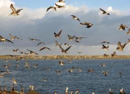
Cold Springs National Wildlife Refuge (NWR), Umatilla NWR, the canyons of the lower Deschutes and John Day Rivers, Lower Deschutes Wildlife Area, Willow Creek Wildlife Area, Irrigon Wildlife Area, Coyote Springs Wildlife Area, Power City Wildlife Area
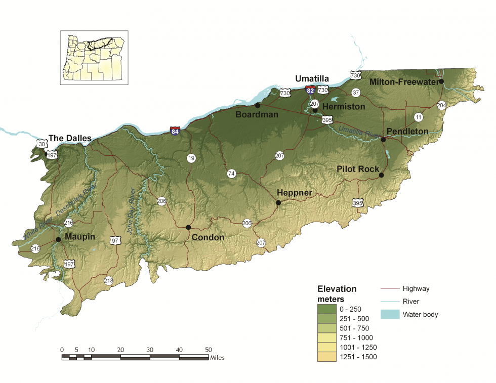
Elevation
100 feet (The Dalles) to over 4,000 feet along the southern border
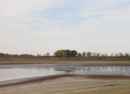
Important Rivers
Columbia, Deschutes, John Day, Umatilla, Walla Walla
Climate
The Columbia Plateau ecoregion consists of irregular plains and hills. The climate is dry and desert-like with hot, dry summers and cold winters. Mean annual precipitation is low, especially in the western area of the ecoregion due to the rain-shadow effect of the Cascade Range. Most summer precipitation evaporates quickly, leaving little water for streams and reservoirs.
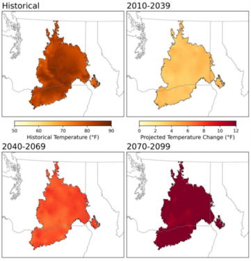
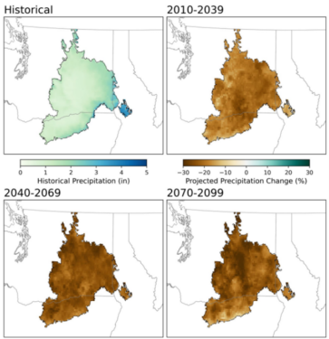
Warming is projected in all seasons across the region, with the largest increases project in summer. The average summer temperature is projected to increase by as much as 7°F for the 2040-2069 period, and as much as 12°F for the 2070-2099 period under a high emissions scenario (SSP585; Figure 1). Late summer precipitation is projected to decrease as much as 24% for a high emissions scenario (SSP585) in the 2070-2099 period (Figure 2). Cool season precipitation projections show an increase in precipitation of as much as 16% for the 2070-2099 period. Confidence is high in these projected precipitation changes. Growing degree days are projected to double by the 2070-2099 period under a high future scenario. Frost days are projected to decrease from 125 per year until there are fewer than 60, on average, under the high emissions scenario (SSP585).
Limiting Factors and Recommended Approaches
Limiting Factor: Water
CMP Direct Threats 7.2, 9.3, 11.4
Water Quantity is a limiting factor for fish and wildlife. Changing climate conditions are leading to rising temperatures and altered patterns of precipitation, which affects water availability across different times of year. In streams, seasonal low flows can limit habitat suitability and reproductive success for many fish and wildlife species. Reduced water availability for plants can affect the quality and availability of forage for many terrestrial species. In areas where urbanization is increasing, the demand for water is contributing to a decrease in the supply of groundwater. This reduces groundwater discharge of cold water to rivers and streams, subsequently reducing the availability of both cold water refugia and suitable habitat for cold-water dependent species. Many communities in the Columbia Plateau ecoregion are reliant on aquifers for water, and agricultural irrigation and private interests, such as aquifer use to cool computers in data centers, may threaten local water supplies. There are seven critical groundwater areas in Oregon, five of which are within the Columbia Plateau.
Water quality can also limit species and habitats. Runoff from agricultural areas can contaminate waterways. Warming temperatures, combined with higher nutrient levels due to agricultural runoff, are increasing the prevalence of harmful algal blooms in waterways like the lower John Day and Deschutes Rivers. These harmful algal blooms can cause large-scale fish die-off, sicken or kill wildlife, impact drinking water, and reduce habitat for fish and wildlife by blocking sunlight and creating hypoxic zones, also known as dead zones.
Recommended Approach
Provide incentives and information about water usage and sharing during low flow conditions (e.g., late summer). Promote water management actions that enable climate resilience and adaptation. Invest in watershed-scale projects for cold water and flow protection. Identify and protect cold water rearing and refugia habitat for aquatic species. Increase awareness and manage timing of applications of potential aquatic contaminants. Improve compliance with water quality standards and pesticide use labels administered by the DEQ and EPA. Work on implementing Senate Bill 1010 (Oregon Department of Agriculture) and DEQ Total Maximum Daily Load water quality plans.
Limiting Factor: Habitat Fragmentation
CMP Direct Threats 2.1, 2.3, 3.3, 8.1
The impact of human activity in the Columbia Plateau is high. The majority of the prairie and shrub-steppe habitat has been converted for agricultural uses. The remaining Key Habitats for at-risk native plant and animal species are limited and largely confined to small and often isolated fragments, such as roadsides and sloughs. These remaining parcels have the potential to be converted to agriculture, and there are few opportunities for large-scale protection or restoration of native landscapes. Existing land use and land ownership patterns present challenges to large-scale ecosystem restoration.
Recommended Approach
Provide incentives (e.g., financial assistance, conservation easements) and information about the benefits of maintaining bird and other wildlife habitat. Broad-scale conservation strategies will need to focus on restoring and maintaining more natural ecosystem processes and functions within a landscape that is managed primarily for other values. This may include an emphasis on more “conservation-friendly” management techniques for existing land uses, and restoration of some key ecosystem components such as riparian function. “Fine filter” conservation strategies that focus on needs of individual Species of Greatest Conservation Need and key sites are particularly important in this ecoregion.
Because approximately 84 percent of the Columbia Plateau ecoregion is privately-owned, voluntary cooperative approaches are the key to long-term conservation using tools such as financial incentives, regulatory assurance agreements, and conservation easements. Where appropriate, plan development carefully to maintain existing native habitats. Identifying important habitat areas and directing mitigation from ongoing energy development may be another protection strategy. Promote the protection, restoration, and maintenance of Priority Wildlife Connectivity Areas, following the guidelines outlined in Oregon’s Wildlife Corridor Action Plan.
Limiting Factor: Invasive Species
CMP Direct Threat 8.1
Invasive plant and animal species disrupt native communities, diminish populations of at-risk native species, and threaten the economic productivity of resource lands including farmland and rangeland. Differences in county policies and funding availability regarding invasive species have resulted in some inconsistencies in approach. Non-native annual grasses, such as cheatgrass and medusahead, have rapidly expanded in perennial grass systems in the Columbia Plateau, displacing desirable forage for wildlife and livestock. Invasion of cheatgrass has also increased fuel loads substantially, leading to catastrophic fire events. Invasive species such as yellow star thistle, Russian thistle, and Russian olive are also of concern, growing rapidly to crowd out native species.
Recommended Approach
Emphasize prevention, risk assessment, early detection, and quick control to prevent new invasive species from becoming fully established. Use multiple site-appropriate tools (e.g., mechanical, chemical and biological) to control the most damaging invasive species. Focus on key invasive species in high priority areas, particularly where Key Habitats and Species of Greatest Conservation Need occur. Ensure cooperation and collaboration between counties, landowners, land managers, and other entities with invasive species policies and interests. Promote the use of native species for restoration and revegetation.
Limiting Factor: Energy Development
CMP Direct Threat 3.3
Climate change and global economies are increasing pressure for renewable energy development, including wind, solar, and geothermal energy. Energy projects offer environmental benefits but also have impacts on fish, wildlife, and their habitats. Wind energy potential is especially high in the Columbia Plateau. The area is increasingly challenged with the need to balance the state’s interest in clean energy development with local natural resource conservation needs.
Recommended Approach
Plan energy projects carefully, using the best available information and consultation with biologists. See the Key Conservation Issue on Land Use Changes, the Oregon Department of Fish and Wildlife Solar Sitting Guidance and the Oregon Columbia Plateau Ecoregion Wind Energy Sitting and Permitting Guidelines. Focus potential mitigation efforts from energy siting into areas of greatest habitat integrity in the region. Avoid siting new facilities within critical movement and migration areas, including Priority Wildlife Connectivity Areas.
Limiting Factor: Soil Erosion
CMP Direct Threats 2.1, 9.3, 9.5
Soil loss through erosion and decreases in soil quality jeopardize the productivity of native habitats and agricultural lands. Agricultural use, particularly tilled production without the use of cover crops, is prevalent in the Columbia Plateau ecoregion. This region also sees characteristically high, sustained winds, contributing to soil loss. Sandy soils along the Columbia River are particularly susceptible to erosion from high winds. Soil erosion decreases water infiltration, which is essential for productive habitats and groundwater recharge, and can also increase sediment loading in streams, as well as air-borne pollutants.
Recommended Approach
Use incentives to promote no-till farming and agricultural practices that do not allow land to lay bare for long periods of time. Support no-till practices that use crop rotation and cover crops. Encourage participation and support for programs such as the Natural Resources Conservation Service’s Conservation Reserve Program, which promote practices that can offset or minimize soil erosion and degradation.
Species of Greatest Conservation Need
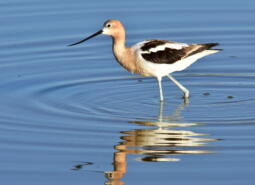
American Avocet
Recurvirostra americana

Black Tern
Chlidonias niger
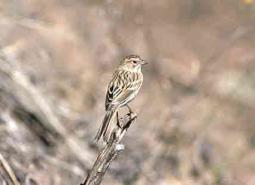
Brewer’s Sparrow
Spizella breweri breweri

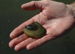
California Floater Mussel
Anodonta californiensis
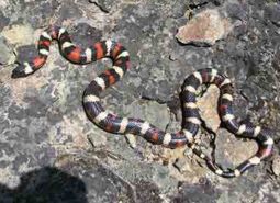
California Mountain Kingsnake
Lampropeltis zonata

California Myotis
Myotis californicus
Canyon Bat
Parastrellus hesperus
Cascade Head catchfly
Silene douglasii var. oraria
Chum Salmon – Coastal SMU
Oncorhynchus keta
Chum Salmon – Lower Columbia SMU
Oncorhynchus keta
Coast Range fawn lily
Erythronium elegans

Coastal Cutthroat Trout
Oncorhynchus clarki clarki
Coastal Greenish Blue Butterfly
Plebejus saepiolus littoralis
Coho Salmon – Coastal SMU
Oncorhynchus kisutch
Coho Salmon – Lower Columbia SMU
Oncorhynchus kisutch
Coho Salmon – Rogue-South Coast SMU
Oncorhynchus kisutch
Columbia Pebblesnail
Fluminicola fuscus

Common Nighthawk
Chordeiles minor
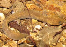
Cope’s Giant Salamander
Dicamptodon copei
Dog Star Skipper (butterfly)
Polites sonora siris
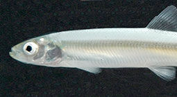
Eulachon
Thaleichthys pacificus

Fall Chinook Salmon – Lower Columbia SMU
Oncorhynchus tshawytscha
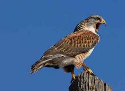
Ferruginous Hawk
Buteo regalis
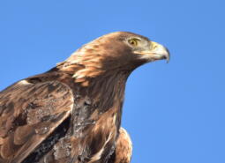
Golden Eagle
Aquila chrysaetos

Gray Wolf
Canis lupus
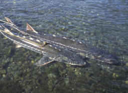
Green Sturgeon – Northern DPS
Acipenser medirostris
Green Sturgeon – Southern DPS
Acipenser medirostris
Highcap Lanx
Lanx alta

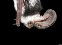
Hoary Bat
Lasiurus cinereus
Johnson’s Hairstreak (butterfly)
Callophrys johnsoni
Large-flowered goldfields
Lasthenia ornduffii

Lewis’s Woodpecker
Melanerpes lewis
Little Brown Myotis
Myotis lucifugus
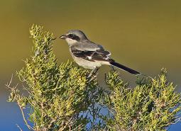
Loggerhead Shrike
Lanius ludovicianus
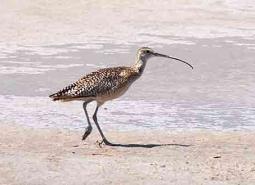
Long-billed Curlew
Numenius americanus

Long-legged Myotis
Myotis volans
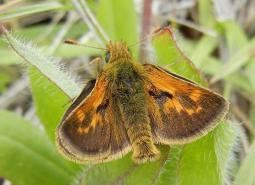
Mardon Skipper Butterfly
Polites mardon
Mendocino coast paintbrush
Castilleja mendocinensis
Millicoma Dace
Rhinichthys cataractae ssp
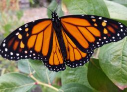
Monarch Butterfly
Danaus plexippus
Nelson’s checkermallow
Sidalcea nelsoniana
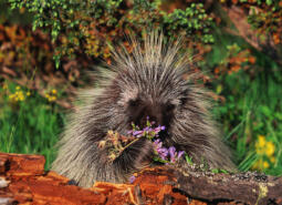
North American Porcupine
Erethizon dorsatum
Oregon Floater Mussel
Anodonta oregonensis
Oregon Silverspot Butterfly
Argynnis zerene hippolyta

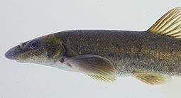
Pacific Lamprey
Entosphenus tridentatus
Pacific Walker
Pomatiopsis californica

Pallid Bat
Antrozous pallidus

Pink sandverbena
Abronia umbellata var. breviflora
Point Reyes bird’s-beak
Chloropyron maritimum ssp. palustre
Robust Walker
Pomatiopsis binneyi
Rocky Mountain Fingernail Clam
Sphaerium patella
Sagebrush Sparrow
Artemisiospiza nevadensis
Seaside gilia
Gilia millefoliata
Seaside Hoary Elfin Butterfly
Callophrys polios maritima

Silver-haired Bat
Lasionycteris noctivagans
Silvery phacelia
Phacelia argentea
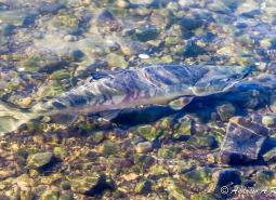
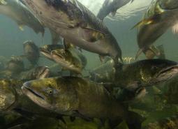
Sockeye Salmon
Oncorhynchus nerka
Spotted Bat
Euderma maculatum
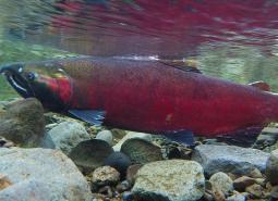
Spring Chinook Salmon – Coastal SMU
Oncorhynchus tshawytscha
Spring Chinook Salmon – Rogue SMU
Oncorhynchus tshawytscha
Stansell’s daisy
Erigeron stanselliae
Suckley’s Cuckoo Bumblebee
Bombus suckleyi
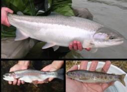
Summer Steelhead/Coastal Rainbow Trout – Coastal SMU
Oncorhynchus mykiss/Oncorhynchus mykiss irideus
Summer Steelhead/Coastal Rainbow Trout – Lower Columbia SMU
Oncorhynchus mykiss/Oncorhynchus mykiss irideus
Summer Steelhead/Coastal Rainbow Trout – Rogue SMU
Oncorhynchus mykiss/Oncorhynchus mykiss irideus
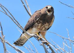
Swainson’s Hawk
Buteo swainsoni

Townsend’s Big-eared Bat
Corynorhinus townsendii
Umpqua Chub
Oregonichthys kalawatseti
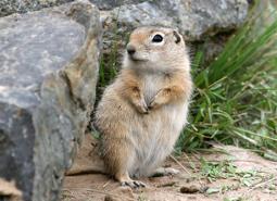
Washington Ground Squirrel
Urocitellus washingtoni
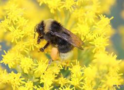
Western Bumble Bee
Bombus occidentalis
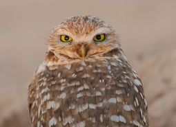
Western Burrowing Owl
Athene cunicularia hypugaea
Western Floater Mussel
Anodonta kennerlyi
Western Grasshopper Sparrow
Ammodramus savannarum perpallidus

Western Grebe
Aechmophorus occidentalis
Western lily
Lilium occidentale
Western Long-eared Myotis
Myotis evotis

Western Painted Turtle
Chrysemys picta belli
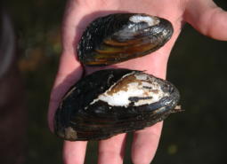
Western Pearlshell Mussel
Margaritifera falcata
Western Ridged Mussel
Gonidea angulata

Western River Lamprey
Occidentis ayresii
Western Small-footed Myotis
Myotis ciliolabrum

Western Toad
Anaxyrus boreas

White Sturgeon – Lower Columbia/Coastal SMU
Acipenser transmontanus
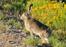
White-tailed Jackrabbit
Lepus townsendii
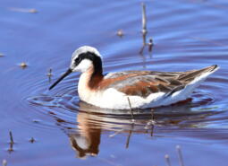
Wilson’s Phalarope
Phalaropus tricolor
Winged Floater Mussel
Anodonta nuttalliana
Winter Steelhead/Coastal Rainbow Trout – Lower Columbia SMU
Oncorhynchus mykiss/Oncorhynchus mykiss irideus
Wolf’s evening primrose
Oenothera wolfii
Yuma Myotis
Myotis yumanensis
Conservation Opportunity Areas
Bakeoven Creek-Buckhollow Creek [COA ID: 151]
The northern boundary of this COA follows Buck Hollow Creek, with the remaining boundaries connecting to the Lower Deschutes River (COA ID 148) and Lawrence Grasslands (COA ID 152) COAs.
Boardman Area [COA ID: 154]
South of the Columbia River, in north central Oregon. Area includes important conservation lands near the Boardman Conservation Area; Willow Creek Wildlife Area; and grassland included in The Nature Conservancy conservation portfolio
Cold Springs National Wildlife Refuge Area [COA ID: 156]
Just east of Hermiston and extending to include a small stretch of the Columbia River. Includes Cold Springs National Wildlife Refuge
Deschutes River [COA ID: 149]
Mainly located on the Warms Springs Reservation, this narrow COA includes a section of the Deschutes River from above the confluence with the Warms Springs River, north to approximately 1.5 miles below White Horse Rapids. From east to west the COA runs from the east side of the Deschutes River, adjacent to White Horse rapids, …

Fifteenmile Creek [COA ID: 147]
Area just east of The Dalles Airport, following Fifteen Mile Creek, and extending north to the Oregon/Washington border along the Columbia River.
Lawrence Grasslands [COA ID: 152]
In the southwest corner of the ecoregion just west of Antelope.
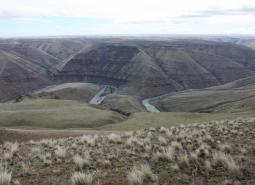
Lower Deschutes River [COA ID: 148]
Follows the Lower Deschutes River Corridor and includes surrounding habitat.
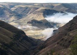
Lower John Day River [COA ID: 153]
Area follows the lower John Day River and surrounding habitats.
Metolius Bench-Mutton Mountains Wildlife Movement Corridor [COA ID: 150]
This long narrow COA spans two ecoregions. Within the East Cascades, it begins on the south side of the Metolius River, northwest of Lake Billy Chinook, and crosses over the river and into the Warm Springs Reservation. Heading north east, the COA crosses into the Blue Mountains ecoregion, across US Highway 26, and at its …
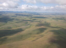
Rock Creek-Butter Creek Grasslands [COA ID: 155]
This is the largest COA within the Columbia Plateau Ecoregion extending from Rock Creek to Butter Creek, totaling 809 square miles.
Test Importer [COA ID: 10602]
DESCRIPTION Recommended Conservation Actions.. Local Conservation Actions and Plans Potential Partners Special Features General Protected Areas Previously Associated With
Walla Walla Headwaters [COA ID: 157]
This COA is mainly located within the Blue Mountains ecoregion of Umatilla, Union, and Wallowa Counties, but enters into a small section of the Columbia Plateau ecoregion along its northwest corner. Characterized by extensive mixed conifer forest, this rugged landscape also contains important native perennial grasslands, abundant springs, and abuts the North Fork Umatilla Wilderness …
Wasco Oaks [COA ID: 125]
Area extends from the Columbia River up through the Mt. Hood National Forest and has served as an important emphasis for conservation and restoration efforts.