Description
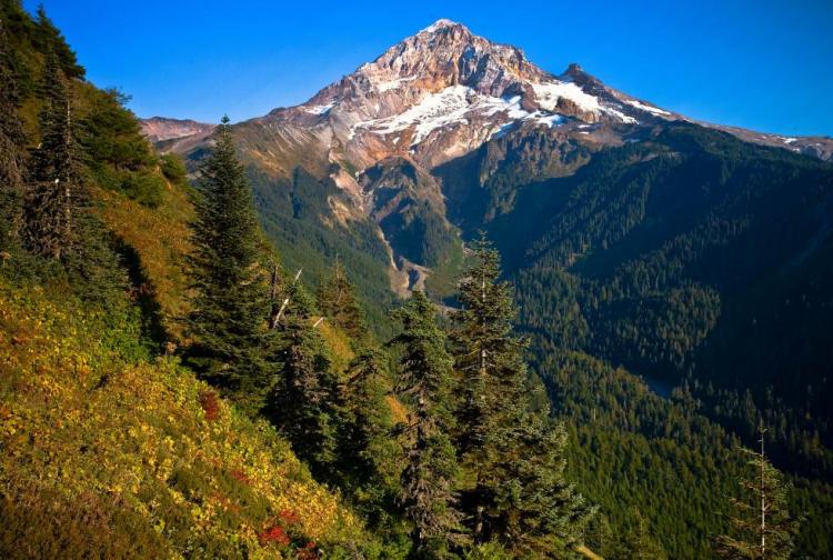
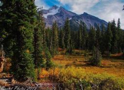
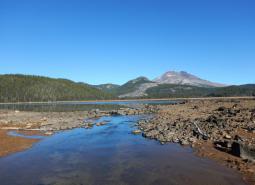
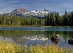
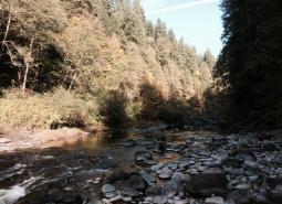
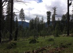
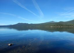
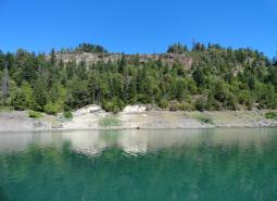
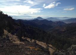
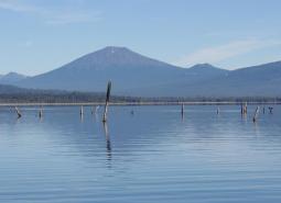
The West Cascades ecoregion extends from just east of the Cascade Mountains’ summit to the foothills of the Willamette, Umpqua, and Rogue Valleys, and spans nearly the entire length of the state of Oregon, from the Columbia River to within five miles of the California border. The topography and soils of the West Cascades ecoregion have been shaped dramatically by its volcanic past. The West Cascades ecoregion has two geologically distinct areas: the younger volcanic crest (approximately 8 million years old) and the “old Cascades” to the west of the crest (at least 30 million years old). The volcanic crest includes the highest peaks in Oregon: Mt. Hood, Mt. Jefferson, and North, Middle, and South Sisters, all more than 10,000 feet. The “old Cascades” are characterized by long, steep ridges and wide, glaciated valleys.
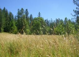
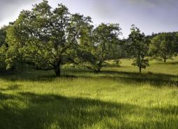
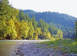
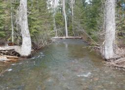
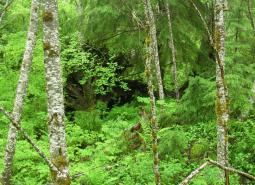
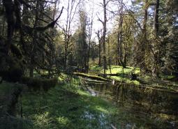
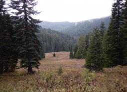
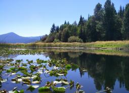
This ecoregion is almost entirely forested by conifers, although the dominant tree species vary by elevation, site characteristics, and stand history. Douglas-fir is the most common tree below 4,000 feet, often with western hemlock as a co-dominant species. At higher elevations, dominant tree species include Pacific silver fir, mountain hemlock, or subalpine fir. Other common conifers include western redcedar, grand fir, and noble fir. Above approximately 7,000 feet, the conditions are too severe for tree growth, and alpine parklands and dwarf shrubs predominate, including some wetlands and barren expanses of rock and ice. In the southern areas, ponderosa pine, sugar pine, and incense cedar often are found with Douglas-fir at the lower elevations.
The climate and resulting fire regimes vary with latitude and elevation. The northern portion of the ecoregion is typified by less frequent but more severe fires, whereas the southern portion is typically drier with moderately frequent, mixed-severity, lightning-caused fires. Across the entire region, fire frequency and severity are increasing due to changing climate. At lower elevations, winter conditions are often mild with high rainfall. In contrast, above 4,000 feet, winters are typified by lower temperatures and much of the precipitation occurs as snowfall.
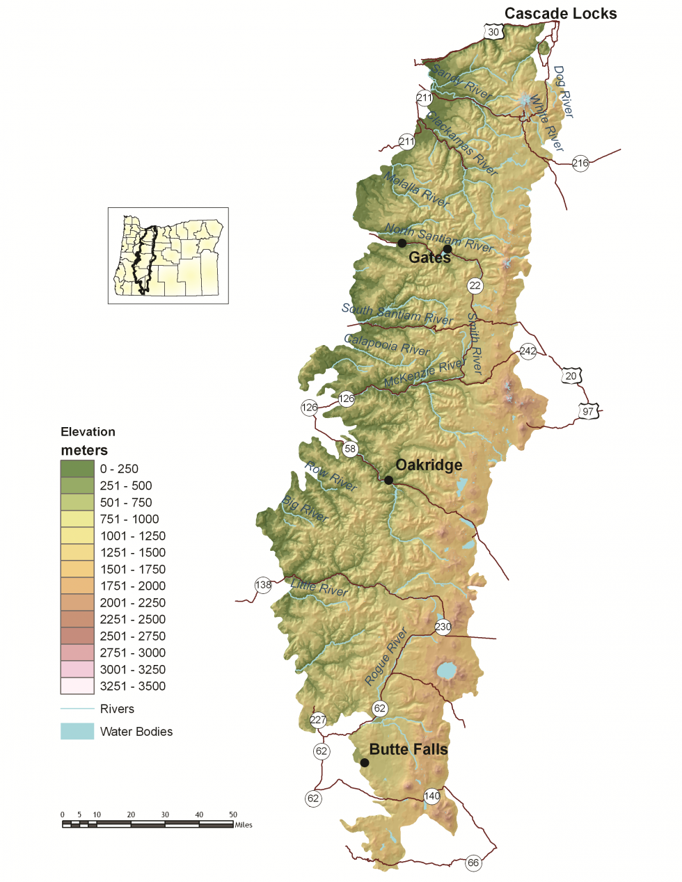
The West Cascades ecoregion is sparsely populated, with towns including Cascade Locks, Butte Falls, Detroit, Gates, Idanha, McKenzie Bridge, Blue River, Oakridge, Westfir, and part of Sandy and Sweet Home (the remainder of which lie in the Willamette Valley ecoregion). Local economies were once entirely dependent on timber harvest but have been greatly affected as market conditions (long-term and broad-scale changes in the forest products marketplace) and shifts in public forest management priorities have shaped Oregon’s timber industry. Many towns are increasingly promoting recreational opportunities, including hiking, camping, fishing, hunting, birding, mountain biking, and skiing.
Characteristics
Important Industries
Forest products, recreation (hiking, biking, wildlife viewing, hunting, fishing, snow sports)
Major Agricultural Products
Fruits, mint, cattle
Important Nature-based Recreational Areas
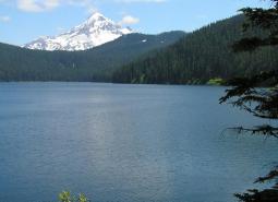
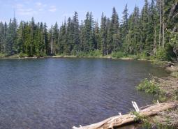
Mt. Hood, Willamette, Umpqua, and Rogue River-Siskiyou National Forests, Waldo Lake, Odell Lake, Detroit and Hills Creek Reservoirs, Crater Lake National Park, Three Sisters, Sky Lakes, and Mount Jefferson Wilderness Areas, Willamette Hatchery
Elevation
98 feet (along the western border of the ecoregion) to 11,240 feet (Cascade peaks)
Important Rivers
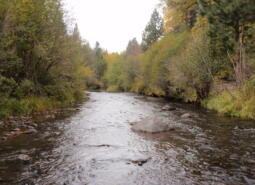
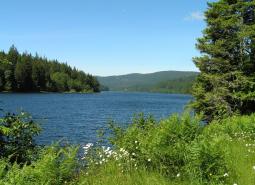
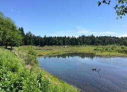
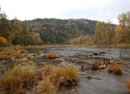
Clackamas (Oak Grove Fork), McKenzie, Rogue, Umpqua, Breitenbush, Middle Santiam, North and Middle Fork of the Willamette
Climate
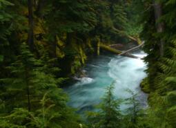
The West Cascades ecoregion is characterized by steep ridges and river valleys to the west and a high plateau to the east. The region has a mild to severe mid-latitude climate with dry, warm summers and mild or cool, very wet winters. The climate varies by latitude and elevation, especially near the volcanoes within this ecoregion.
Warming is projected in all seasons across the Cascades ecoregion, with the largest increases projected for summer. Summer average temperature is projected to increase by as much as 7°F for the 2040-2069 period and as much as 11°F for the 2070-2099 period (Figure 1). Late summer precipitation is projected to decrease by as much as 19% by the 2070-2099 period, and cool season precipitation is projected to increase by 6% (Figure 2). Less precipitation will fall as snow in Cascades in the future, leading to even wetter winters and drier summers. Confidence in cool season projections, however, is low after 2010-2039. Growing degree days are projected to more than double by the 2070-2099 period for this ecoregion under a high emissions scenario (SSP585). Frost days are projected to decrease from 171 per year until there are fewer than 100 per year, on average, under the high emissions scenario (SSP585).


Limiting Factors and Recommended Approaches
Limiting Factor: Altered Fire Regimes
CMP Direct Threats 7.1, 11.3, 11.4
Many forests in the West Cascades ecoregion are at risk of losing one or more ecosystem components to wildfire. Fire suppression and certain forest practices have resulted in young, dense, mixed-species stands of trees that are at increased risk of forest-destroying crown fires, disease, and damage by insects. Under changing climate conditions these risks are expected to increase, with warming temperatures and more frequent drought contributing to shorter fire return intervals and more severe fires. Efforts to reduce risks of uncharacteristically severe fires can help to restore habitat but require careful planning to provide sufficient habitat features that are important to wildlife (e.g., snags, downed logs, hiding cover).
Recommended Approach
Use an integrated approach to wildfire issues that considers historical conditions, wildlife conservation, natural fire intervals, and silvicultural techniques. Consider the broader landscape context, including habitat connectivity, cumulative impacts, fish and wildlife species presence, and mapped or modeled suitable habitat when engaging in forest management and wildfire risk mitigation activities. Reintroduce fire where feasible; prioritize sites and applications. Maintain important wildlife habitat features, such as snags and logs, to sustain wildlife species that are dependent on dead wood. Maintain early-, mid-, and late-seral habitats to support a diversity of species. Monitor these efforts and use adaptive management techniques to ensure efforts are meeting habitat restoration and wildfire prevention objectives with minimal impacts on wildlife. Work with homeowners and resort operators to reduce vulnerability of properties to wildfire while maintaining habitat quality. Highlight successful, environmentally sensitive fuel management programs. In the case of post-wildfire recovery, maintain high snag densities and replant with site-adapted native tree, shrub, grass, and forb species. Promote revegetation with native species that are expected to be climate resilient. Prevent colonization of invasive vegetation, such as scotch broom. Manage reforestation after wildfire to create species and structural diversity, based on local management goals.
Limiting Factor: Water
CMP Direct Threats 7.2, 114
Water Quantity is a limiting factor for fish, wildlife, and livestock. Changing climate conditions are leading to rising temperatures and altered patterns of precipitation, which affect water availability across different times of year, and drought conditions are occurring more frequently. In high elevation areas, loss of snowpack due to warming climate conditions is affecting habitat for many species along the Cascade crest and is leading to reduced stream flow rates and peak flow rates that are occurring earlier in the year. In streams, seasonal low flows can limit habitat suitability, survival, and reproduction for many fish and wildlife species.
Water quality can also limit species and habitats. Runoff from agricultural areas and herbicides applied to forest lands can contaminate waterways. Warming temperatures, combined with higher nutrient levels due to agricultural runoff, are increasing the prevalence of toxic cyanobacterial blooms.
Recommended Approach
Provide incentives and information about water usage and sharing during low flow conditions (e.g., late summer). Promote water management actions that enable climate resilience and adaptation. Invest in watershed-scale projects for cold water and flow protection. Identify and protect cold water rearing and refugia habitat for aquatic species. Increase awareness and manage timing of applications of potential aquatic contaminants. Improve compliance with water quality standards and pesticide use labels administered by the DEQ and EPA. Work on implementing Senate Bill 1010 (Oregon Department of Agriculture) and DEQ Total Maximum Daily Load water quality plans.
Limiting Factor: Habitat Fragmentation
CMP Direct Threats 1, 2.1, 2.3, 3.3, 8.1
Increasing traffic volumes, road density, recreational pressure, and urban and rural development are contributing to habitat loss and fragmentation, and create significant barriers to animal movements. Hydropower systems, including high-head flood control and hydropower dams, also have significant impacts to species movement in this ecoregion. Levees, hydropower canals, and hardened stream banks reduce available habitat for fish and aquatic species and can entrap and kill wildlife. Altered hydrology from these systems, including impacts to temperatures and timing of water availability, can affect fish passage.
Recommended Approach
Work with community leaders and local governments to encourage planned, efficient growth. Support existing land use regulations to preserve forestland, farmland, rangeland, open spaces, recreation areas, wildlife refuges, and natural habitats. Work with community leaders and agency partners to protect wildlife movement corridors and to fund and implement site-appropriate habitat enhancement and restoration efforts to facilitate wildlife movement. Continue working with Oregon Watershed Enhancement Board, Oregon Department of Transportation, Oregon Department of Forestry, USFS, BLM, counties, local municipalities, irrigation districts, and other partners to inventory, prioritize, and provide fish passage at artificial obstructions, leveraging current work done by ODFW’s Fish Passage Task Force to expand implementation of fish passage priorities. Minimize entrapment risk in hydropower canals by providing crossing structures and escape devices at regular intervals. Provide incentives (e.g., financial assistance, conservation easements) and information about the benefits of maintaining wildlife habitat. Broad-scale conservation strategies will need to focus on restoring and maintaining more natural ecosystem processes and functions within areas that are managed primarily for other values. This may include an emphasis on more “conservation-friendly” management techniques for existing land uses, and restoration of some key ecosystem components such as riparian function.
Limiting Factor: Invasive Species
CMP Direct Threat 8.1
Invasive plants and animals disrupt and degrade native communities, diminish populations of at-risk native species, and threaten the economic productivity of resource lands. Invasive plants, particularly noxious weeds, have increased substantially. In many cases, the spread of invasives is facilitated by wildfire, as many invasive species can quickly colonize disturbed areas. In this ecoregion, Scotch broom is of particular concern. Scotch broom spreads aggressively to form monocultures, displacing native, beneficial plants and forage grasses, with seeds that can remain viable for decades, making it very difficult to eradicate. Himalayan blackberry is also widespread, with significant local impacts to meadows, riparian areas, and grasslands.
While not as disruptive as invasive vegetation, invasive animals have caused problems for native wildlife species in this ecoregion. A variety of sport fish, introduced to many high elevation lakes, compete with native amphibians for limited resources and prey on native species and/or their eggs or young. Barred Owl, expanding westward from their native range in the eastern US, compete directly with the native, threatened Northern Spotted Owl for food and habitat.
Recommended Approach
Emphasize prevention, risk assessment, early detection, and quick control to prevent new invasive species from becoming fully established. Prioritize efforts to focus on key invasive species in high priority areas, particularly where Key Habitats and Species of Greatest Conservation Need occur. Where needed, use multiple site-appropriate tools (e.g., mechanical, chemical, and biological) to control the most damaging invasive species. During post-fire recovery efforts, use techniques that prevent establishment of or quickly eradicate invasive vegetation. Ensure native species are used during restoration and revegetation efforts and promote native species that are expected to be climate resilient.
Limiting Factor: Recreational Activity
CMP Direct Threats 1.3, 4.1, 5.1, 5.2, 5.4, 6.1
Increasing demands for year-round recreational activity can disturb wildlife. Population growth has contributed to increased pressure on natural areas from recreationists, including those engaging in hiking, biking, camping, fishing, hunting, foraging, rafting, backcountry skiing, boating, paddleboarding, and off-road vehicle use. Expanded road and trail systems developed to help accommodate higher numbers of visitors are increasing habitat fragmentation and risks of behavioral impacts to wildlife. Recreational pressure can lead to an increase in wildlife stress response and behavioral changes that ultimately impact reproductive rates and population abundance. Human recreation can contribute to destruction of sensitive vegetation, harassment of wildlife from off-leash pets, spread of invasive species, and contamination of areas with refuse. Many species will avoid areas near trails, campgrounds, and access roads when humans are present.
Recommended Approach
Plan new recreational trail systems carefully and with consideration for native wildlife and their habitats. For example, limit use and access to certain areas to minimize disturbance to wildlife, avoiding areas more sensitive to damage such as wetlands. Take advantage of abandoned or closed roads, rail lines, or previously impacted areas for conversion into trails. Work with land management agencies such as the USFS to designate areas as high value recreation and low habitat impact areas. Institute road and/or area closures to protect species during sensitive times of year and decommission roads when possible. In high use areas, establish permitted entry systems to decrease recreational pressure. Engage in outreach and education to increase public awareness of recreation impacts to fish and wildlife species; develop messaging to communicate the need for “responsible recreation”.
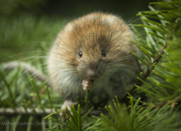
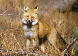
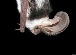
Species of Greatest Conservation Need

A Caddisfly
Farula constricta
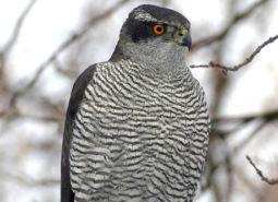
American Goshawk
Accipiter atricapillus

American Pika
Ochotona princeps
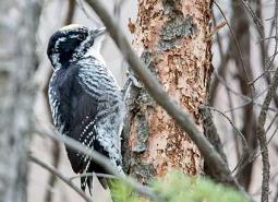
American Three-toed Woodpecker
Picoides dorsalis
Beller’s Ground Beetle
Agonum belleri
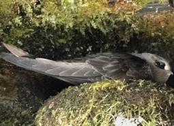
Black Swift
Cypseloides niger borealis
Black Tern
Chlidonias niger
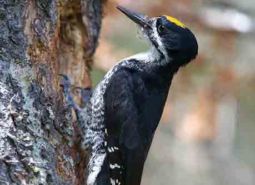
Black-backed Woodpecker
Picoides arcticus
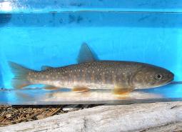
Bull Trout – Coastal Recovery Unit
Salvelinus confluentus
Bull Trout – Klamath Recovery Unit
Salvelinus confluentus

California Floater Mussel
Anodonta californiensis
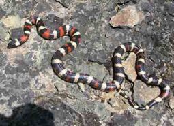
California Mountain Kingsnake
Lampropeltis zonata

California Myotis
Myotis californicus
Canyon Bat
Parastrellus hesperus
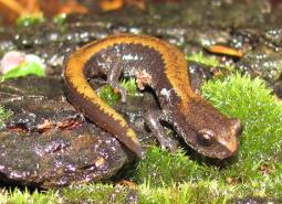
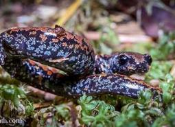
Cascade Torrent Salamander
Rhyacotriton cascadae
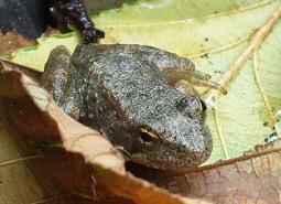
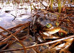
Cascades Frog
Rana cascadae
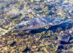
Chum Salmon – Lower Columbia SMU
Oncorhynchus keta

Clouded Salamander
Aneides ferreus

Coastal Cutthroat Trout
Oncorhynchus clarki clarki

Coastal Tailed Frog
Ascaphus truei
Coho Salmon – Lower Columbia SMU
Oncorhynchus kisutch
Coho Salmon – Rogue-South Coast SMU
Oncorhynchus kisutch
Columbia Gorge Caddisfly
Neothremma andersoni
Columbia Pebblesnail
Fluminicola fuscus
Columbia yellowcress
Rorippa columbiae
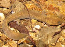
Cope’s Giant Salamander
Dicamptodon copei
Dalles Hesperian
Vespericola depressus
Dog Star Skipper (butterfly)
Polites sonora siris

Fall Chinook Salmon – Lower Columbia SMU
Oncorhynchus tshawytscha
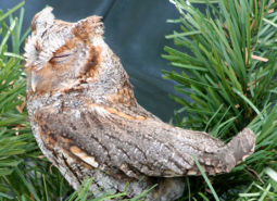
Flammulated Owl
Psiloscops flammeolus
Foothill Yellow-legged Frog
Rana boylii
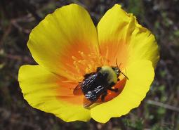
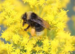
Franklin’s Bumble Bee
Bombus franklini

Fringed Myotis
Myotis thysanodes
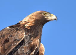
Golden Eagle
Aquila chrysaetos

Gray Wolf
Canis lupus
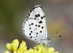
Gray-blue (butterfly)
Agriades podarce klamathensis
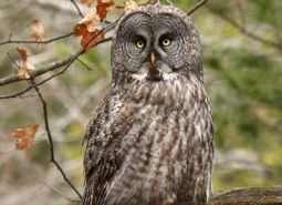
Great Gray Owl
Strix nebulosa
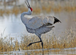
Greater Sandhill Crane
Antigone canadensis tabida
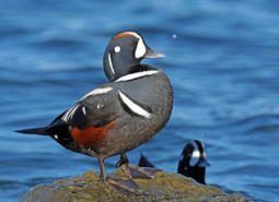
Harlequin Duck
Histrionicus histrionicus

Hoary Bat
Lasiurus cinereus
Johnson’s Hairstreak (butterfly)
Callophrys johnsoni
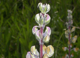
Kincaid’s lupine
Lupinus oreganus
Larch Mountain Salamander
Plethodon larselli
Leona’s Little Blue Butterfly
Philotiella leona

Lewis’s Woodpecker
Melanerpes lewis
Little Brown Myotis
Myotis lucifugus

Long-legged Myotis
Myotis volans
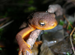
Mazama (Crater Lake) Newt
Taricha granulosa mazamae
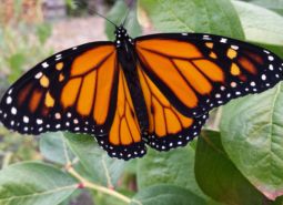
Monarch Butterfly
Danaus plexippus
Morrison Bumble Bee
Bombus morrisoni
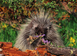
North American Porcupine
Erethizon dorsatum

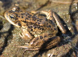
Northern Red-legged Frog
Rana aurora
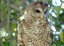
Northern Spotted Owl
Strix occidentalis caurina
Northern wormwood
Artemisia campestris var. wormskioldii

Northwestern Pond Turtle
Actinemys marmorata

Olive-sided Flycatcher
Contopus cooperi
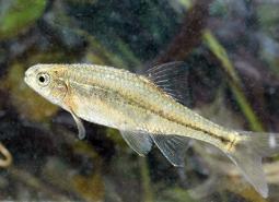
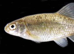
Oregon Chub
Oregonichthys crameri
Oregon Floater Mussel
Anodonta oregonensis
Oregon Shoulderband
Helminthoglypta hertleini
Oregon Slender Salamander
Batrachoseps wrighti
Oregon Spotted Frog
Rana pretiosa
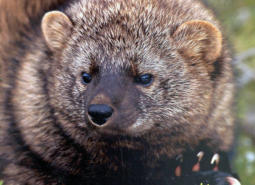
Pacific Fisher
Pekania pennanti

Pacific Lamprey
Entosphenus tridentatus
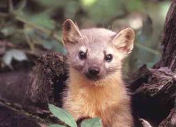
Pacific Marten
Martes caurina

Pallid Bat
Antrozous pallidus
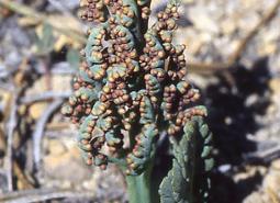
Pumice grape-fern
Botrychium pumicola
Red Tree Vole
Arborimus longicaudus

Ringtail
Bassariscus astutus
Scott’s Apatanian Caddisfly
Allomyia scotti
Shortface Lanx
Fisherola nuttalli
Sierra Nevada Red Fox
Vulpes vulpes necator

Silver-haired Bat
Lasionycteris noctivagans
Siskiyou Hesperian
Vespericola sierranus
Spotted Bat
Euderma maculatum
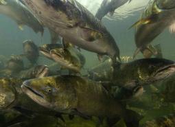
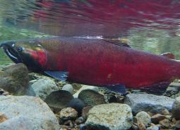
Spring Chinook Salmon – Coastal SMU
Oncorhynchus tshawytscha
Spring Chinook Salmon – Lower Columbia SMU
Oncorhynchus tshawytscha
Spring Chinook Salmon – Rogue SMU
Oncorhynchus tshawytscha
Spring Chinook Salmon – Willamette SMU
Oncorhynchus tshawytscha
Subarctic Darner
Aeshna subarctica
Suckley’s Cuckoo Bumblebee
Bombus suckleyi
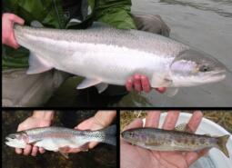
Summer Steelhead/Coastal Rainbow Trout – Coastal SMU
Oncorhynchus mykiss/Oncorhynchus mykiss irideus
Summer Steelhead/Coastal Rainbow Trout – Lower Columbia SMU
Oncorhynchus mykiss/Oncorhynchus mykiss irideus
Summer Steelhead/Coastal Rainbow Trout – Rogue SMU
Oncorhynchus mykiss/Oncorhynchus mykiss irideus
Summer Steelhead/Redband Trout – Upper Klamath Basin SMU
Oncorhynchus mykiss

Townsend’s Big-eared Bat
Corynorhinus townsendii
Umpqua Chub
Oregonichthys kalawatseti
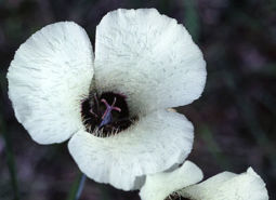
Umpqua mariposa lily
Calochortus umpquaensis
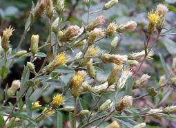
Wayside aster
Eucephalus vialis
Western Bumble Bee
Bombus occidentalis
Western Floater Mussel
Anodonta kennerlyi

Western Grebe
Aechmophorus occidentalis
Western Long-eared Myotis
Myotis evotis

Western Painted Turtle
Chrysemys picta belli
Western Pearlshell Mussel
Margaritifera falcata

Western Purple Martin
Progne subis arboricola
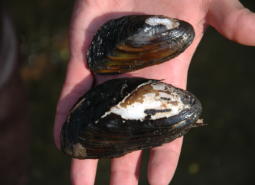
Western Ridged Mussel
Gonidea angulata

Western River Lamprey
Occidentis ayresii
Western Small-footed Myotis
Myotis ciliolabrum

Western Toad
Anaxyrus boreas
White fairy poppy
Meconella oregana
Conservation Opportunity Areas
Antelope Creek-Paynes Cliffs [COA ID: 099]
This area includes important and rare low eleveation rocky outcropping and cliff habitat as well as Antelope Creek, historically one of the biggest producers of Summer Steelhead in the Rogue Watershed.

Big Butte Area [COA ID: 122]
This area is in the foothills of the West Cascades ecoregion and contains important Oak Woodland and Ceanothus Shrubland habitats.
Big Marsh Creek [COA ID: 133]
Area includes river headwaters near Crescent Lake Junction and flows into Oregon Cascades National Recreation Area.
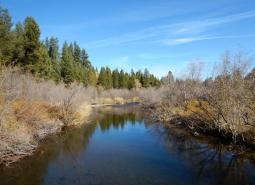
Breitenbush River [COA ID: 110]
The Breitenbush River COA (73 mi2) extends from the edge of the Opal Creek Wilderness eastward into the Cascades, up toward Potato Butte. This area contains mid to high elevation managed forest and tributaries of the North Santiam River. This COA is adjacent to the Mt Jefferson Wilderness, North COA. Recommended Conservation Actions Identify and …
Bull of the Woods, North [COA ID: 108]
The Bull of the Woods, North COA (27 mi2) is located along the northern edge of the Bull of the Woods Wilderness in the Mount Hood National Forest. This COA contains portions of the Collawash River and its tributaries, which feed into the Clackamas River further downstream. Recommended Conservation Actions Create quality rearing habitats for …
Bull Run-Sandy Rivers [COA ID: 105]
The Bull Run – Sandy River COA (200 mi2) includes the headwaters of the Sandy River and its tributaries, including the Bull Run River. Nearly all the Bull Run Watershed is contained within this COA, which is a protected area that provides drinking water to the city of Portland. This area is located almost entirely …
Calapooia River [COA ID: 082]
The Calapooia River COA (79 mi2) extends from just upstream of the confluence of the Calapooia and Willamette Rivers, upstream along the Calpooia River all the way to the border of the Willamette National Forest. The area includes the associated riparian and upland areas surrounding the river. This COA is adjacent to the Crawfordsville Oak-Washburn …
Central Cascades Crest, Southeast [COA ID: 116]
Directly adjacent to the Upper Deschutes River COA.
Central Cascades Crest, West [COA ID: 113]
The Central Cascades Crest, West COA (345 mi2) extends down the westside of the Cascade crest from Sentinel Creek down to Skookum Creek and Battle Peak. The area is partially bounded by the North Santiam River to the north, the McKenzie River to the west, the Middle Fork Willamette to the south, and the Mt …
Clackamas River and Tributaries [COA ID: 065]
The Clackamas River and Tributaries COA (59 mi2) extends from the confluence with the Willamette River area upstream to Estacada and includes the associated floodplain, tributaries, and upland habitats of the lower Clackamas River. This COA is adjacent to the Lower Willamette River Floodplain COA. Recommended Conservation Actions Maintain and enhance in-channel watershed functions, connection …
Coburg Ridge [COA ID: 087]
The Coburg Ridge COA (52 mi2) extends from just outside Coburg at Coburg Ridge northward to Indian Head. The area includes the surrounding ridgelines, foothills, and associated lowlands. This COA is adjacent to the McKenzie River Area, Calapooia River, and Mohawk River COAs. Recommended Conservation Actions Maintain and enhance grasslands, remnant native wet prairies and …
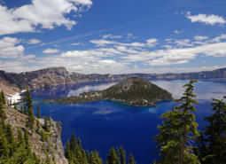
Crater Lake [COA ID: 121]
Crater Lake, Crater Lake National Park and surrounding wetlands and forest habitats.
Hood River [COA ID: 106]
The Hood River COA (40 mi2) extends from the confluence with the Columbia River upstream to where the river leaves the Mt Hood National Forest, and includes the floodplains and associated uplands of the lower Hood River. This COA is adjacent to the Mt Hood Area COA. Recommended Conservation Actions Work with partners to exclude …
Little North Santiam River Area [COA ID: 109]
The Little North Santiam River COA (45 mi2) extends from Silver Falls State Park eastward into the Cascades toward the Willamette National Forest boundary. The area primarily consisted of mixed conifer forest and includes the headwaters of North Santiam and Pudding Rivers. It is comprised of a matrix of private industrial forest and both state …

Lower Sandy River [COA ID: 057]
The Lower Sandy River COA (42 mi2) extends from the confluence of the Sandy and Columbia Rivers up along the Lower Sandy River and its tributaries. The are includes the Sandy River Delta, Beaver Creek, and the lower reaches of the Bull Run River. This COA is located on the eastern edge of the Portland …
McKenzie River Area [COA ID: 114]
The McKenzie River Area COA (116 mi2) extends from the confluence with the Willamette River upstream to Sardine Butte and includes the associated floodplain, tributaries, and upland habitats of the McKenzie River. This COA is adjacent to the Upper Willamette River Floodplain, Coburg Ridge and Mohawk River COAs. Recommended Conservation Actions Maintain and enhance in-channel …
Metolius River Area [COA ID: 127]
Includes Metolius River basin, includes Green Ridge, and extends to include nearby valleys. Nationally known scenic recreation area that provides high quality habitat for fish and wildlife in Central Oregon.
Middle Fork Willamette River [COA ID: 115]
The Middle Fork Willamette River COA (167 mi2) extends from Lookout Point Lake upstream along the Middle Fork Willamette River and into the surrounding forestlands as far east as Huckleberry Mountain. The area skirts along the northern edge of Oakridge, and goes north to Alpine Ridge. This COA is adjacent to the Upper Willamette River …
Middlefork Willamette River Headwaters [COA ID: 118]
The Middlefork Willamette River Headwaters COA (71 mi2) extends from Hills Creek Reservoir south and east toward Summit Lake and the edge of the Diamond Peak Wilderness. This area includes a significant stretch of the Middle Fork Willamette River, including many of its headwaters streams. Recommended Conservation Actions Maintain and restore wetland and wet meadow …
Molalla River [COA ID: 069]
The Molalla River COA (38 mi2) extends along the Molalla River corridor from Mulino upstream to the Dickie Prairie area, and includes the associated floodplain, tributaries, and upland habitats. This COA is adjacent to the Missouri Ridge COA. Recommended Conservation Actions Maintain and enhance in-channel watershed functions, connection to riparian habitat, water flow and hydrology. …
Mt Hood Area [COA ID: 107]
The Mt Hood Area COA (143 mi2) is located within Mount Hood National Forest and includes the headwater streams of Hood, Clackamas, Sandy and White Rivers. The area is a late successional mixed conifer forest with wetlands, open meadows, alpine lakes, flowing rivers and riparian habitats. This COA is adjacent to the Hood River COA. …
Mt Jefferson Wilderness, North [COA ID: 111]
The Mt Jefferson Wilderness, North COA (57 mi2) is located directly east of the Mount Jefferson Wilderness. This area extends from just north of Olallie Lake south to Bear Butte and Waldo Glacier, and includes the headwaters of the Clackamas, North Santiam and Deschutes Rivers. The area is high elevation late successional mixed conifer forest …
North Umpqua River Area [COA ID: 090]
The North Umpqua River Area COA (119 mi2) is located on the eastside of Roseburg and includes a significant stretch of the North Umpqua River and its tributaries, as well as surrounding riparian and upland habitats. This COA is adjacent to the Umpqua River and South Fork Umpqua River and Tributaries COAs. Recommended Conservation Actions …
Odell Lake-Davis Lake [COA ID: 117]
Includes Davis Lake and surrounding habitat, continuing west to Salt Creek and encompassing the Crescent Lake Airport
One Horse Slough-Beaver Creek [COA ID: 083]
The One Horse Slough-Beaver Creek COA (48 mi2) extends from the eastside of Lebanon east to Upper Berlin Dr and north nearly all the way to Hwy 226. This area is located along the boundary of the Willamette Valley and West Cascades Ecoregions, adjacent to the South Santiam River. This COA is adjacent to the …
Pelican Butte-Sky Lakes Area [COA ID: 123]
At the ecoregion boundary adjacent to the East Cascades, and immediately adjacent to the Upper Klamath Lake COA in the East Cascades
Quartzville Creek Area [COA ID: 112]
The Quartzville Creek Area COA (82 mi2) extends from the BLM land near Crabtree Mountain eastward into the Cascades, toward Lucky Butte and South Pyramid Peak. The area includes a major tributary of the Middle Santiam River (Quartzville Creek) and is largely comprised of federally managed late-successional mixed conifer forest southwest of Mount Jefferson. Recommended …

Rock Creek [COA ID: 120]
Relatively small (31 sq mi) COA encompassing an important stretch of Rock Creek. Area connects Umpqua Headwaters COA and North Umpqua COA, providing important fish and wildlife habitat connectivity.
Santiam Confluences [COA ID: 078]
The Santiam Confluences COA (109 mi2) extends from the confluence of the mainstem with the Willamette River upstream along the North Fork Santiam through confluences with Jefferson Ditch and Valentine Creek, up toward Mill Creek. This COA also extends along the South Santiam River through confluences with Spring Branch, Thomas Creek, Spring Creek, Crabtree Creek, …
Shady Cove Foothills [COA ID: 098]
This area contains important Oregon and California Oak Woodlands and Ceanothus Shrublands. It is
Soda Mountain Area [COA ID: 124]
This area is a transition zone at the nexus of three ecoregions and as a results has a high diversity of species in unique assemblages.
South Fork Umpqua River and Tributaries [COA ID: 091]
The South Fork Umpqua River and Tributaries COA (224 mi2) follows the winding course of the South Umpqua River and many of its tributaries. Area boundaries occur near the towns of Roseburg, Winston, Dillard, Riddle, and Tiller. This area is a priority for coho recovery, with many collaborative stream and water quality restoration projects occurring …
Umpqua Headwaters [COA ID: 119]
Located within the Umpqua National Forest and includes the headwaters of the Umpqua River.
Upper Deschutes River [COA ID: 129]
Follows the Upper Deschutes River closely from the Cascade Crest.
Upper Klamath Lake Area [COA ID: 138]
Includes Upper Klamath Lake, the largest freshwater lake west of the Rocky Mountains. Area includes surrounding habitat to the north and adjacent to the Sky Lakes area
Upper Willamette River Floodplain [COA ID: 061]
The Upper Willamette River Floodplain COA (168 mi2) extends long the mainstem Willamette River from the confluence with the Calapooia River to Lookout Point Lake south of Springfield (river miles 120 to 203). This COA includes the river’s floodplain and adjacent uplands, as well as Dexter Reservoir and Lookout Point Lake. This COA is adjacent …
Wasco Oaks [COA ID: 125]
Area extends from the Columbia River up through the Mt. Hood National Forest and has served as an important emphasis for conservation and restoration efforts.