Description
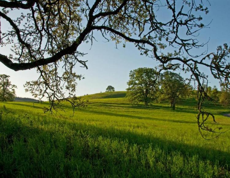
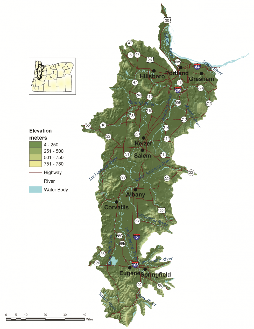
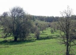
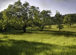
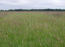
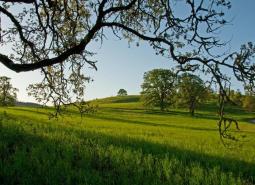
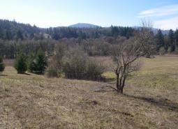
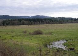
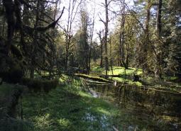
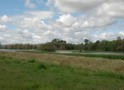
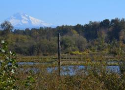
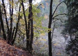
Bounded on the west by the Coast Range and on the east by the Cascade Range, this ecoregion encompasses 5,308 square miles and includes the Willamette Valley and adjacent foothills. Twenty to 40 miles wide and 120 miles long, the Willamette Valley is an elongated, level alluvial plain with scattered groups of low basalt hills. Elevations on the valley floor are about 400 feet at the southern end near Eugene, dropping gently to near sea-level in Portland. The climate is characterized by mild, wet winters and warm, dry summers. Fertile soil and abundant rainfall make the valley the most important agricultural region in the state.
Societally, the Willamette Valley is a land of contrasts. Bustling urban areas are nestled within rural farmlands. A wide diversity of industries contribute to the vibrant economy. It includes more than half of the state’s agricultural-producing counties, and the vast majority of the largest private sector employers (e.g., manufacturing, technology, forest products, agriculture, and services). Interstate 5 runs the length of the ecoregion, contributing to the transportation system and flow of goods while connecting communities. The Willamette Valley is the most urban ecoregion in the state, containing 8 of the 10 largest cities in Oregon. It is also a fast-growing ecoregion. Pressure on valley ecosystems from population growth, land use conversion, recreation, and pollution is likely to increase as population centers expand.
Characteristics
Important Industries
Agriculture, manufacturing, technology, forest products, construction, retail, services, government, academia, health care, tourism
Major Agricultural Products
Nursery and greenhouse plants, grass seed, wine grapes, Christmas trees, poultry, dairy, vegetables, small fruits and berries, nuts, grains, hops, cannabis
Important Nature-based Recreational Areas
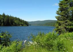
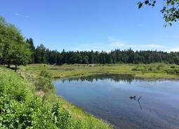
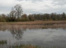
Smith and Bybee Wetlands Natural Area, Henry Hagg Lake, Fall Creek Lake, Milo McIver State Park, Willamette River Greenway and Water Trail, Willamette Valley National Wildlife Refuge Complex, Fern Ridge Reservoir, McDonald and Dunn Research Forests, Rivers to Ridges parks network, Howard Buford Recreation Area, Tualatin and William L. Finley National Wildlife Refuges, Sauvie Island Wildlife Area, E. E. Wilson Wildlife Area
Elevation
4 feet (Columbia River) to over 2,000 feet in the south
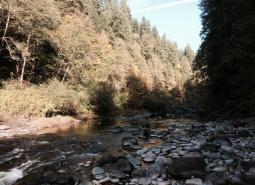
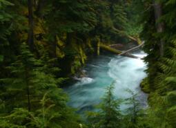
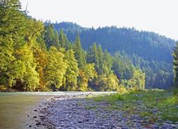
Important Rivers
Willamette, McKenzie, Santiam, Sandy, Molalla, Clackamas, Tualatin, Yamhill, Calapooia, Marys, Muddy, Pudding, Luckiamute, Long Tom
Climate
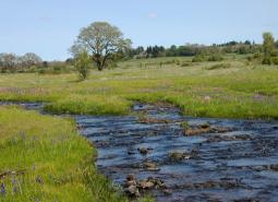
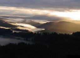
The Willamette Valley is mostly a low elevation valley with terraces and floodplains encompassed by rolling hills. The climate is Mediterranean, with mild, wet winters and warm, dry summers. Mean annual precipitation varies by elevation, with more occurring in the mountainous foothills. Many tributaries join the Willamette River, entering this ecoregion from the Cascades to the east and Coast Range to the west.
Warming is projected in all seasons across the region, with the largest increases projected for summer. Summer average temperature is projected to increase as much as 6°F for the 2040-2069 period, and as much as 10°F for the 2070-2099 period for a high emissions scenario (SSP585; Figure 1). Warming temperatures will lead to wetter winters and drier summers. Late summer precipitation is projected to decrease as much as 20% by the end of the century (Figure 2). Models generally agree on late summer precipitation projections, so confidence in these projections is high. Projections of cool season precipitation show an increase of 6% for the same period under a high emissions scenario (SSP585), although there is less confidence in predicted changes in cool season precipitation. Under a high emissions scenario (SSP585), growing degree days are projected to double for the 2070-2099 period, while frost days are projected to decrease from 50 per year on average to fewer than 20 per year on average.


Limiting Factors and Recommended Approaches
Limiting Factor: Land Use Conversion and Urbanization
CMP Direct Threats 1, 2.1, 2.3, 7.2
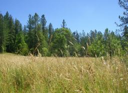
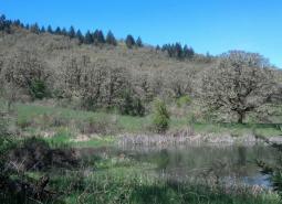
Of all the ecoregions in Oregon, the Willamette Valley has been most impacted by development and conversion of native habitats to other uses. The fragmented nature of remaining habitat patches in the Willamette Valley creates barriers to movement and dispersal for many species, particularly amphibians, reptiles, invertebrates, and small mammals. Continued fragmentation of remnant habitats, including grasslands and oak woodlands, has resulted in small and disjunct populations that are at an increased risk of genetic isolation and extirpation.
In addition to rural and urban residential and commercial development, conversion of habitat for vineyards is also increasing. Application of fungicides and insecticides applied to protect wine grapes and other crops, including grasses and hazelnuts, may impact the health, survival, and reproduction of pollinators, birds, and fish. The extensive development of the Willamette Valley ecoregion also means the potential for conflict between people and wildlife is high. For example, agricultural production may cause conflicts with wildlife that are attracted to feed on plants, nuts, or ripened fruit. Lack of suitable habitat may cause bats and birds to nest or roost in houses and other human structures. High road densities and road traffic volumes increase the potential for collisions with wildlife, with hundreds of thousands of animals lost each year to roadkill.
Recommended Approach
Landscape Scale: Because so much of the Willamette Valley ecoregion is privately-owned, voluntary cooperative approaches are the key to long-term conservation using tools such as financial incentives, Candidate Conservation Agreements with Assurances, and conservation easements. Careful land use planning is also essential. Work with local governments to support and implement existing land use regulations to preserve farmland, open spaces, recreation areas, and natural habitats. Monitor changes in land uses across the landscape and in land use plans and policies.
Within Urban Areas: Parks and natural areas, wildlife corridors, and green infrastructure can contribute to conservation, connect people to the natural environment, and enhance the quality of life in communities. Mitigate the impacts of development to the greatest extent possible. Many Priority Wildlife Connectivity Areas
exist throughout the Willamette Valley that can help maintain important movement corridors for wildlife. Promote programs such as the Backyard Habitat Certification Program to increase wildlife habitat and connectivity within urban spaces. Support and promote innovative campaigns and programs to reduce wildlife hazards. Work with municipalities to develop policies, such as wildlife-friendly building guidelines, wildlife-friendly lighting strategies, and integration of fish and wildlife crossings into transportation plans to reduce hazards. Engage in community outreach and education efforts to promote habitat protection and coexistence with wildlife.
Limiting Factor: Altered Fire Regimes
CMP Direct Threats 7.1, 11.3, 11.4
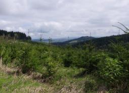
Past forest practices and fire suppression have resulted in young, dense, conifer-dominated forests where open-structured habitats like grasslands, oak savannas, and wet prairies once dominated. Maintenance of these Key Habitats is dependent, in part, on periodic burning. Forest crowding is a particularly significant issue in oak habitat, as large legacy oaks have become surrounded by dense stands of younger trees. The dense stands that have replaced open-structured habitats are at increased risk of high-intensity fires, disease, and damage by insects. Wildfire risk is further exacerbated by warming climate conditions and changes to patterns of precipitation, and more frequent, moderate to severe wildfires are becoming more common, particularly along the urban/rural interface surrounding many Willamette Valley communities. Reintroduction of fire poses significant management problems in many areas of the ecoregion. These problems include conflicts with surrounding land use, smoke management, air quality, and safety.
Recommended Approach
Use multiple tools, including mowing and controlled grazing, to maintain open-structured habitats. Ensure that tools are site-appropriate and implemented to minimize impacts to native species. Reintroduce fire at locations where conflicts, such as smoke and safety concerns, can be minimized. Work with communities to ensure that air quality and other local concerns are addressed. Support the formation of Prescribed Burn Associations and other community partnerships to promote and implement controlled burns.
Limiting Factor: Water
CMP Direct Threats 7.2, 11.4
Water Quantity is a limiting factor for fish and wildlife. Changing climate conditions are leading to rising temperatures and altered patterns of precipitation, which affects water availability across different times of year. In streams, seasonal low flows can limit habitat suitability and reproductive success for many fish and wildlife species. In much of the Willamette Valley, the demand for water for supporting population growth and agricultural production is putting increasing pressure on the supply of groundwater. This decreases groundwater discharge of cold water to rivers and streams, subsequently reducing the availability of both cold water refugia and suitable habitat for cold-water dependent species.
Water quality can also limit species and habitats. Runoff from agricultural areas can contaminate waterways. Warming temperatures, combined with higher nutrient levels due to agricultural runoff, is increasing the prevalence of toxic cyanobacterial blooms, sometimes called “harmful algal blooms” or “HABs”, leading to fish and wildlife mortality and safety issues for people and pets. Stormwater runoff from urban areas and from historic industrial activities, such as the Portland Harbor Superfund site, has introduced a variety of pollutants into wetland and aquatic habitats.
Recommended Approach
Provide incentives and information about water usage and sharing during low flow conditions (e.g., late summer). Promote water management actions that enable climate resilience and adaptation. Invest in watershed-scale projects for cold water and flow protection. Identify and protect cold water rearing and refugia habitat for aquatic species. Increase awareness and manage timing of applications of potential aquatic contaminants. Improve compliance with water quality standards and pesticide use labels administered by the DEQ and EPA. Work on implementing Senate Bill 1010 (Oregon Department of Agriculture) and DEQ Total Maximum Daily Load water quality plans.
Limiting Factor: Habitat Fragmentation
CMP Direct Threats 1, 2.1, 2.3, 3.3, 8.1
Habitats for at-risk native plant and animal species are largely confined to small and often isolated fragments, such as roadsides and sloughs. Habitat fragmentation also limits species’ ability to move across the landscape to fulfill life history needs. Opportunities for large-scale protection or restoration of native landscapes are limited. Barriers to large-scale ecosystem restoration include existing development, growth pressures, high land costs, and fragmented land ownerships. Remnant habitat patches in the otherwise highly developed Willamette Valley ecoregion are critical to protect, maintain, and restore. Even small patches of intact habitat can serve as important steppingstones for wildlife movement and migration.
Roadways are also a significant contributor to habitat fragmentation in this ecoregion. Interstate 5 bisects the ecoregion, running north to south. The number of lanes, traffic speeds, and volume of freight and motorist traffic make the interstate a near complete barrier to species movement, preventing species dispersal, range expansion, or migration. The Willamette Valley ecoregion has the highest road density of any ecoregion in the state, significantly impeding wildlife connectivity in urban areas.
Recommended Approach
Broad-scale conservation strategies will need to focus on restoring and maintaining more natural ecosystem processes and functions within a landscape that is managed primarily for other values. This may include an emphasis on more “conservation-friendly” management techniques for existing land uses and restoration of some key ecosystem components, such as river-floodplain connections and wetland and riparian habitats. “Fine-filter” conservation strategies that focus on needs of individual Species of Greatest Conservation Need and key sites are particularly critical in this ecoregion. Manage for the full lifecycle of the species to maintain access to breeding, migration, and nonbreeding habitats. Plan for and promote habitat connectivity. Many Priority Wildlife Connectivity Areas exist throughout the Willamette Valley that can help maintain important movement corridors for wildlife. Integration of fish and wildlife crossings into transportation plans will help to reduce hazards.
Limiting Factor: Invasive Species
CMP Direct Threat 8.1, 8.2
Invasive species disrupt native plant and animal communities and impact populations of at-risk native species. Hundreds of non-native and invasive plants have been introduced in this ecoregion for use as livestock forage, erosion control, and ornamental purposes. Plants such as reed canary grass and water primrose form dense monocultures, displacing native plants in wetland and riparian areas, choking waterways, and reducing foraging and breeding areas for wildlife. Himalayan blackberry is also widespread in this ecoregion, with significant local impacts to meadows, riparian areas, and grasslands. European hawthorn, black locust, and English ivy, among many others, are also highly invasive, outcompeting and engulfing native trees and shrubs.
Invasive animals have also caused significant issues in the Willamette Valley. American bullfrogs are rapidly expanding, competing with native species for limited resources or preying on native species and/or their eggs or young. Nutria degrade water quality and destabilize stream banks, while competing with native species, such as American beaver and muskrat, for food. Eastern fox squirrel and Eastern gray squirrels prey on native birds and compete with native species, such as Western gray squirrels, for food and nest sites. Common snapping turtles prey on native fish and wildlife species, and red-eared sliders compete directly with Northwestern pond turtles and Western painted turtles. Several mussel species, including zebra, quagga, and golden mussels, pose significant threats to aquatic systems. A variety of non-native fish have been introduced to waterways in the ecoregion, such as Gambusia, bass, and sunfish, which compete with native fish for food and prey directly on native fish, amphibians, and/or their eggs or young.
Emerging threats from invasive invertebrates are also becoming a concern in the Willamette Valley. Japanese beetles can infest and defoliate native hardwood trees like oaks and maples. The non-native emerald ash borer defoliates tree species characteristic of riparian habitats, such as Oregon ash, putting riparian areas, and in-stream habitats that depend on shading from bankside trees, at risk. Mediterranean oak borer targets native oak species, including Oregon white oak and California black oak, which have already experienced significant declines in the ecoregion due to habitat loss and development.
Recommended Approach
Emphasize prevention, risk assessment, early detection, and quick control to prevent new invasive species from becoming fully established. Use multiple site-appropriate tools (e.g., mechanical, chemical, biological) to control the most damaging non-native species. Prioritize efforts that focus on key invasive species in high priority areas, particularly where Key Habitats and Species of Greatest Conservation Need occur. Work with the Oregon Invasive Species Council and other partners to educate people about invasive species issues and to prevent introductions of potentially high-impact species, such as the zebra mussel. Provide technical and financial assistance to landowners interested in controlling invasive species on their properties. Promote the use of native species for restoration and revegetation.
Limiting Factor: Altered Floodplain
CMP Direct Threat 7.2
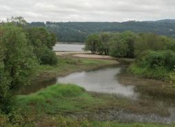
The floodplain dynamics of Willamette Valley rivers have been significantly altered. Historically, multiple braided channels dispersed floodwaters, deposited fertile soil, moderated water flow and temperatures, and provided a variety of slow-water habitats, such as sloughs and oxbow lakes. Since Euro-American settlement, however, many of the valley’s major rivers, including the Willamette, Santiam, and McKenzie Rivers, have largely been confined to a single channel and disconnected from their floodplains. Addition of dikes and levees, bank hardening, and channelization to facilitate agricultural irrigation have all had significant impacts to riparian habitats in the ecoregion. Hydroelectric projects located on the major rivers and their tributaries, while reducing downstream flood risk, have altered hydrology significantly, restricting fish passage and acting as barriers to movement of aquatic wildlife.
Recommended Approach
Cooperative efforts are needed to restore floodplain function and critical off-channel habitats. Using green infrastructure and careful planning for development outside of floodplains can help maintain floodplain function. Removing infrastructure such as revetments that channelize rivers can help restore natural stream flows.
Limiting Factor: Wildlife Hazards
CMP Direct Threats 1.1, 1.2
Urban landscapes can present a variety of hazards for wildlife. High densities of buildings increase risk of bird collisions with windows. Collisions with vehicles and powerlines and entanglements in fencing are also significant hazards for wildlife in urban areas. Outdoor cats, even well-fed, indoor/outdoor cats, prey on a variety of wildlife species, with significant local impacts to populations of birds, small mammals, and reptiles. Similarly, off-leash dogs in natural areas can disturb, injure, or kill wildlife. Noise and light pollution, as well as other disturbances from human presence and activity, can alter wildlife behavior. Food provided to wildlife, either intentionally with devices like bird feeders or unintentionally by leaving garbage unsecured or by leaving pet food outdoors, can increase disease transfer and can cause human-wildlife conflicts. Illegal encampments can degrade or destroy sensitive fish and wildlife habitats, particularly riparian areas, due to loss of vegetation, felling of snags for use as firewood, and unmanaged human refuse and waste. Additional hazards include exposure to pesticides, rodenticides, and other contaminants, harassment, and poaching. These hazards can significantly impact wildlife and undermine habitat conservation efforts.
Recommended Approach
Support and promote innovative campaigns and programs to reduce wildlife hazards. Work with municipalities to develop policies, such as wildlife-friendly building guidelines, wildlife-friendly lighting strategies, feeding ordinances, and integration of wildlife crossings into transportation plans to reduce hazards. Support research into better understanding of urban wildlife hazards and the management strategies to reduce those hazards. Communities can work with local park districts and conservation organizations to support habitat enhancement projects and reduce the need for herbicide use in parks. Communities, local governments, and non-profit organizations can promote bird-friendly building design and outreach efforts about the impacts of cats on wildlife. Support policies that address housing access to alleviate the pressure for illegal camping on public lands.
Species of Greatest Conservation Need

A Stonefly
Capnia kersti

Black Tern
Chlidonias niger

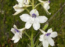
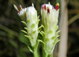
Bradshaw’s desert parsley
Lomatium bradshawii
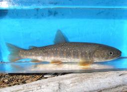
Bull Trout – Coastal Recovery Unit
Salvelinus confluentus

California Floater Mussel
Anodonta californiensis

California Myotis
Myotis californicus
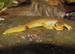
Cascade Torrent Salamander
Rhyacotriton cascadae
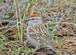
Chipping Sparrow
Spizella passerina
Chum Salmon – Lower Columbia SMU
Oncorhynchus keta

Clouded Salamander
Aneides ferreus

Coastal Cutthroat Trout
Oncorhynchus clarki clarki

Coastal Tailed Frog
Ascaphus truei
Coho Salmon – Lower Columbia SMU
Oncorhynchus kisutch
Columbia Pebblesnail
Fluminicola fuscus
Columbia Torrent Salamander
Rhyacotriton kezeri
Columbia yellowcress
Rorippa columbiae

Common Nighthawk
Chordeiles minor
Dalles Hesperian
Vespericola depressus
Dog Star Skipper (butterfly)
Polites sonora siris
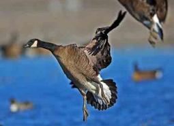
Dusky Canada Goose
Branta canadensis occidentalis
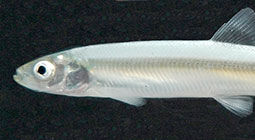
Eulachon
Thaleichthys pacificus
Fall Chinook Salmon – Lower Columbia SMU
Oncorhynchus tshawytscha
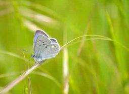
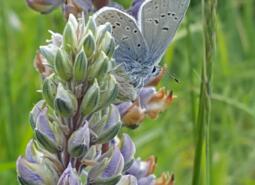
Fender’s Blue Butterfly
Icaricia icarioides fenderi
Foothill Yellow-legged Frog
Rana boylii

Fringed Myotis
Myotis thysanodes
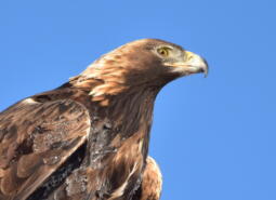
Golden Eagle
Aquila chrysaetos
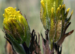
Golden paintbrush
Castilleja levisecta

Gray Wolf
Canis lupus
Hitchcock’s blue-eyed grass
Sisyrinchium hitchcockii

Hoary Bat
Lasiurus cinereus
Johnson’s Hairstreak (butterfly)
Callophrys johnsoni
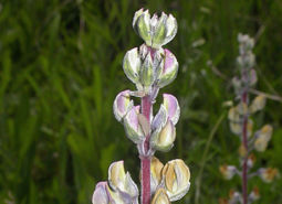
Kincaid’s lupine
Lupinus oreganus
Little Brown Myotis
Myotis lucifugus

Long-legged Myotis
Myotis volans
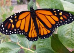
Monarch Butterfly
Danaus plexippus
Montane Peaclam
Pisidium ultramontanum
Nelson’s checkermallow
Sidalcea nelsoniana
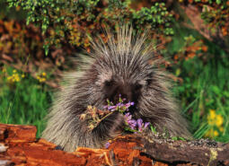
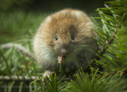
North American Porcupine
Erethizon dorsatum

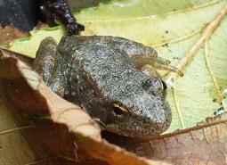
Northern Red-legged Frog
Rana aurora
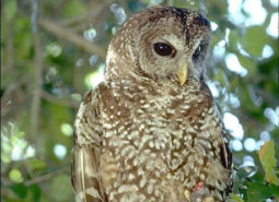
Northern Spotted Owl
Strix occidentalis caurina

Northwestern Pond Turtle
Actinemys marmorata

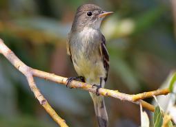
Olive-sided Flycatcher
Contopus cooperi
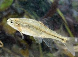
Oregon Chub
Oregonichthys crameri
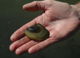
Oregon Floater Mussel
Anodonta oregonensis
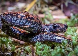
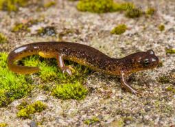
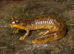
Oregon Slender Salamander
Batrachoseps wrighti
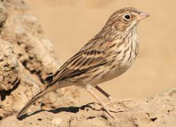
Oregon Vesper Sparrow
Pooecetes gramineus affinis
Pacific Brook Lamprey
Occidentis pacifica

Pacific Lamprey
Entosphenus tridentatus

Pallid Bat
Antrozous pallidus
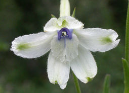
Peacock larkspur
Delphinium pavonaceum
Red Tree Vole
Arborimus longicaudus

Ringtail
Bassariscus astutus
Rocky Mountain Fingernail Clam
Sphaerium patella
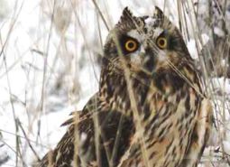
Short-eared Owl
Asio flammeus flammeus
Shortface Lanx
Fisherola nuttalli

Silver-haired Bat
Lasionycteris noctivagans
Southern Torrent Salamander
Rhyacotriton variegatus
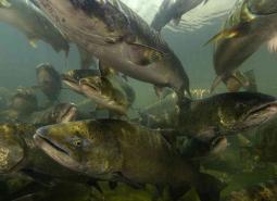
Spring Chinook Salmon – Lower Columbia SMU
Oncorhynchus tshawytscha
Spring Chinook Salmon – Willamette SMU
Oncorhynchus tshawytscha
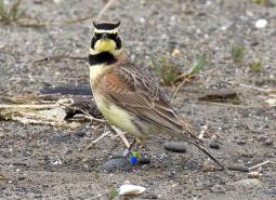
Streaked Horned Lark
Eremophila alpestris strigata
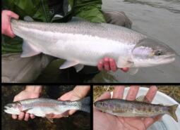
Summer Steelhead/Coastal Rainbow Trout – Lower Columbia SMU
Oncorhynchus mykiss/Oncorhynchus mykiss irideus
Tall western penstemon
Penstemon hesperius
Taylor’s Checkerspot Butterfly
Euphydryas editha taylori
Thin-leaved pea
Lathyrus holochlorus

Townsend’s Big-eared Bat
Corynorhinus townsendii
Water howellia
Howellia aquatilis
Wayside aster
Eucephalus vialis
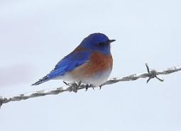
Western Bluebird
Sialia mexicana occidentalis
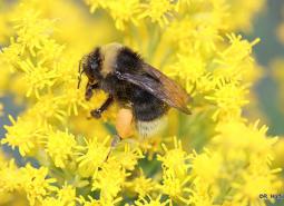
Western Bumble Bee
Bombus occidentalis
Western Floater Mussel
Anodonta kennerlyi
Western Grasshopper Sparrow
Ammodramus savannarum perpallidus
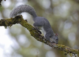
Western Gray Squirrel
Sciurus griseus

Western Grebe
Aechmophorus occidentalis
Western Long-eared Myotis
Myotis evotis
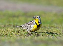
Western Meadowlark
Sturnella neglecta

Western Painted Turtle
Chrysemys picta belli
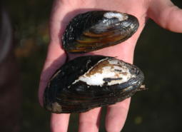
Western Pearlshell Mussel
Margaritifera falcata

Western Purple Martin
Progne subis arboricola
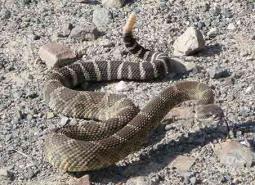
Western Rattlesnake
Crotalus oreganus oreganus
Western Ridged Mussel
Gonidea angulata

Western River Lamprey
Occidentis ayresii

Western Toad
Anaxyrus boreas
White rock larkspur
Delphinium leucophaeum

White Sturgeon – Lower Columbia/Coastal SMU
Acipenser transmontanus
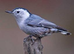
White-breasted Nuthatch (Pacific)
Sitta carolinensis aculeata
White-topped aster
Sericocarpus rigidus

Willamette daisy
Erigeron decumbens
Willamette navarretia
Navarretia willamettensis
Willow Flycatcher
Empidonax traillii
Winged Floater Mussel
Anodonta nuttalliana
Winter Steelhead/Coastal Rainbow Trout – Lower Columbia SMU
Oncorhynchus mykiss/Oncorhynchus mykiss irideus
Winter Steelhead/Coastal Rainbow Trout – Willamette SMU
Oncorhynchus mykiss/Oncorhynchus mykiss irideus
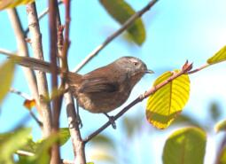
Wrentit
Chamaea fasciata
Yuma Myotis
Myotis yumanensis
Conservation Opportunity Areas
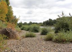
Baskett Butte [COA ID: 072]
The Basket Butte COA (27 mi2) is located north of Dallas. It is bordered to the south by the Salem-Willamina Highway and the east by Hwy 99W. This area contains upland oak-dominated hills, Basket Slough, Ash Swale, and headwaters of Salt Creek, tributary of South Yamhill River. Recommended Conservation Actions Maintain and restore existing habitat …
Bull Run-Sandy Rivers [COA ID: 105]
The Bull Run – Sandy River COA (200 mi2) includes the headwaters of the Sandy River and its tributaries, including the Bull Run River. Nearly all the Bull Run Watershed is contained within this COA, which is a protected area that provides drinking water to the city of Portland. This area is located almost entirely …
Calapooia River [COA ID: 082]
The Calapooia River COA (79 mi2) extends from just upstream of the confluence of the Calapooia and Willamette Rivers, upstream along the Calpooia River all the way to the border of the Willamette National Forest. The area includes the associated riparian and upland areas surrounding the river. This COA is adjacent to the Crawfordsville Oak-Washburn …
Clackamas River and Tributaries [COA ID: 065]
The Clackamas River and Tributaries COA (59 mi2) extends from the confluence with the Willamette River area upstream to Estacada and includes the associated floodplain, tributaries, and upland habitats of the lower Clackamas River. This COA is adjacent to the Lower Willamette River Floodplain COA. Recommended Conservation Actions Maintain and enhance in-channel watershed functions, connection …
Coburg Ridge [COA ID: 087]
The Coburg Ridge COA (52 mi2) extends from just outside Coburg at Coburg Ridge northward to Indian Head. The area includes the surrounding ridgelines, foothills, and associated lowlands. This COA is adjacent to the McKenzie River Area, Calapooia River, and Mohawk River COAs. Recommended Conservation Actions Maintain and enhance grasslands, remnant native wet prairies and …
Corvallis Area Forests and Balds [COA ID: 081]
The Corvallis Area Forests and Balds COA (135 mi2) extends from Airlie Rd, just north of the E.E. Wilson Wildlife Area, south to just past Decker Rd. This area spans the Greasy Creek and Mary’s River Drainages south and west of Philomath, is bordered to the west by Kings Valley, and continues through the hills …

Crawfordsville Oak-Washburn Butte [COA ID: 085]
The Crawfordsville Oak-Washburn Butte COA (17 mi2) eztends from northeast of Brownsville eastward to Hwy 228. The area is primarily forested, covering the foothills north of the Calapooia River. This COA is adjacent to the Calapooia River COA. Recommended Conservation Actions Maintain or restore riparian and wetland habitats ecological functions and connectivity; ensure sufficient habitat …
Deer Island [COA ID: 053]
The Deer Island COA (11 mi2) covers the entirety of Deer Island, which is located from river mile 78-81 along the Lower Columbia River. The island contains important riparian and shoreline habitat for many strategy species. Land ownership is a mix of small private parcels and preserved land owned by the Columbia Land Trust. Deer …
Dundee Oaks [COA ID: 066]
The Dundee Oaks COA (8 mi2) is a small chunk of habitat between Carlton and Dundee. This area includes a portion if the Red Hills of Dundee, and separates the Chehalem Valley from the Yamhill River basin and the headwater tributaries of the Yamhill River. Recommended Conservation Actions Manage public access and recreation with fish, …
Eola Hills [COA ID: 073]
The Eola Hills COA (22 mi2) is located just west of Salem and north of Hwy 22, extending west to just past Richards Creek. This area includes tributaries of the South Yamhill River, Willamette River, and Rickreall Creek. This COA is adjacent to the Basket Butte COA. Recommended Conservation Actions Maintain and restore existing habitat …
Finley-Muddy Creek Area [COA ID: 084]
The Finley-Muddy Creek Area COA (48 mi2) extends from just south of Corvallis down to just south of the Finley Wildlife Refuge, bordered to the east by Hwy 99. This COA is adjacent to the Corvallis Area Forests and Balds and Upper Willamette River Floodplain COAs. Recommended Conservation Actions Maintain and enhance wetlands, ponds, and …
Forest Park [COA ID: 058]
The Forest Park COA (80.5 mi2) is located in the Tualatin Mountains and extends from the edge of downtown Portland northward to Dixie Mountain and Snooseville Corner in the Coast Range. This area contains one of the largest urban parks in the county (Forest Park), as well as some highly residential neighborhoods in Portland’s west …
Gales Creek [COA ID: 013]
The Gales Creek COA (58 mi2) extends from the edge of Forest Grove west into the Tillamook State Forest, toward Larch Mountain and the crest of the Cascade Range. The area is a late successional mixed deciduous and conifer forest with wetlands, flowing water and riparian habitats in the Gales Creek watershed. This COA is …
Habeck Oaks [COA ID: 074]
The Habeck Oaks COA (16 mi2) is located directly east of Falls City, extending northeast toward the edge of Dallas. This area is primarily privately-owned mixed farmland and forest located north of the Little Luckiamute River. This COA is adjacent to the McTimmons Valley – Airlie Savanna COA. Recommended Conservation Actions Maintain a diversity of …
Hayden Island-Government Island [COA ID: 055]
The Hayden Island-Government Island COA (5 mi2) includes portions of multiple Columbia River islands to the north of Portland just outside city limits. The COA includes islands located between river miles 111 and 119: the western section of Hayden Island, Government Island, Tri Club Island, Lemon Island and McGuire Island. These large riverine islands are …
Kings Valley-Woods Creek Oak Woodlands [COA ID: 080]
The Kings Valley-Woods Creek Oak Woodlands COA (37 mi2) extends from Maxfield Creek Rd near the Polk-Benton county line down to Hyde Creek and Hwy 34. This COA is adjacent to the Luckiamute River and Tributaries, Corvallis Area Forests and Balds, and Mary’s Peak COAs. Recommended Conservation Actions Maintain and enhance grassland/prairie habitats, oak savanna, …
Kingston Prairie-Scio Oak Pine Savanna [COA ID: 079]
The Kingston Prairie-Scio Oak Pine Savanna COA (17 mi2) extends from the town of Scio east to Bear Branch Creek. It is located just south of the North Santiam River and north of Thomas Creek. This area consists largely of small private properties, many of which are agricultural. This COA is adjacent to the Santiam …
Little North Santiam River Area [COA ID: 109]
The Little North Santiam River COA (45 mi2) extends from Silver Falls State Park eastward into the Cascades toward the Willamette National Forest boundary. The area primarily consisted of mixed conifer forest and includes the headwaters of North Santiam and Pudding Rivers. It is comprised of a matrix of private industrial forest and both state …

Lower Sandy River [COA ID: 057]
The Lower Sandy River COA (42 mi2) extends from the confluence of the Sandy and Columbia Rivers up along the Lower Sandy River and its tributaries. The are includes the Sandy River Delta, Beaver Creek, and the lower reaches of the Bull Run River. This COA is located on the eastern edge of the Portland …
Lower Willamette River Floodplain [COA ID: 059]
The Lower Willamette River Floodplain COA (17 mi2) extends along the mainstem Willamette River from the confluence with the Columbia River upstream to Willamette Falls in Oregon City (river miles 0 to 26). This COA includes the river’s floodplain and adjacent uplands. This COA is adjacent to the Sauvie Island – Scappoose, Forest Park, Smith-Bybee …
Luckiamute River and Tributaries [COA ID: 075]
The Luckiamute River and Tributaries COA (81 mi2) begins at the confluence of the Luckiamute and Willamette Rivers and extends up the drainages of the Luckiamute and Little Luckiamute Rivers. The area includes the surrounding upland habitats around the rivers, and many nearby agricultural areas surrounding Kings Valley and south of Falls City. This COA …
Mary’s Peak [COA ID: 028]
The Mary’s Peak COA (48 mi2) extends from the Siuslaw National Forest around Mary’s Peak westward into the Coast Range, out toward Lone Spring Mountain and Grass Mountain. This COA is adjacent to the Kings Valley – Woods Creek Oak Woodlands COA. Recommended Conservation Actions Maintain and enhance existing forest and woodland habitats, especially older …
McKenzie River Area [COA ID: 114]
The McKenzie River Area COA (116 mi2) extends from the confluence with the Willamette River upstream to Sardine Butte and includes the associated floodplain, tributaries, and upland habitats of the McKenzie River. This COA is adjacent to the Upper Willamette River Floodplain, Coburg Ridge and Mohawk River COAs. Recommended Conservation Actions Maintain and enhance in-channel …
McTimmons Valley – Airlie Savanna [COA ID: 076]
The McTimmons Valley – Airlie Savanna COA (11 mi2) is located west of Lewisville. Although small, this area contains important grassland and oak savanna habitat surrounding McTimmonds Creek and the McTimmonds Valley. This COA is adjacent to, and almost entirely bordered by, the Luckiamute River and Tributaries COA. Recommended Conservation Actions Maintain and restore existing …
Middle Fork Willamette River [COA ID: 115]
The Middle Fork Willamette River COA (167 mi2) extends from Lookout Point Lake upstream along the Middle Fork Willamette River and into the surrounding forestlands as far east as Huckleberry Mountain. The area skirts along the northern edge of Oakridge, and goes north to Alpine Ridge. This COA is adjacent to the Upper Willamette River …
Middle Willamette River Floodplain [COA ID: 060]
The Middle Willamette River Floodplain COA (102 mi2) extends along the mainstem Willamette River from Willamette Falls to the confluence with the Calapooia River near Albany (river miles 26 to 120). This COA includes the river’s floodplain and adjacent uplands. This COA is adjacent to the Lower Willamette River Floodplain, Upper Willamette River Floodplain, Pudding …
Missouri Ridge [COA ID: 070]
The Missouri Ridge COA (6 mi2) is located between Scotts Mills and Molalla in the Rock Creek subbasin, a tributary of the Pudding River. This COA is adjacent to the Molalla River COA. Recommended Conservation Actions Work with collaborators and private landowners to minimize habitat loss, especially in relation to potential effects of climate change. …
Mohawk River [COA ID: 088]
The Mohawk River COA (15 mi2) extends from outside Springfield up the Mohawk River to Marcola. The area includes the surrounding foothills and associated lowlands. This COA is adjacent to the McKenzie River Area and Coburg Ridge COAs. Recommended Conservation Actions Continue efforts to maintain high water quality and meet temperature standards for Mohawk River …
Molalla River [COA ID: 069]
The Molalla River COA (38 mi2) extends along the Molalla River corridor from Mulino upstream to the Dickie Prairie area, and includes the associated floodplain, tributaries, and upland habitats. This COA is adjacent to the Missouri Ridge COA. Recommended Conservation Actions Maintain and enhance in-channel watershed functions, connection to riparian habitat, water flow and hydrology. …
One Horse Slough-Beaver Creek [COA ID: 083]
The One Horse Slough-Beaver Creek COA (48 mi2) extends from the eastside of Lebanon east to Upper Berlin Dr and north nearly all the way to Hwy 226. This area is located along the boundary of the Willamette Valley and West Cascades Ecoregions, adjacent to the South Santiam River. This COA is adjacent to the …
Pudding River [COA ID: 068]
The Pudding River COA (27 mi2) extends from the confluence with the Molalla River upstream to the Howell Prairie area located west of Mount Angel and includes the associated floodplain, tributaries, and upland habitats of the lower Pudding River. This COA is adjacent to the Middle Willamette River Floodplain COA. Recommended Conservation Actions Maintain and …
Red Prairie-Mill Creek-Willamina Oaks South [COA ID: 071]
The Red Prairie – Mill Creek – Willamina Oaks South COA (35 mi2) is located south of Highway 19 along Highway 22 in the foothills of the Coast Range. This area includes tributaries of the South Yamhill River and associated lowland habitats. This COA is adjacent to the Mill Creek and Baskett Butte COAs. Recommended …
Salem Hills-Ankeny NWR [COA ID: 077]
The Salem Hills-Ankeny NWR COA (43 mi2) is located southwest of Turner, extending down to the Ankeny National Wildlife Refuge. This COA is adjacent to the Middle Willamette River Floodplain and Santiam Confluences COAs. Recommended Conservation Actions Maintain and enhance remnant native wet prairie, seasonal wetlands, upland prairie and oak savanna habitat. Maintain and enhance …
Santiam Confluences [COA ID: 078]
The Santiam Confluences COA (109 mi2) extends from the confluence of the mainstem with the Willamette River upstream along the North Fork Santiam through confluences with Jefferson Ditch and Valentine Creek, up toward Mill Creek. This COA also extends along the South Santiam River through confluences with Spring Branch, Thomas Creek, Spring Creek, Crabtree Creek, …
Sauvie Island-Scappoose [COA ID: 054]
The Sauvie Island – Scappoose COA (54 mi2) extends along the westside of the Columbia River from Saint Helens to the southern tip of Sauvie Island. This COA contains a mosaic of tidally influenced sloughs, wetland and ponds, along with cottonwood galleries and bottomland hardwood forests. The area includes Sauvie Island, Multnomah Channel, Scappoose Bay and the …
Scoggins Valley-Mount Richmond [COA ID: 063]
The Scoggins Valley – Mount Richmond COA (41 mi2) is located in the foothills of the Coast Range, extending from Henry Hagg Lake south to Moore’s Valley. The area includes the Upper Tualatin-Scoggins Watershed, portions of the North Yamhill River and headwater tributaries, Mount Richmond, and the Oak Ridge / Moore’s Valley area. This COA …
Smith-Bybee Lakes and Columbia Slough [COA ID: 056]
The Smith-Bybee Lakes and Columbia Slough COA (7.5 mi2) is located along the northern edge of the Portland metropolitan area. The Columbia Slough flows out of Fairview Lake and along the northern edge of Fairview, Maywood Park and Portland through a series of regulated levees. The Columbia Slough eventually connects to the wetland system located …
Tualatin River [COA ID: 064]
The Tualatin River COA (95 mi2) extends along the lower Tualatin River from just below Hagg Lake down to the confluence with the Willamette River. The area includes the associated floodplains, numerous tributaries, and associated upland habitats. This COA is adjacent to the Scoggins Valley – Mount Richmond and Gales Creek COAs. Recommended Conservation Actions …
Upper Siuslaw [COA ID: 089]
The Upper Siuslaw COA (120 mi2) follows the winding Siuslaw River from Territorial Hgihway up into the Coast Range and includes the surrounding riparian and upland habitat. This COA is adjacent to the West Eugene Area COA. Recommended Conservation Actions Maintain and enhance in-channel watershed functions, connection to riparian habitat, water flow and hydrology. Maintain …
Upper Willamette River Floodplain [COA ID: 061]
The Upper Willamette River Floodplain COA (168 mi2) extends long the mainstem Willamette River from the confluence with the Calapooia River to Lookout Point Lake south of Springfield (river miles 120 to 203). This COA includes the river’s floodplain and adjacent uplands, as well as Dexter Reservoir and Lookout Point Lake. This COA is adjacent …
West Eugene Area [COA ID: 086]
The West Eugene Area COA (264 mi2) extends from Camas Swale north along the foothills of the Coast Range to Cox Butte, including the West Eugene wetlands. This COA is adjacent to the Upper Willamette River Floodplain and Upper Siuslaw COAs. Recommended Conservation Actions Continue active management of restored habitats to conserve ecological values. Maintain and restore …
Yamhill Oaks-Willamina Oaks North [COA ID: 067]
The Yamhill Oaks – Willamina Oaks North COA (78 mi2) is located west of McMinnville in the foothills of the Coast Range and within the South Yamhill River Watershed. This area contains a variety of wildlife habitat, including grassland, oak savanna, mixed deciduous and conifer, and riparian habitat. Recommended Conservation Actions Manage public access and …